Snow Observations List
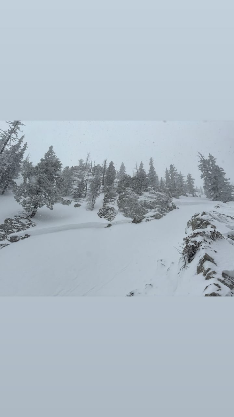
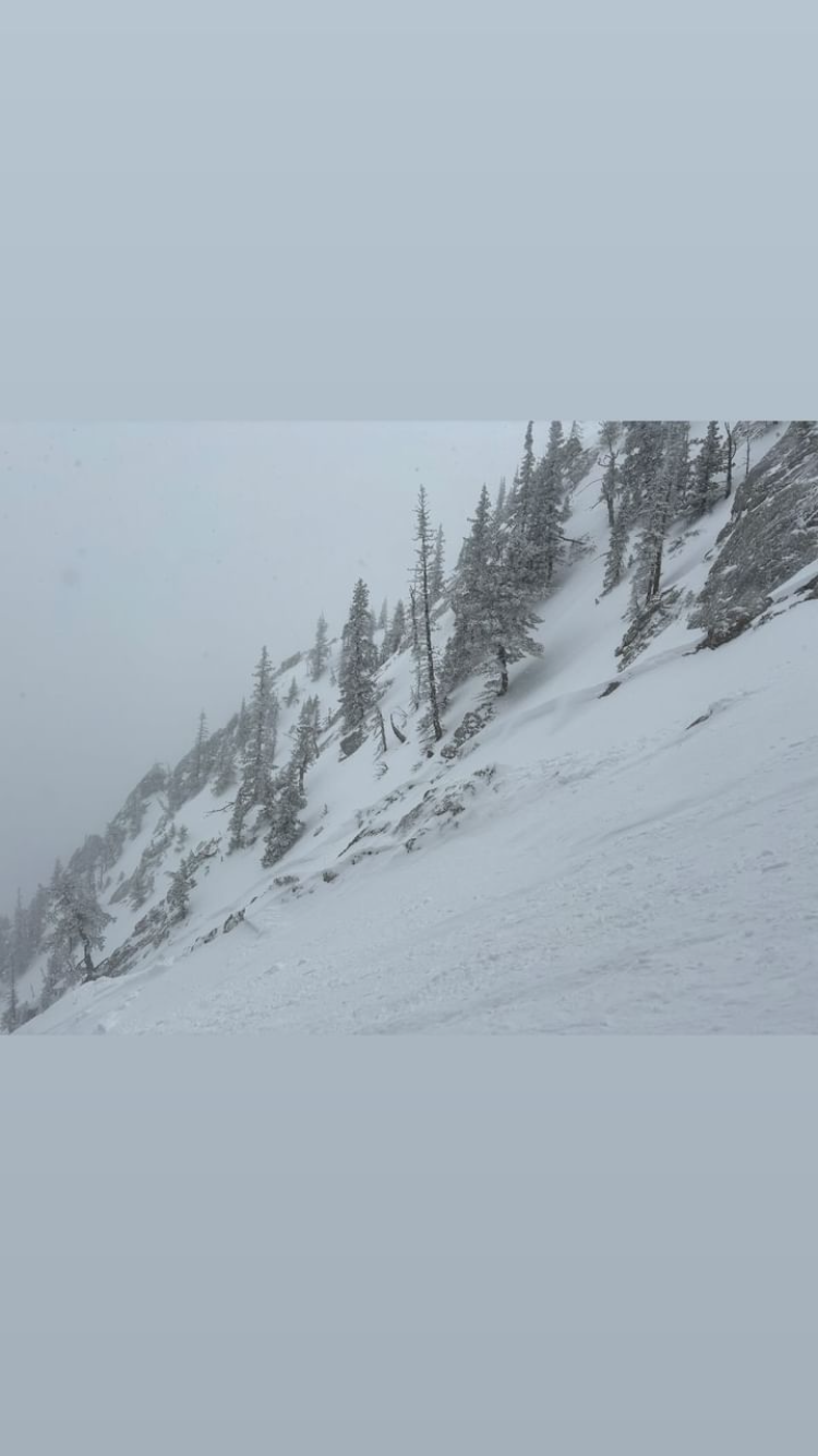
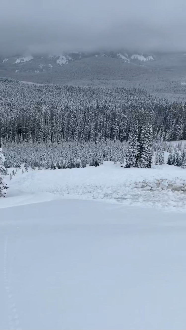
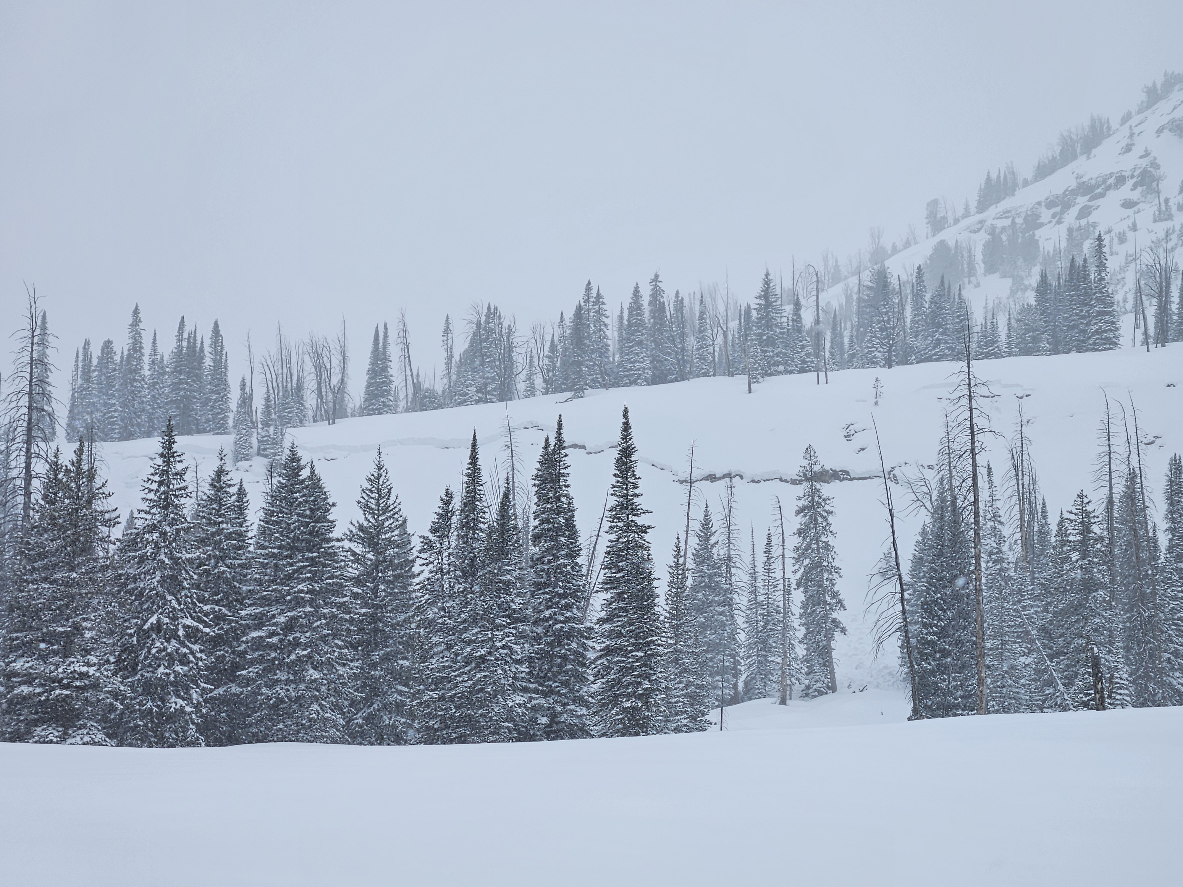
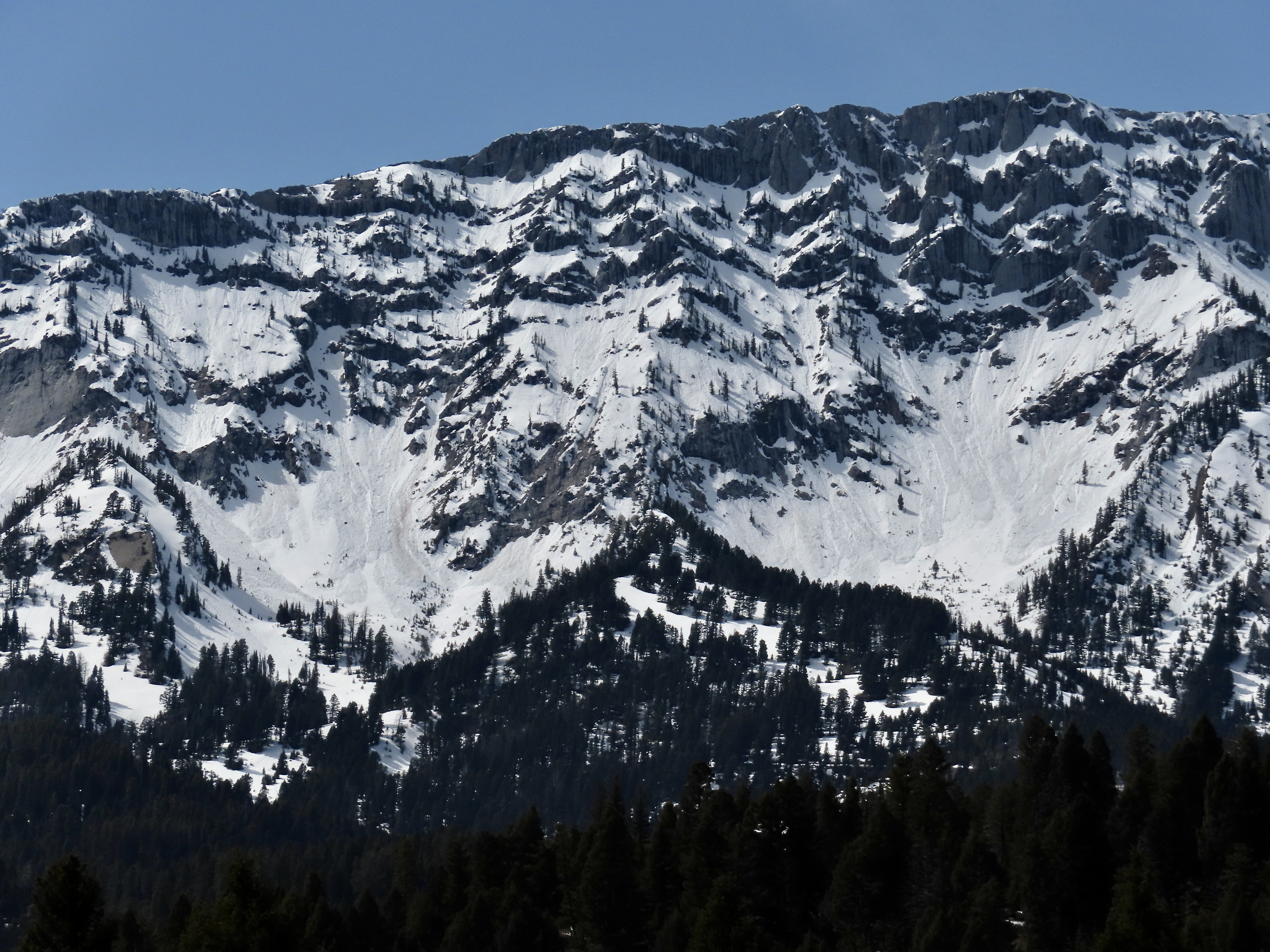
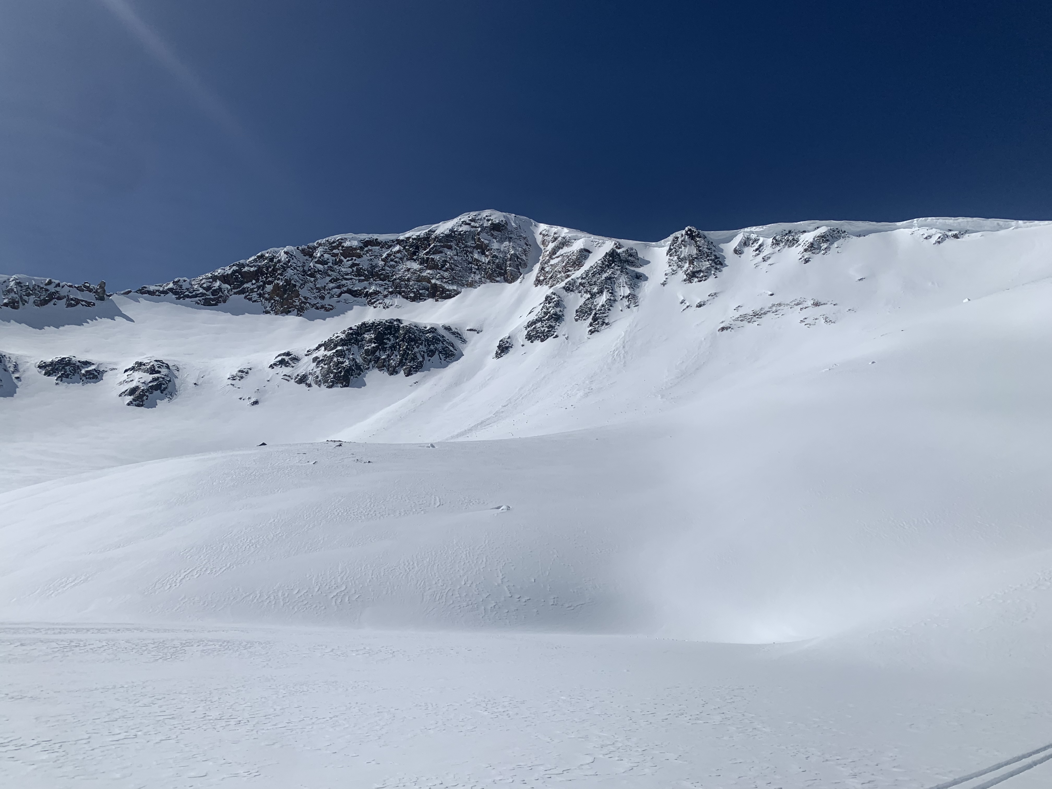
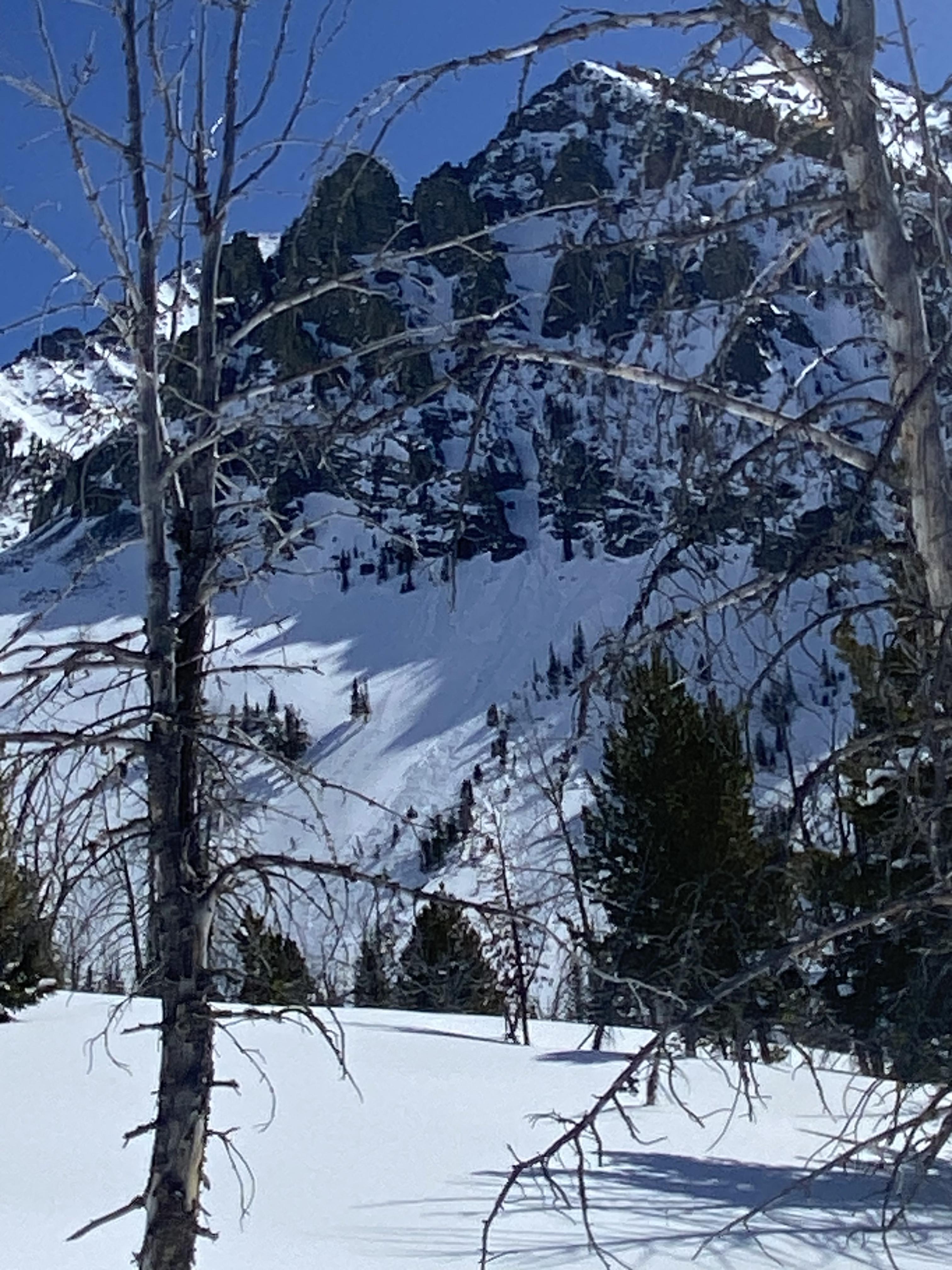
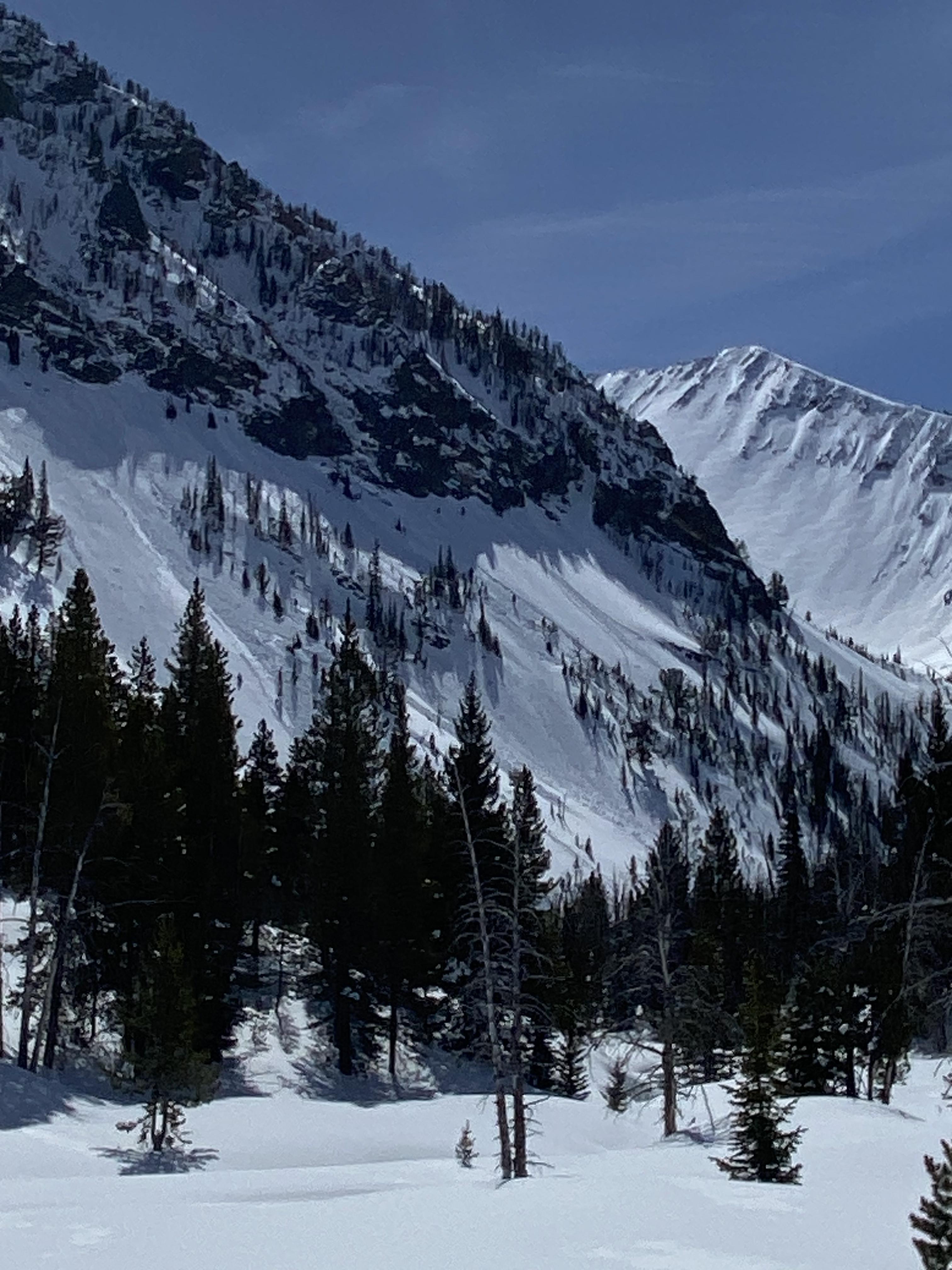
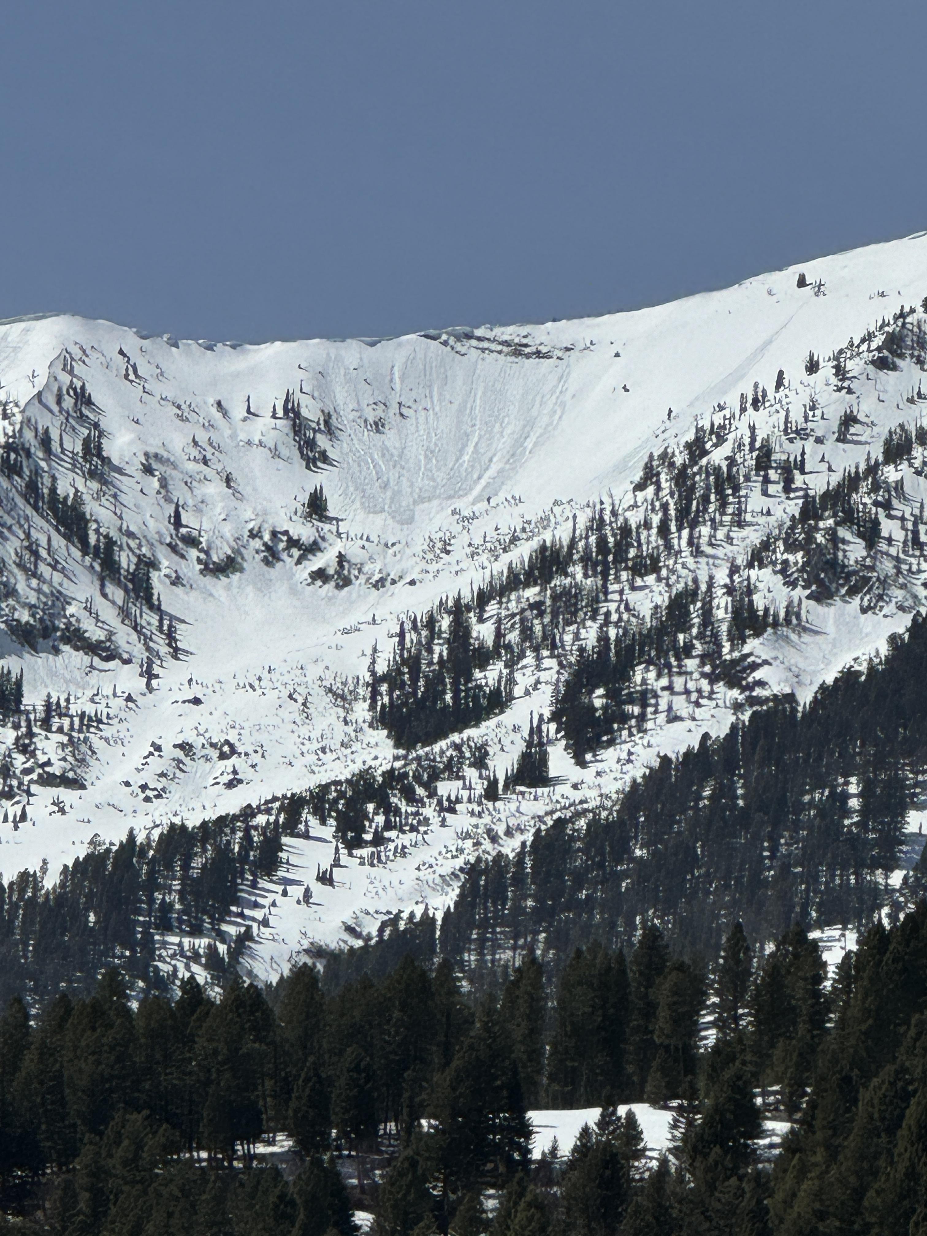
Out in the Western Tobacco Roots today. Recent snow was decently wind affected and storm depths were particularly variable. One thing was common with all new snow deposits: they were bonded very poorly to the widespread underlying crust. In most areas the new snow was not cohesive or deep, so this resulted only in tricky skinning and long running sluffs.
However, where wind or sun had strengthened the slab this surface layer was reactive, with sluffs entraining significant amounts of snow and one small slab that I managed to trigger. I popped this slab underneath a mild, somewhat cross-loaded convexity on a north face near treeline, and it broke around 30 feet wide, 4-6 inches deep, and ran ~ 300 feet (N, 9500', SS- ASu - R1/D1).
The underlying snowpack showed no signs of instability, though while boot packing I did break through the crust in some shallower areas and found some basal facets. The snow surface stayed pretty cool throughout the day above 8.5 kft, and winds were light out of the west.
Full Snow Observation Report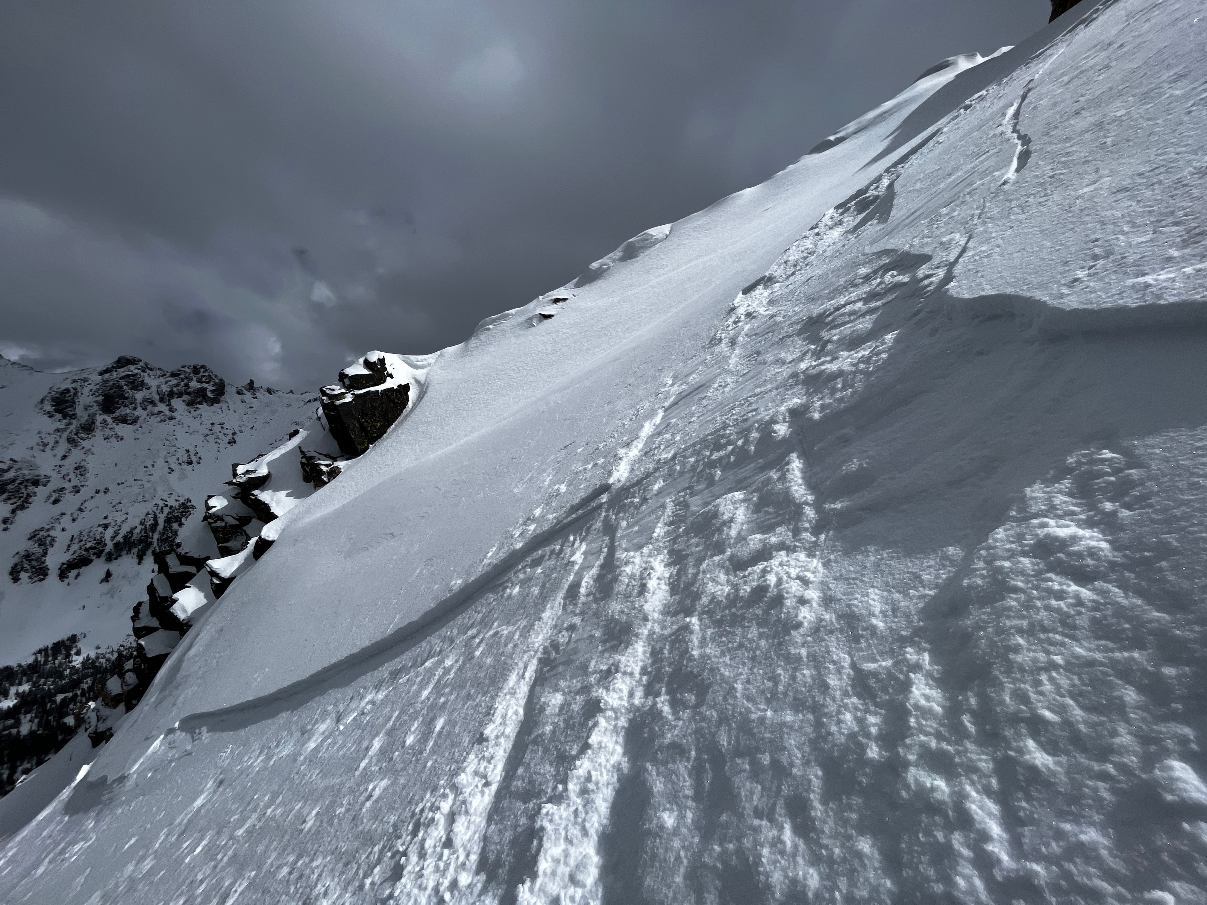
Skied the Banana Coulior off Ross today. 6-8" of fresh, dry snow has fallen and lies above a bomber crust that was observed on all aspects we traveled on. The weak interface between new, dry snow and the pervasive crust allowed for a large sluff, or dry-loose slide, that began near the top of the Banana Coulior and ran for ~ 500'
Full Snow Observation ReportFrom IG message 4/17/24: "Remote trigger up little bear today. Went to the groundish."
Full Snow Observation Report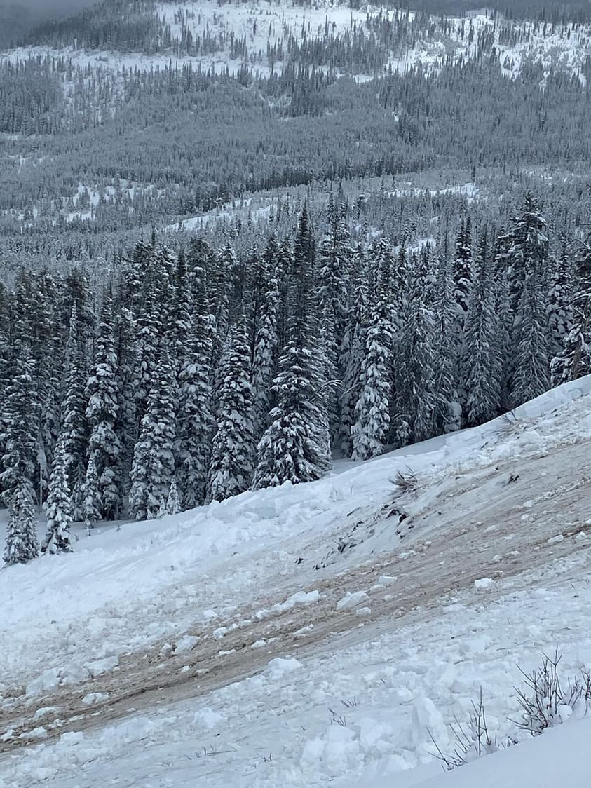
Wet slab 150-200 ft across, SE shoulder of Abundance towards Wolverine. Looks to have maybe happened before new snow. New snow 6-8 was extra funky, 2-3 powder on a rain? crust on heavy wet. Bonded to unsupportive melt freeze on completely saturated glop. Lots of short running sluffs
Full Snow Observation Report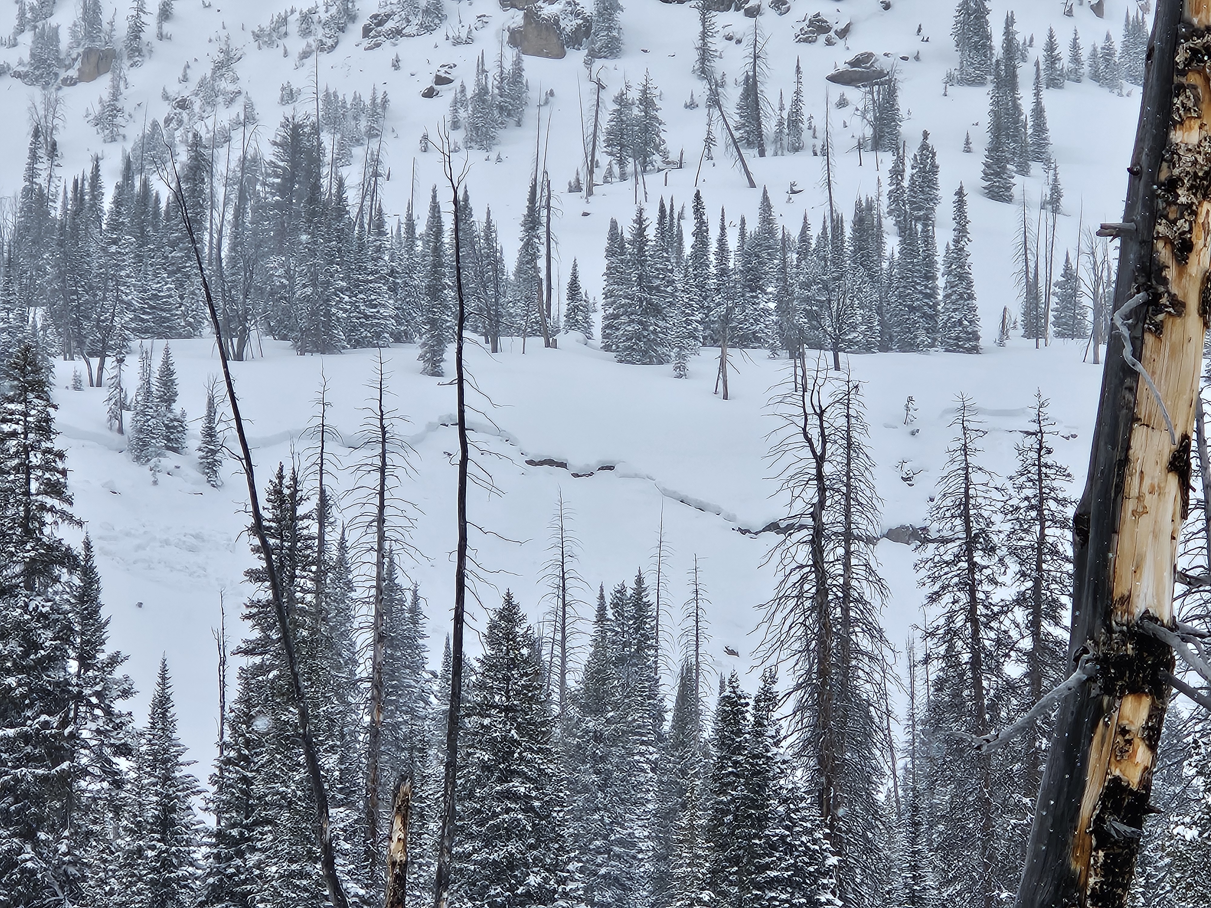
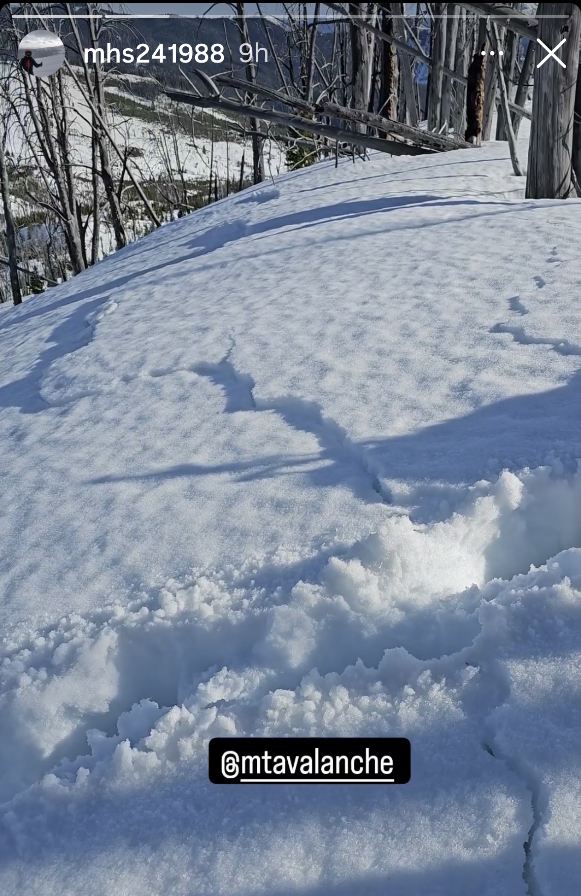
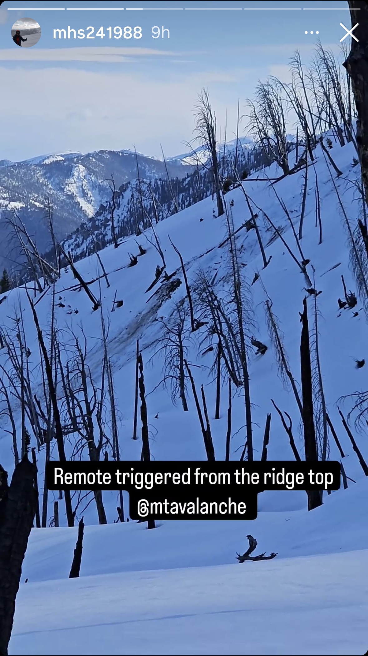
From IG: A group of riders noted very wet snow west of Cabin Creek and Southwest of the Taylor Fork. They were sinking to the ground where it was unconsolidated. The group remotely triggered a wet slab avalanche from the ridge top. There were shooting cracks that connected their location to the avalanche. This is an interesting of persistent weak layer and wet snow avalanche problems.
Full Snow Observation Report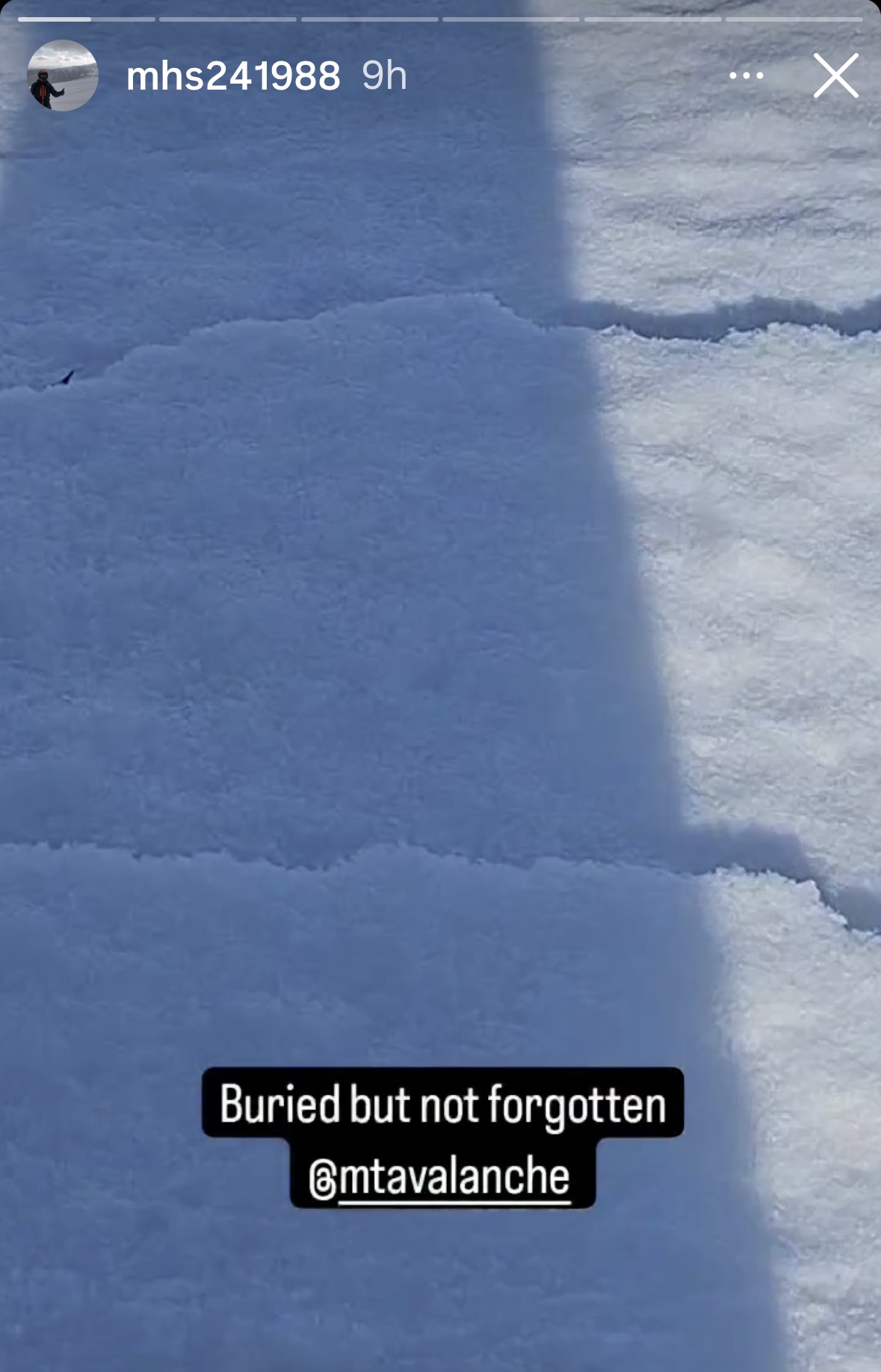
From IG: Wet slide to the ground above Quake Lake.
Full Snow Observation Report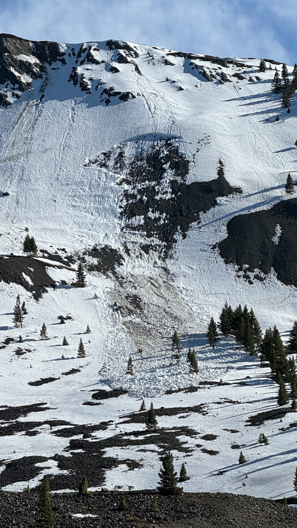
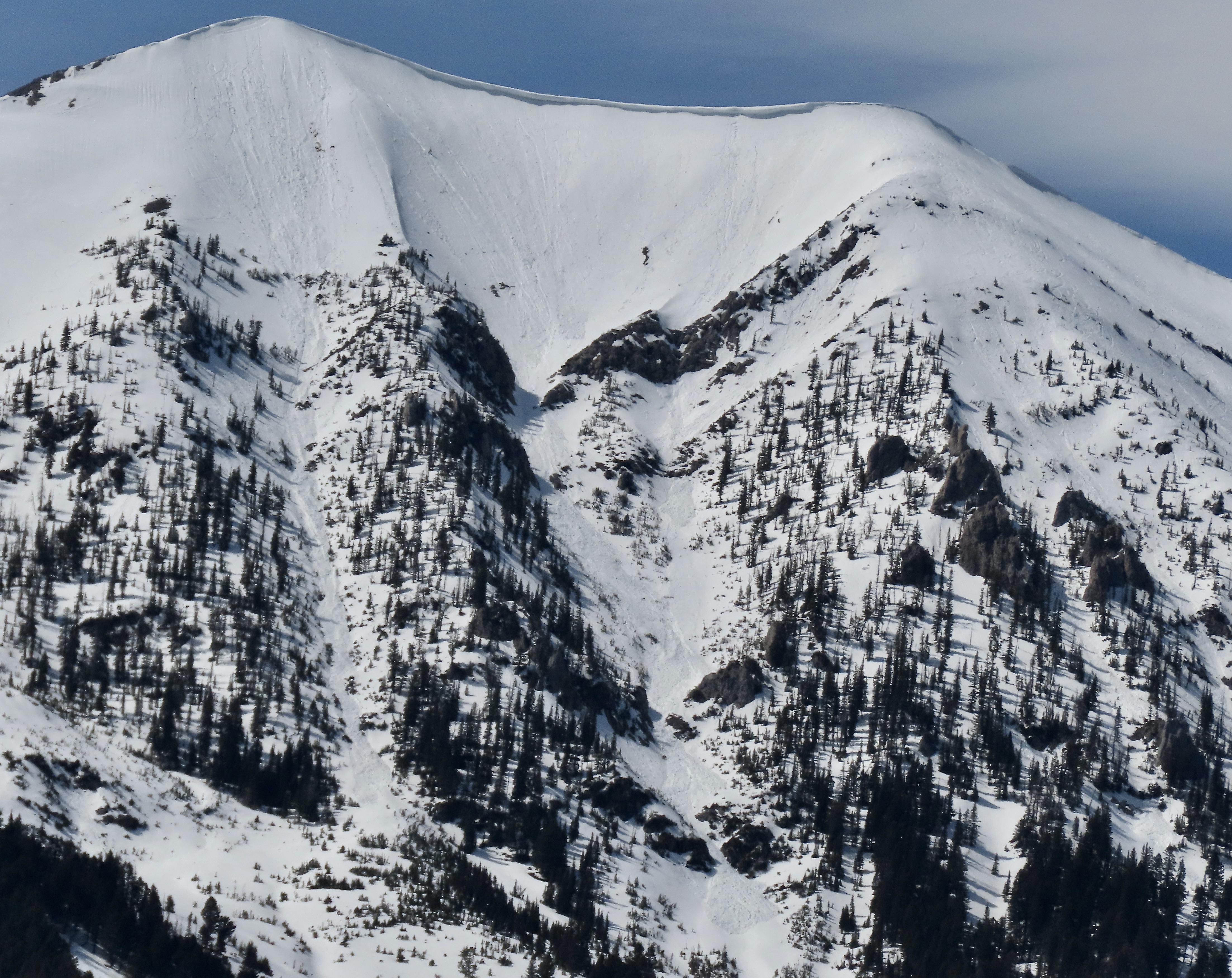
On sunday 4/14 a large wet loose avalanche ran naturally in closed terrain at Bridger. The larger of the two in the photo is from 4/14 at 1230pm. The other slide, on the left, happened yesterday or late in the day Friday.
Full Snow Observation Report
Saw what looked like a wet slab avalanche from the road along the Madison River. Roughly north facing slope at 7500'.
Full Snow Observation Report
Saw a slab avalanche on a NE face at around 9000-10000 feet. Did not see any signs of instability on the tour, but there was not a very concrete freeze. Everything below 8000 remained unfrozen.
Full Snow Observation Report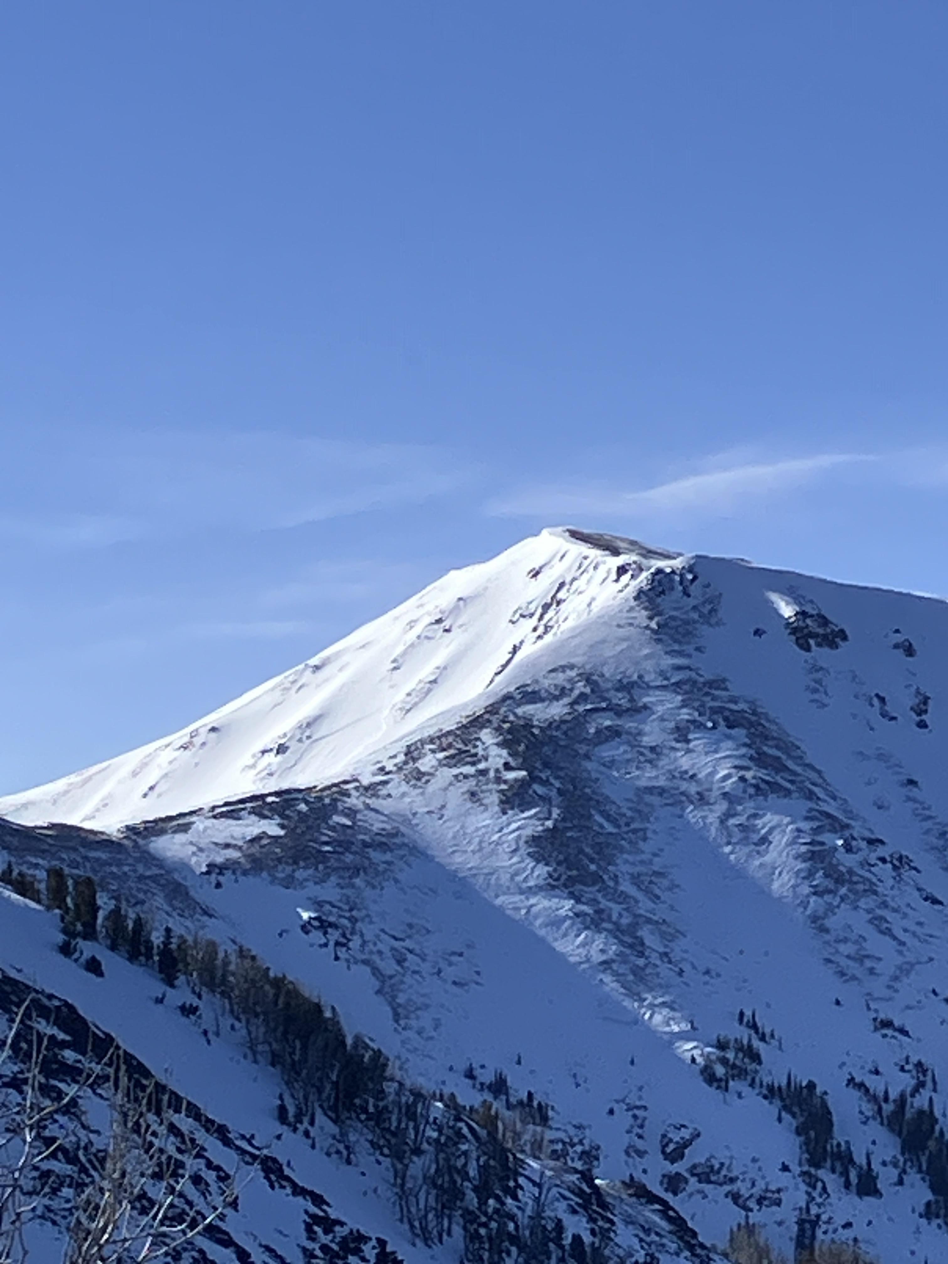
This afternoon I drove up Bridger canyon to Seitz Rd to see the extent of wet snow activity, and stopped in a few places to look with binoculars. There were many loose wet avalanches that ran over the last 1-3 days. I estimate they involved the upper 6-12" of snow. Activity was widespread and many slides were plenty large enough to be dangerous, but there was nothing especially remarkable about the size and I saw zero wet slabs.
Temperature was 65-70 degrees in the canyon, mostly clear skies with a few clouds, calm to light wind.
Full Snow Observation Report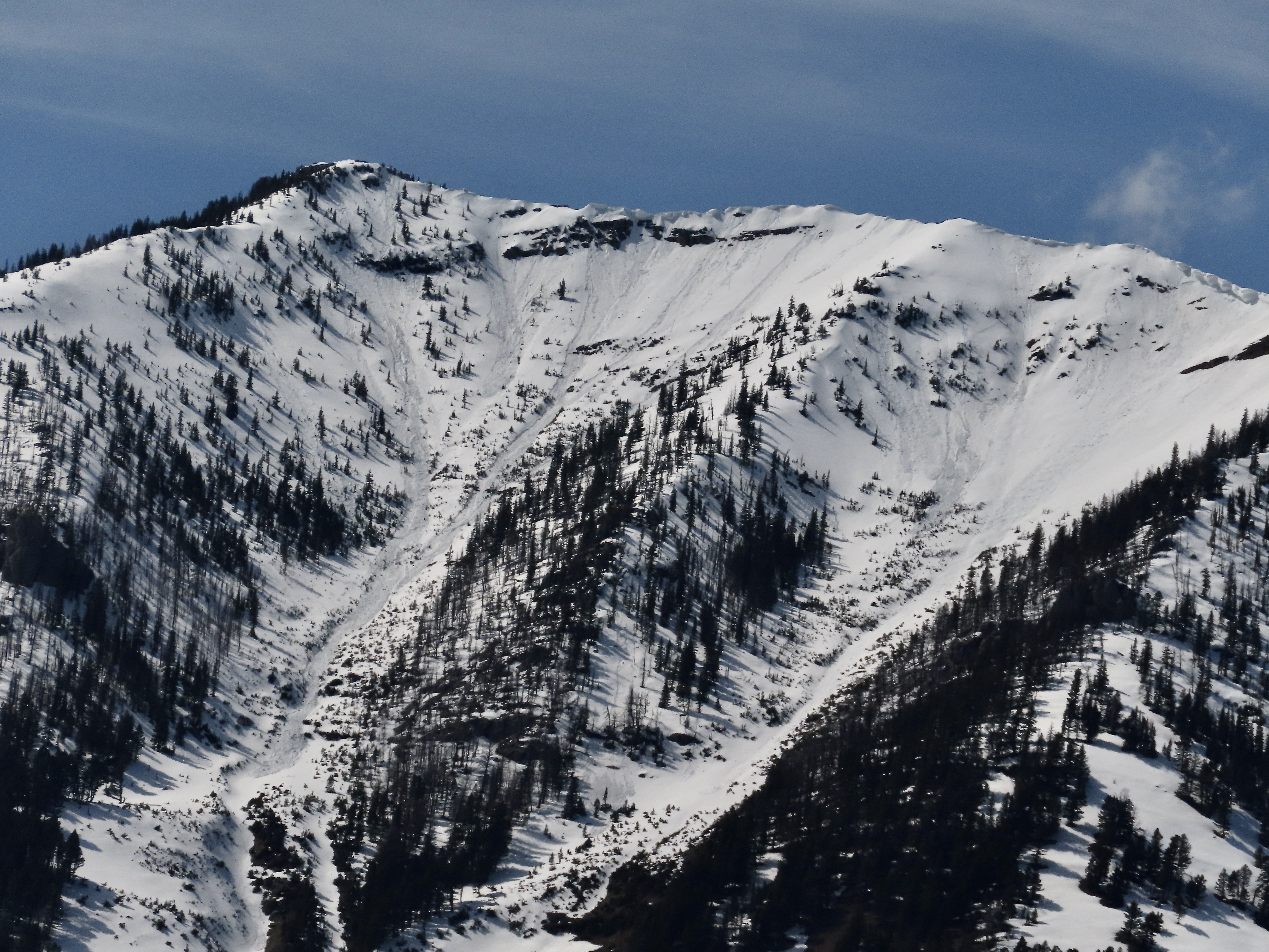
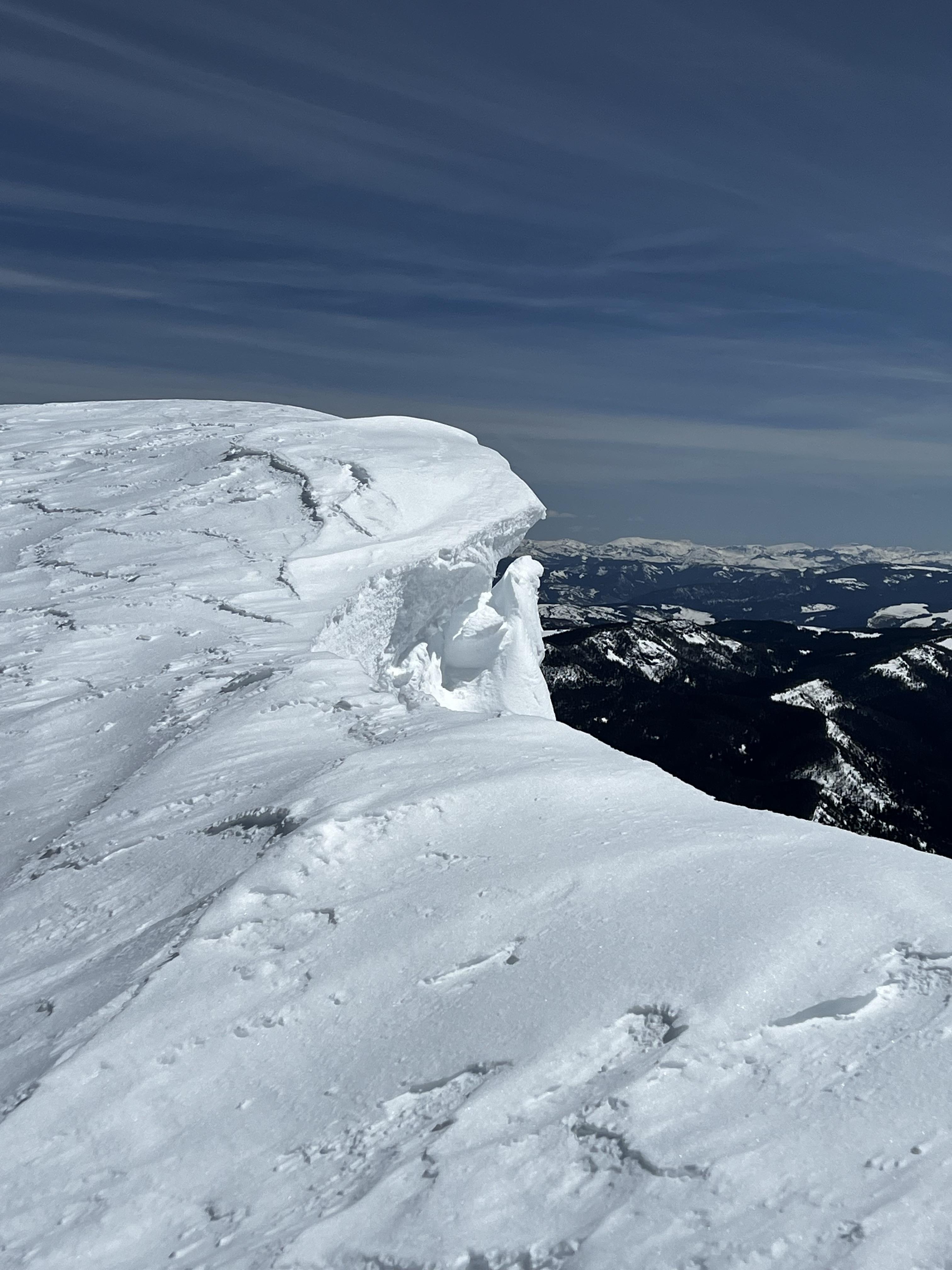
Natural cornice failure and small slab on Iceberg Peak’s NE face. We skied by the day prior and judging by what the wind did to our tracks overnight, this looked like it happened in the morning.
Full Snow Observation Report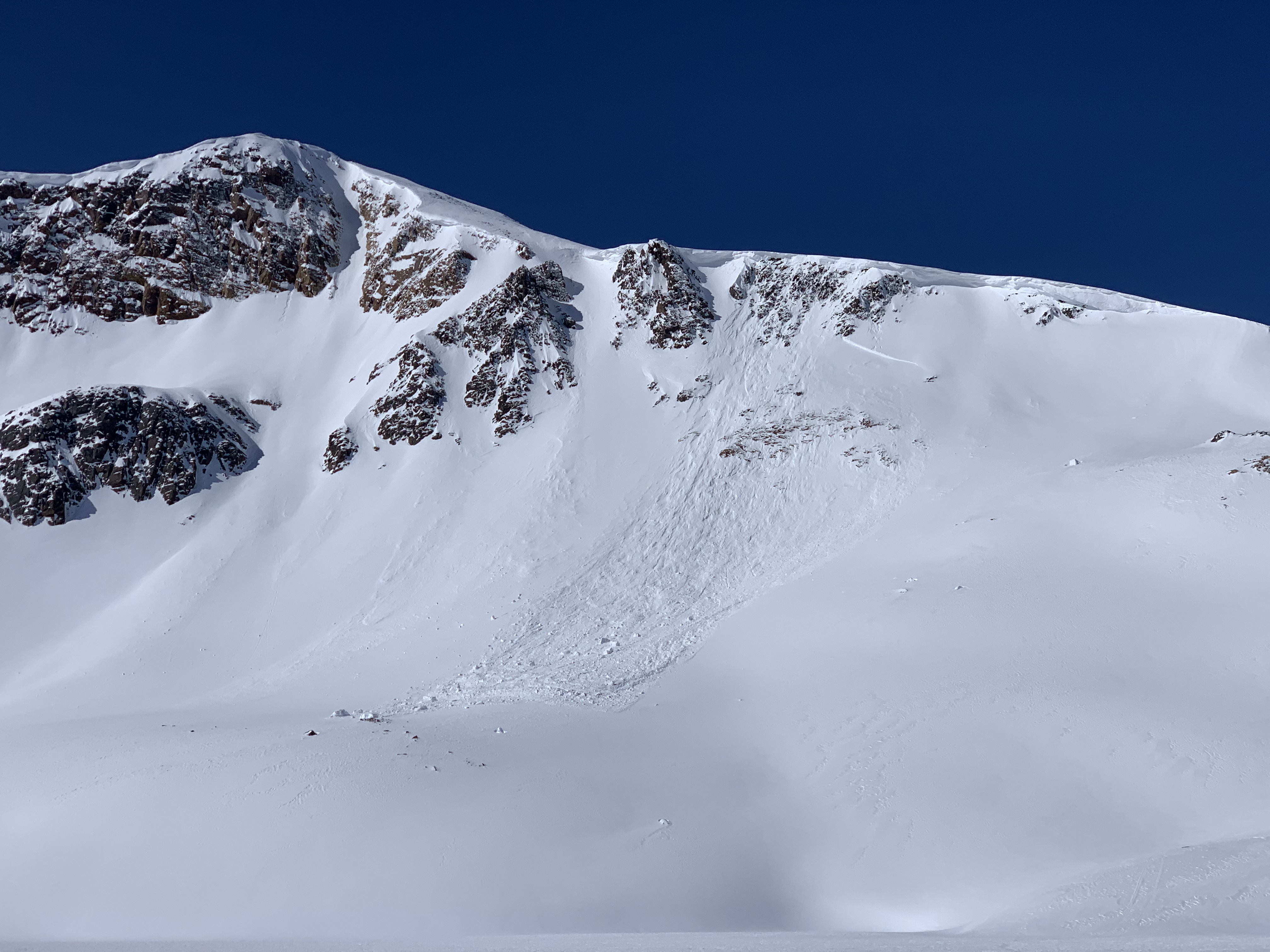
Rode from Buttermilk to Lionhead Ridge to take down the weather station for the season. The snowpack was fully saturated and sloppy at lower elevations. By 8000 ft there was a firm crust with a couple inches of wet snow above it around noon. Winds were breezy at ridgetops, keeping the snowpack a bit cooler (but still getting wet). Ominous clouds moved in around 12:30 pm. We quickly left before getting rained on.
We saw no signs of recent avalanches.
Full Snow Observation ReportClouds may have kept the danger from reaching CONSIDERABLE, but from webcams it looks like they eventually blew through, so I'm not sure.
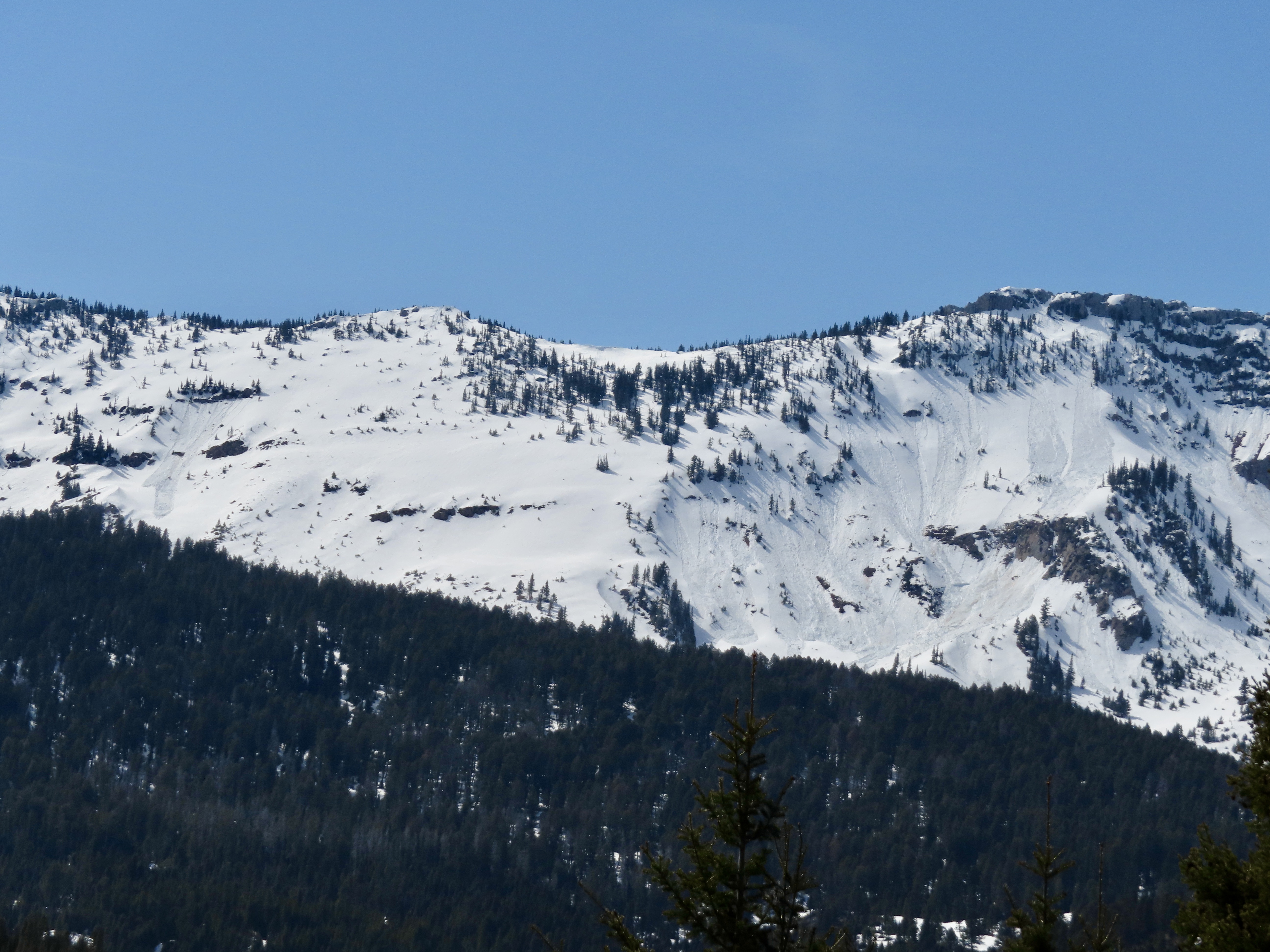
Rode up cottonwood creek on the west side of the crazies. Saw several recent wet loose slides on southern aspects as well as some isolated slides on north/west aspects. Only saw one larger slide that had a wide crown(500ft) D2 on an east aspect. All slides were breaking in the upper 40cm in new/old snow.
Dug a pit north east aspect HS270cm ECTN24 @40cm down from surface. Melt freeze down 70cm might start reacting when water penetrates through upper snow pack, dry snow in upper 60cm but becoming more moist on solars.
Full Snow Observation Report
Driving home from Bridger Bowl I spotted a number of wet loose avalanches in Argentina bowl. It was 1:30 PM when I saw them and the sun was still blazing. I would expect there was more activity as the afternoon progressed.
Full Snow Observation Report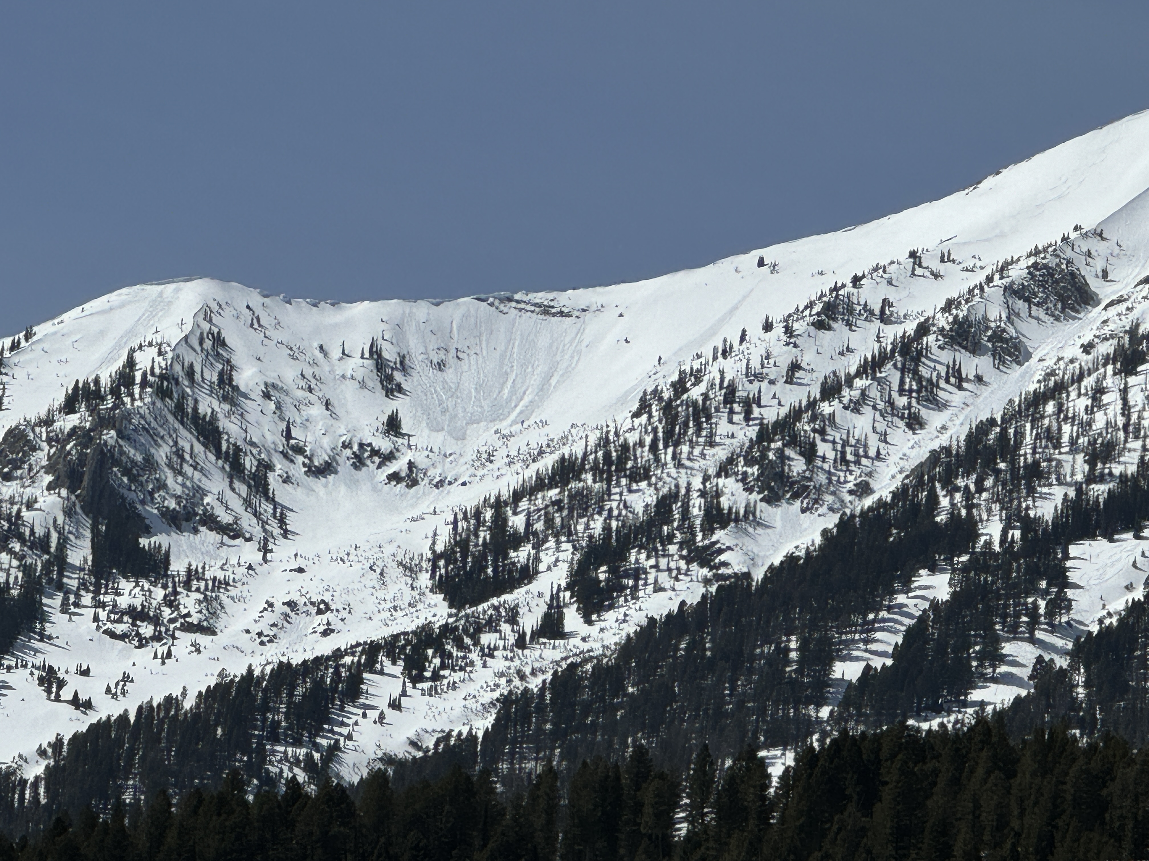
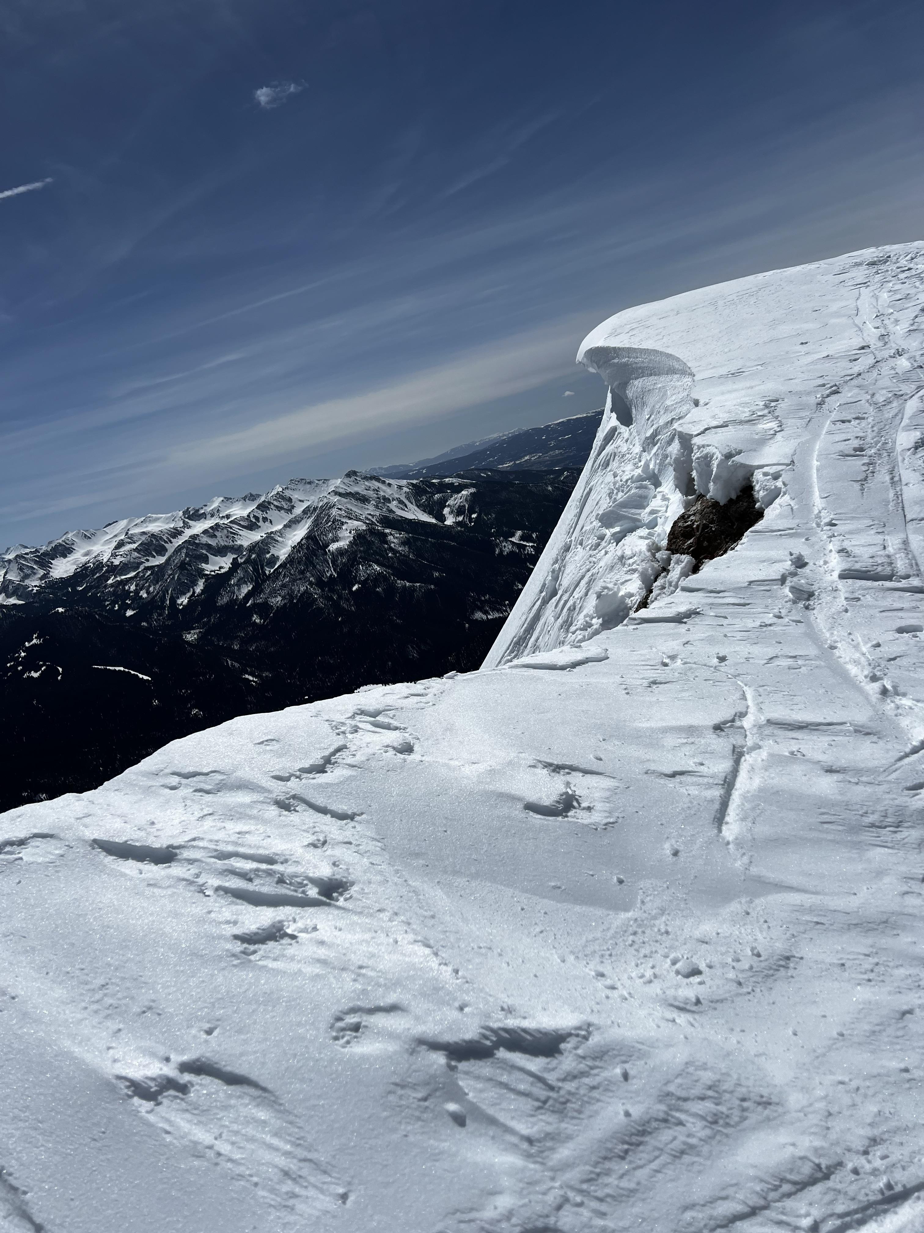
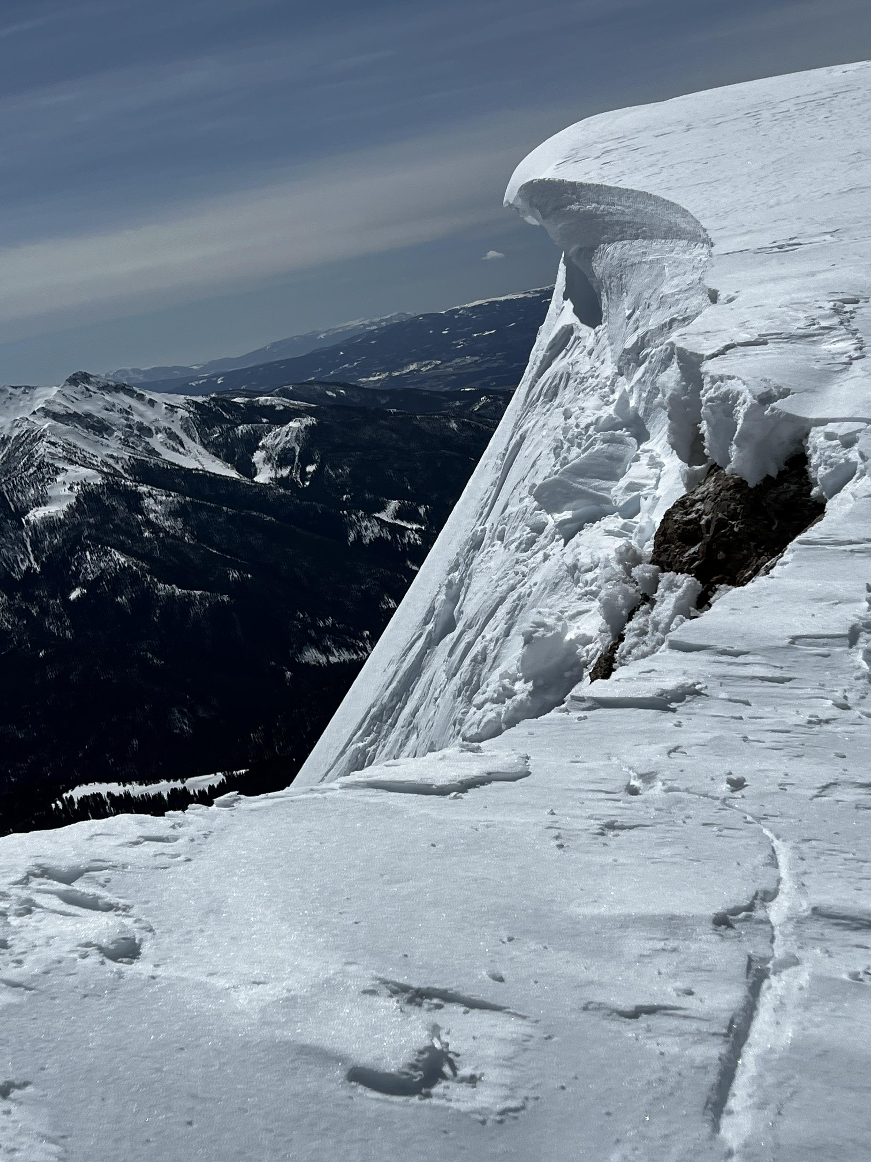
Unintentionally triggered a large cornice collapse on the south face of the Sphinx. I should have expected it, but it was certainly touchier than I was anticipating. Intermittent wind gusts kept upper elevations cooler and we found somewhat cold snow up high. At treeline and below it was hot and crusty! Photos show cornice before and after.
Full Snow Observation Report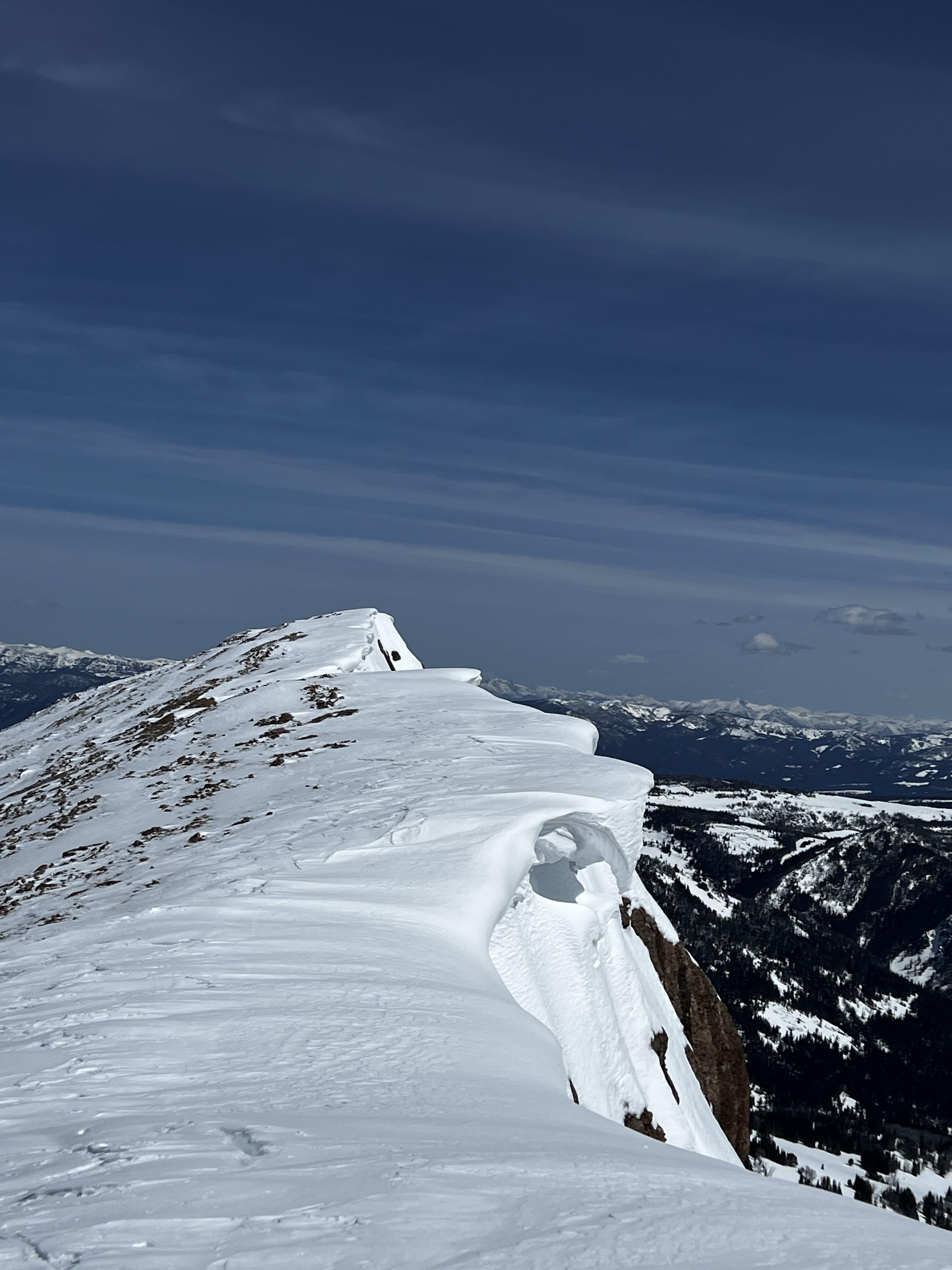
From email: "Had propagation on 1.5mm rounding facets below the mid-March, 1/2cm thick and knife hard MF crust. This location is always shallow and has a poor structure, but I was surprised to get propagation.
Further up valley on a west aspect, HS 130, 1 of 2 pits had ECTP28 on the basal facets. Pretty wild to still be getting propagation in mid April.
Winds were light out of the south, gusting to strong at ridgetops out of the west with active snow transport. No wet loose activity seen today, but several old wet loose avalanches on Climax from the last warm up. "
Full Snow Observation ReportWe skied two North-facing lines in the Northern Gallatin range on Wednesday ranging in elevation from 8500 - 9700 ft with some slight West and East flavor. We saw no signs of instability and set off a couple large sluffs in the top 8-12" of snow and some wind-loaded pockets breaking 6-8" deep. I dug a pit and did a CT and ECT and got CT15 on new snow 30cm deep and CT28 on a layer 45 cm deep. Got ECTN16 on same 30-35 cm deep new snow layer. The interface with the old freeze-thaw layer below the new snow did not show a very high quality fracture plane / bed surface for the upper new snow to slide on. the freeze-thaw layer was about 1-2cm thick but did not feel it while skiing. Upon pulling on ECT column with shovel, broke on 45-cm layer with poor quality and also on basal facet layer at ground. Overall right-side-up snowpack density going from fist to pencil hardness pretty linearly. Total depth of snow 210cm. Depth of new snow from last storm approx. 12-16". 9600 ft NNE aspect.
Full Snow Observation Report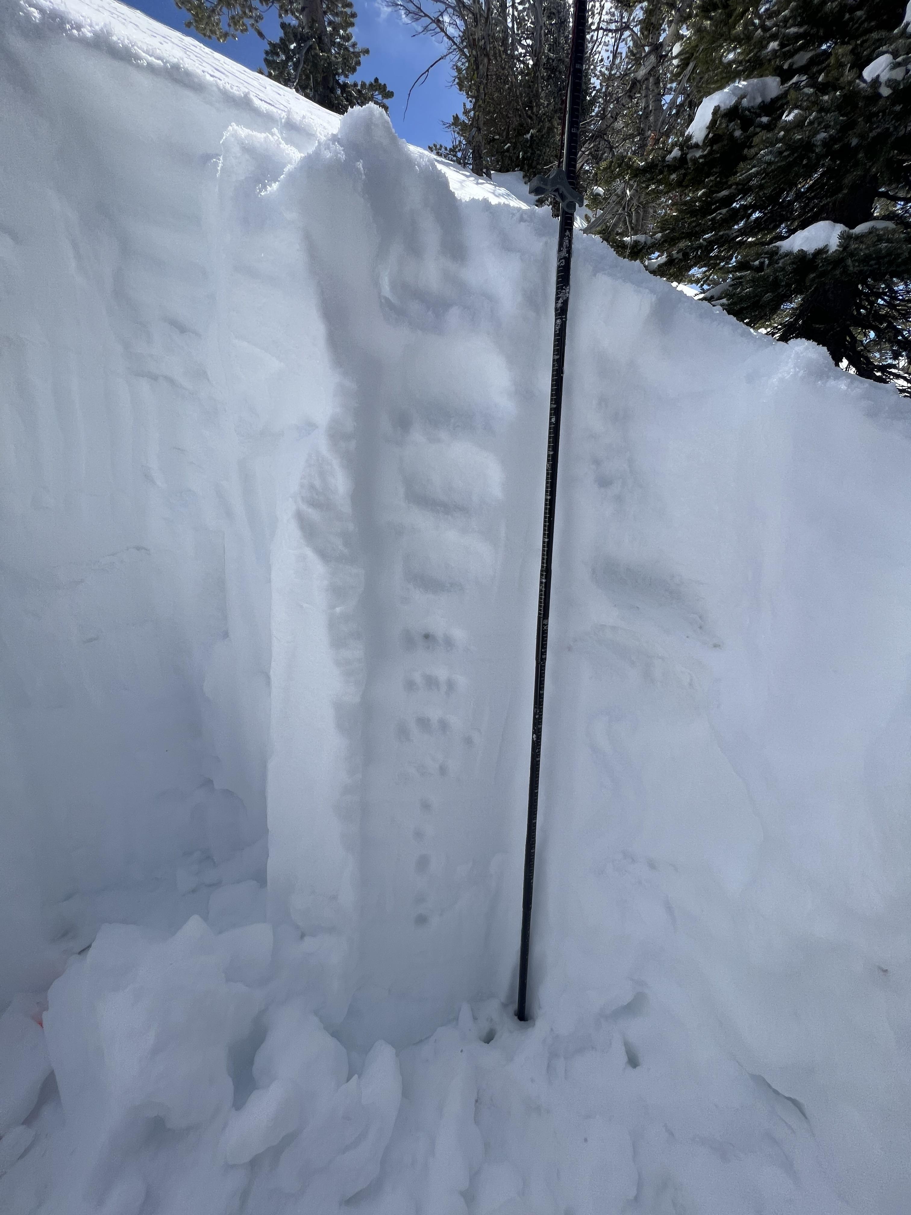
Dug a pit on our way up the west side of Henderson Mountain. Incline 26 degrees, elevation 9545. Surface depth at 165cm, dug down to about 65cm. Performed extended column test and yielded ECTN17 along melt freeze crust at 135cm above ground.
Full Snow Observation Report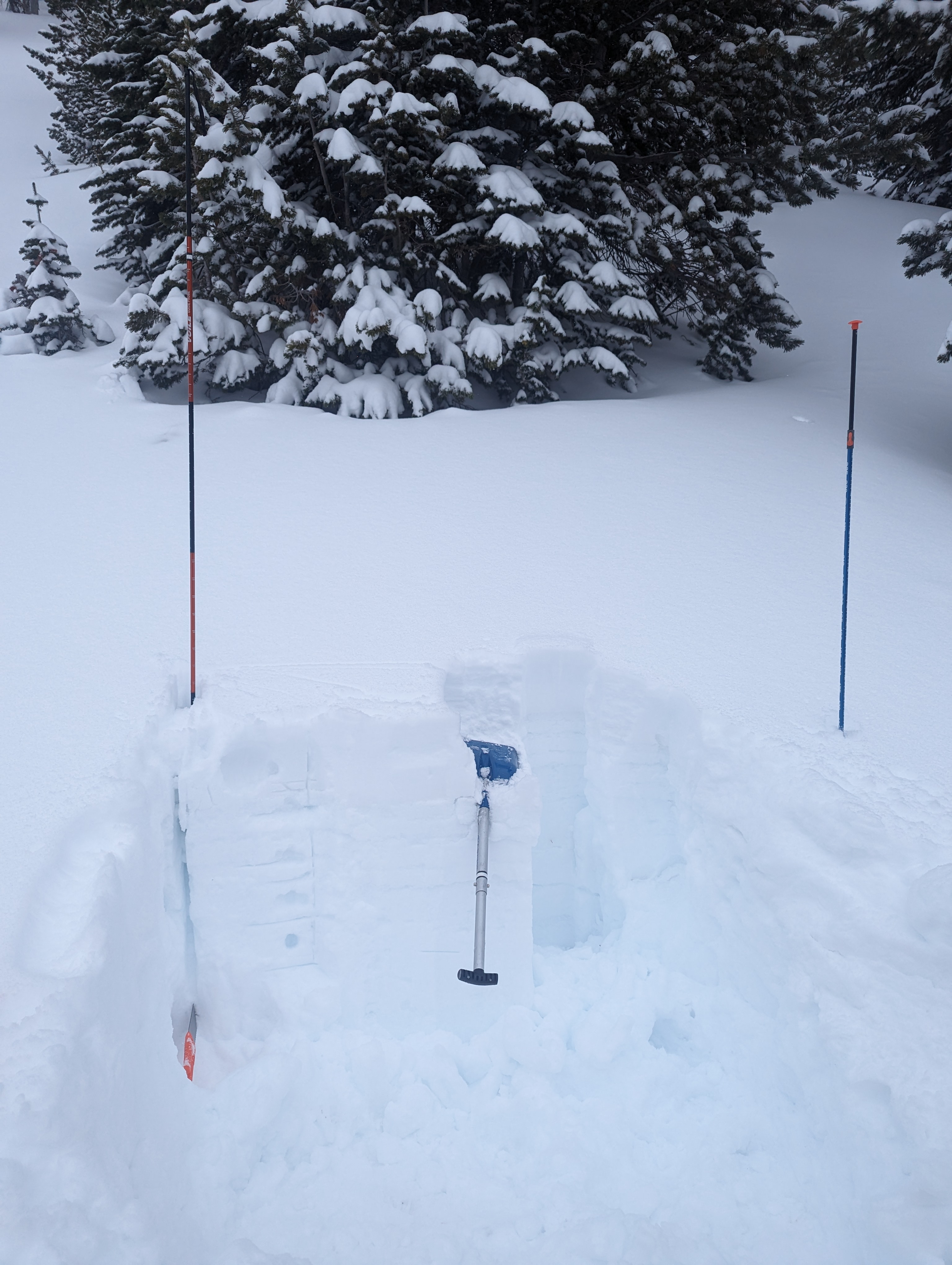
We toured from the Bracket Creek trailhead to The Playground.
It snowed all day, predominantly S-1 with a few notable pulses of S-2.
Winds were super elevation-dependent, with moderate (gusts to strong) upslope winds (E-NE) up until about 6500', moderate upslope winds from approx. 6500'-7300', and light and at times variable south-westerlies up until our high point at 8200'. We saw very little wind effect above 7300' and we did not travel on any wind-loaded steep slopes during our tour.
By 5:30 PM, there was 14-16" of new snow at 7000' and 22-24" at 8000'. Below the new snow was a stout and supportable melt-freeze crust.
At the beginning of the day, we found the storm snow to be relatively low-density and unconsolidated, except for a 1-2" super soft slab capping the new snow in most locations we traveled. That thin soft slab got capped with another 3-5" of low-density snow that fell by the end of the day.
Though we could get small columns in hand pits to slide on the crust below, they lacked cohesion and broke apart when moved. We experienced only minor cracking on the ascent. The surface snow sluffed easily during our descents, but did not entrain much volume. In the wind-sheltered zones through which we traveled, neither test slopes, uptrack tests, nor ski descents produced any obvious signs of instability.
Full Snow Observation Report
From IG message: “Rode the banana today.. lots of fast moving sluff. Had a mid elevation pocket pop. New snow seemed to have bonded well, the spot that did pop had formed into 12” slab below rock face. Little to no signs of instability.”
Full Snow Observation Report