On 1/12 observed a D .5 soft slab near Long Lake above the snowmobile trail. Also saw some small dry loose activity on E facing terrain in Zimmer Creek. Photo: BPG
Trip Planning for Cooke City Area
Past 5 Days

Considerable

Considerable

Moderate

Moderate

Moderate
Relevant Avalanche Activity
HS-N-R2-D2.5-O
Elevation: 9,600
Aspect: NW
Coordinates: 44.9940, -109.9220
Caught: 0 ; Buried: 0
From obs. 1/13: "Spotted another natural avalanche today on Woody Ridge north of the "KNBs." Northwest facing slope, crown elevation approx 9600'. Ran 1000 to 1200'. Unsure of when it went, we did not notice it this morning only this afternoon on the hike out."
More Avalanche Details
SS
Coordinates: 45.1170, -109.8930
Caught: 0 ; Buried: 0
On 1/12 observed a D .5 soft slab near Long Lake above the snowmobile trail. Also saw some small dry loose activity on E facing terrain in Zimmer Creek.
More Avalanche Details
HS-N-R3-D3-O
Elevation: 10,000
Aspect: W
Coordinates: 44.9701, -109.9270
Caught: 0 ; Buried: 0
Observed a large avalanche on a west facing slope approx 10000ft, with a higher crown at 10200'. Crown depth 4-6'. HS-Ns-D2-R2-O . Ran 1000ft and into terrain I had previously considered safe.
More Avalanche Details
Relevant Photos
-
-
Woody Ridge north of the "KNBs." Northwest facing slope, crown elevation approx 9600'. Ran 1000 to 1200'. Photo: N Gaddy
-
Woody Ridge north of the "KNBs." Northwest facing slope, crown elevation approx 9600'. Ran 1000 to 1200'. Unsure of when it went, we did not notice it this morning only this afternoon on the hike out. Photo: N Gaddy
-
Observed a large avalanche on a west facing slope approx 10000ft, with a higher crown at 10200'. Crown depth 4-6'. HS-Ns-D2-R2-O . Ran 1000ft and into terrain I had previously considered safe. Photo: N Gaddy
-
Observed a large avalanche on a west facing slope approx 10000ft, with a higher crown at 10200'. Crown depth 4-6'. HS-Ns-D2-R2-O . Ran 1000ft and into terrain I had previously considered safe. Photo: N Gaddy
-
Observed a large avalanche on a west facing slope approx 10000ft, with a higher crown at 10200'. Crown depth 4-6'. HS-Ns-D2-R2-O . Ran 1000ft and into terrain I had previously considered safe. Photo: N Gaddy
-
Observed a large avalanche on a west facing slope approx 10000ft, with a higher crown at 10200'. Crown depth 4-6'. HS-Ns-D2-R2-O . Ran 1000ft and into terrain I had previously considered safe. Photo: N Gaddy
-
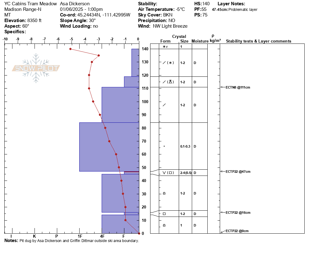
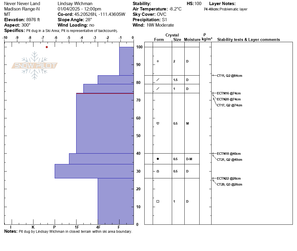
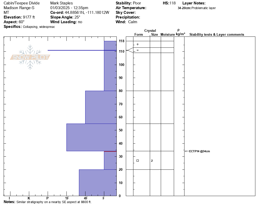
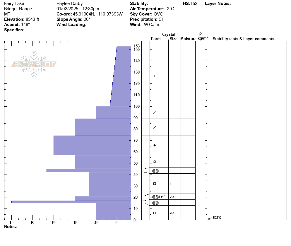
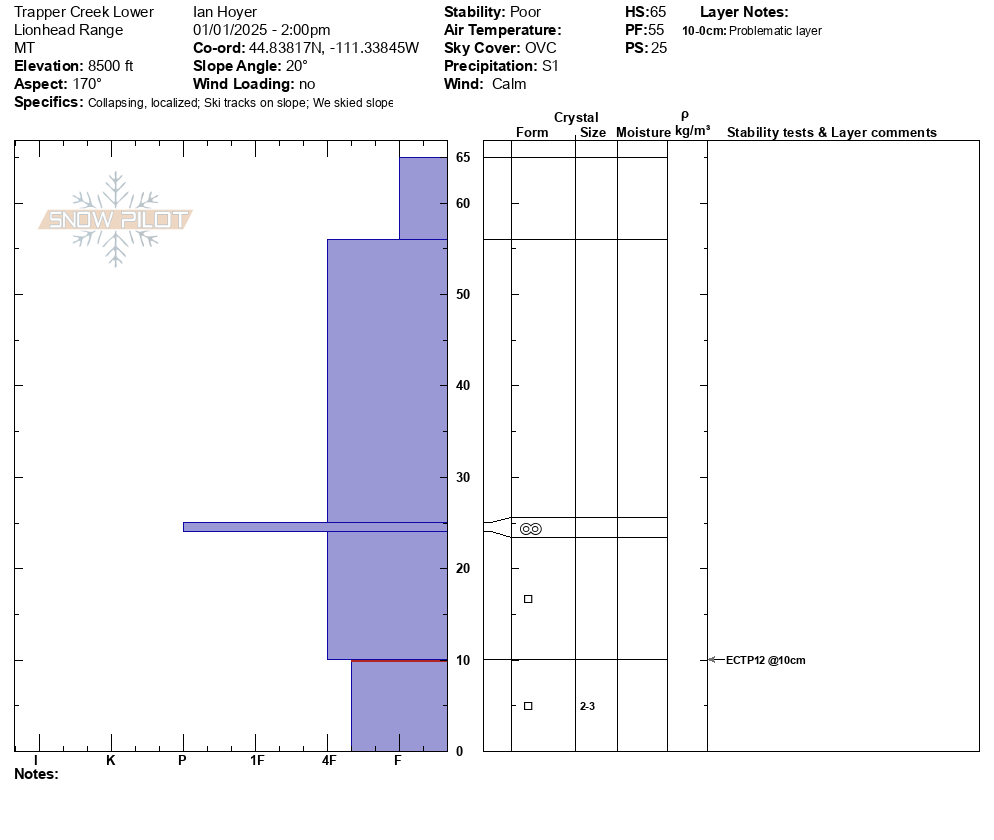
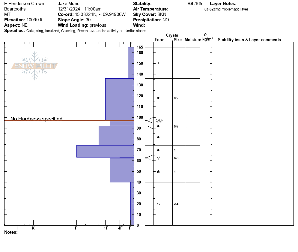
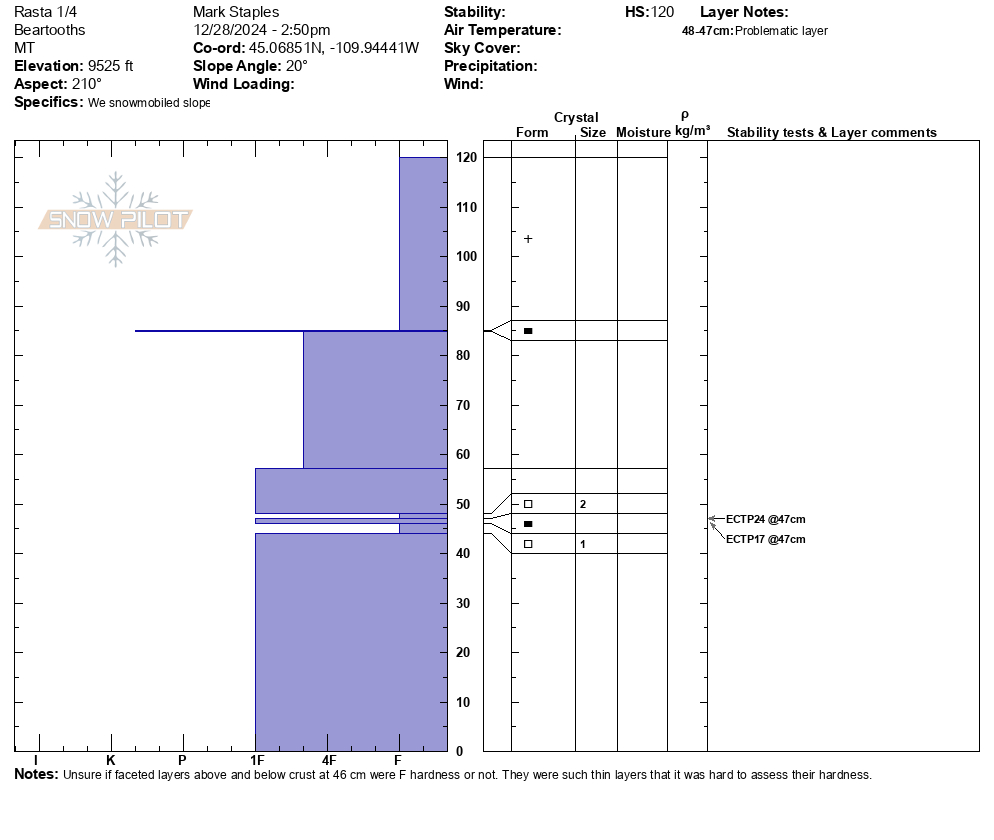
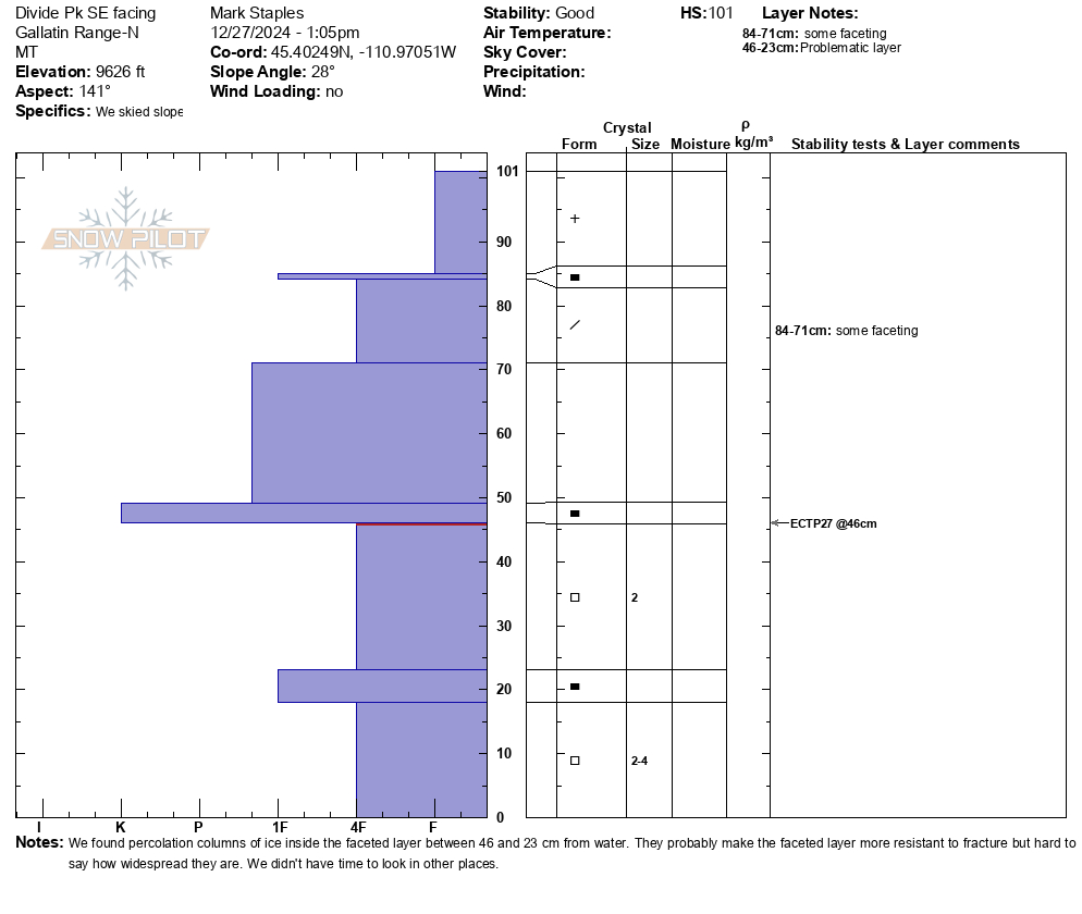
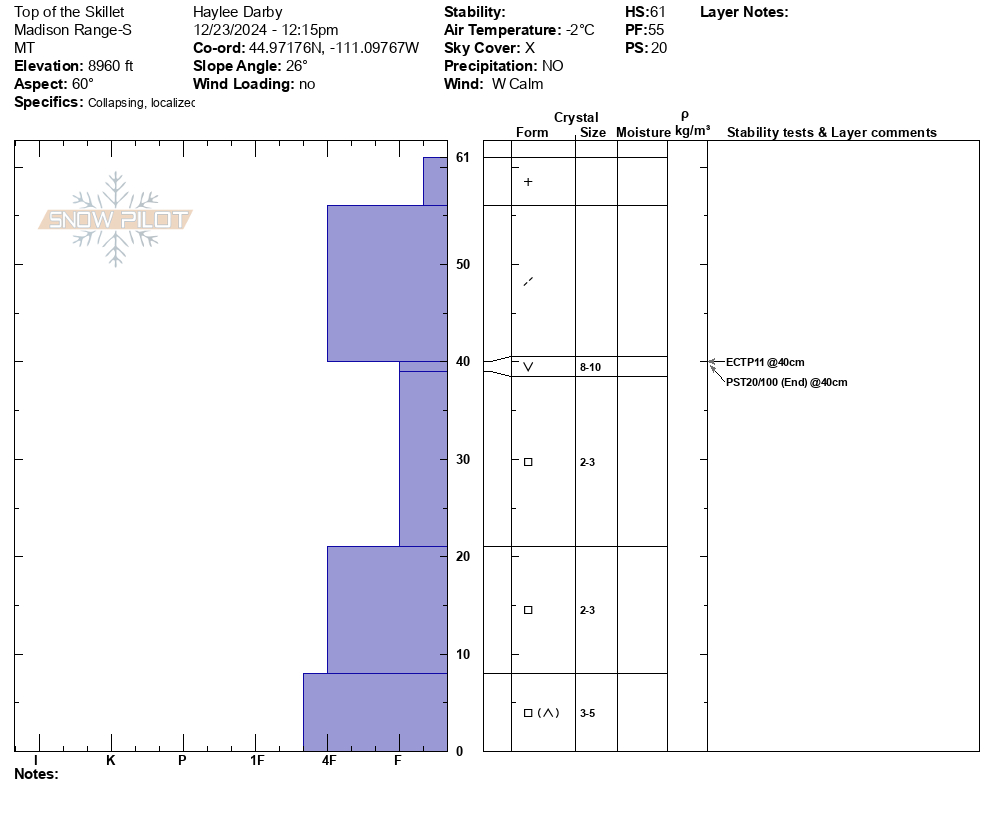
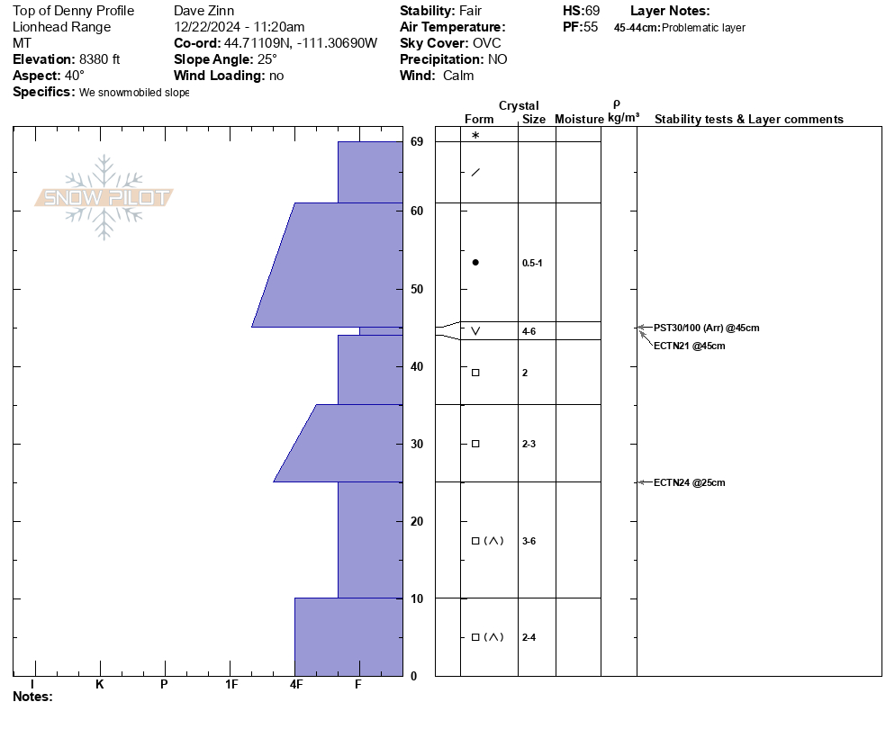
Jan 10, We dug a pit on Henderson Bench on a northeast facing slope, and one on Scotch Bonnet on a south facing slope (pictured). Both showed a 4' thick strong slab on weaker, faceted snow at the base. The weak layers are not terribly weak and didn't produce concerning test scores, so they may get better when they get a break from snowfall and wind-loading, but for now recent avalanches show these layers are weak enough and will produce more big avalanches as snowfall and wind continue. Photo: GNFAC
-
We looked at two 4-6' deep persistent slab avalanches that were reported yesterday on the east side of Henderson Mtn., which likely happened yesterday (Jan 9). Wind-loading was the likely trigger. There were not tracks near the larger one above the bench, where riders could easily get to, but they could have been filled in. The other slide was below the highest point below a cornice and likely natural. Both looked like they broke on facets at the bottom of the snowpack. Photo: GNFAC
-
We looked at two 4-6' deep persistent slab avalanches that were reported yesterday on the east side of Henderson Mtn., which likely happened yesterday (Jan. 9). Wind-loading was the likely trigger. There were not tracks near the larger one above the bench, where riders could easily get to, but they could have been filled in. The other slide was below the highest point below a cornice and likely natural. Both looked like they broke on facets at the bottom of the snowpack. Photo: GNFAC
-
On Jan 9 We saw many avalanches of various types and ages. Some occurred today and within the last 24 hours and some were up to a week old. Avalanche types ranged from 3-6' deep and broke on weak layers near the bottom of the snowpack to shallow soft, fresh wind slabs. Photo: GNFAC
-
On Jan 9 We saw many avalanches of various types and ages. Some occurred today and within the last 24 hours and some were up to a week old. Avalanche types ranged from 3-6' deep and broke on weak layers near the bottom of the snowpack to shallow soft, fresh wind slabs. Photo: GNFAC
-
On Jan. 9 we rode away from our snowpit on Mt. Abundance we saw a fresh 3'deep x 10' wide slide that we might have remote triggered from the flat ridge above.
-
Jan. 9, About 45 minutes after we left a snowpit on Mt. Abundance, from a couple miles away, we saw a 4-6' deep avalanche that happened since we had been there, about 1000' up the ridge from our snowpit m. This slide was either natural or remote triggered by riders about 1000' away who were there after we were. Photo: GNFAC
-
On Jan. 9 we saw this large avalanche on the north side of Fisher Mtn. that happened at some time in the last week (could have been 48 hours to a week old). Photo: GNFAC
-
On Jan 9, we saw one 3-4' deep slide that looked like it broke within recent new and wind-drifted snow on the north end of Henderson. Photo: GNFAC
-
There were a couple of avalanches on E Henderson, one that I think happened today, a few on E Sheep Mountain, some shallower avalanches, and plenty of loose dry snow moving around in the steeps. Photo: N Mattes
-
There were a couple of avalanches on E Henderson, one that I think happened today, a few on E Sheep Mountain, some shallower avalanches, and plenty of loose dry snow moving around in the steeps. Photo: N Mattes
-
There were a couple of avalanches on E Henderson, one that I think happened today, a few on E Sheep Mountain, some shallower avalanches, and plenty of loose dry snow moving around in the steeps. Photo: N Mattes
-
There were a couple of avalanches on E Henderson, one that I think happened today, a few on E Sheep Mountain, some shallower avalanches, and plenty of loose dry snow moving around in the steeps. Photo: N Mattes
-
There were a couple of avalanches on E Henderson, one that I think happened today, a few on E Sheep Mountain, some shallower avalanches, and plenty of loose dry snow moving around in the steeps. Photo: N Mattes
-
-
3-4 foot crown about 100 yards wide on East face of sheep mountain. Photo: Mike F
-
3-4 foot crown about 100 yards wide on East face of sheep mountain. Photo: Mike F
-
On Jan 2, 2025 we saw three avalanches just north of Daisy Pass and one on Henderson Mtn. The one on Henderson was difficult to see the crown, but we could see the debris. Two of the slides north of Daisy were 2-3' deep and 100-150' wide and ran into thick stands of trees, looked like thick soft slabs/drifts of recent snowfall. There were a lot of tracks from previous days nearby, but trigger in unknown. The other slide was 1-2' deep and 300-500' wide, soft slab of recent snow. Photo: GNFAC
-
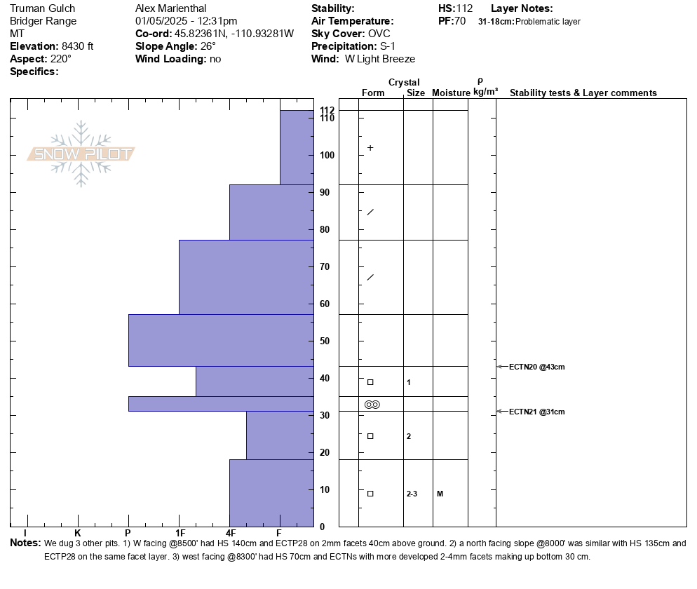
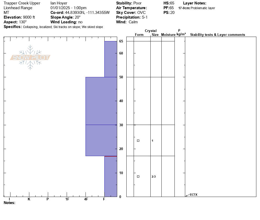
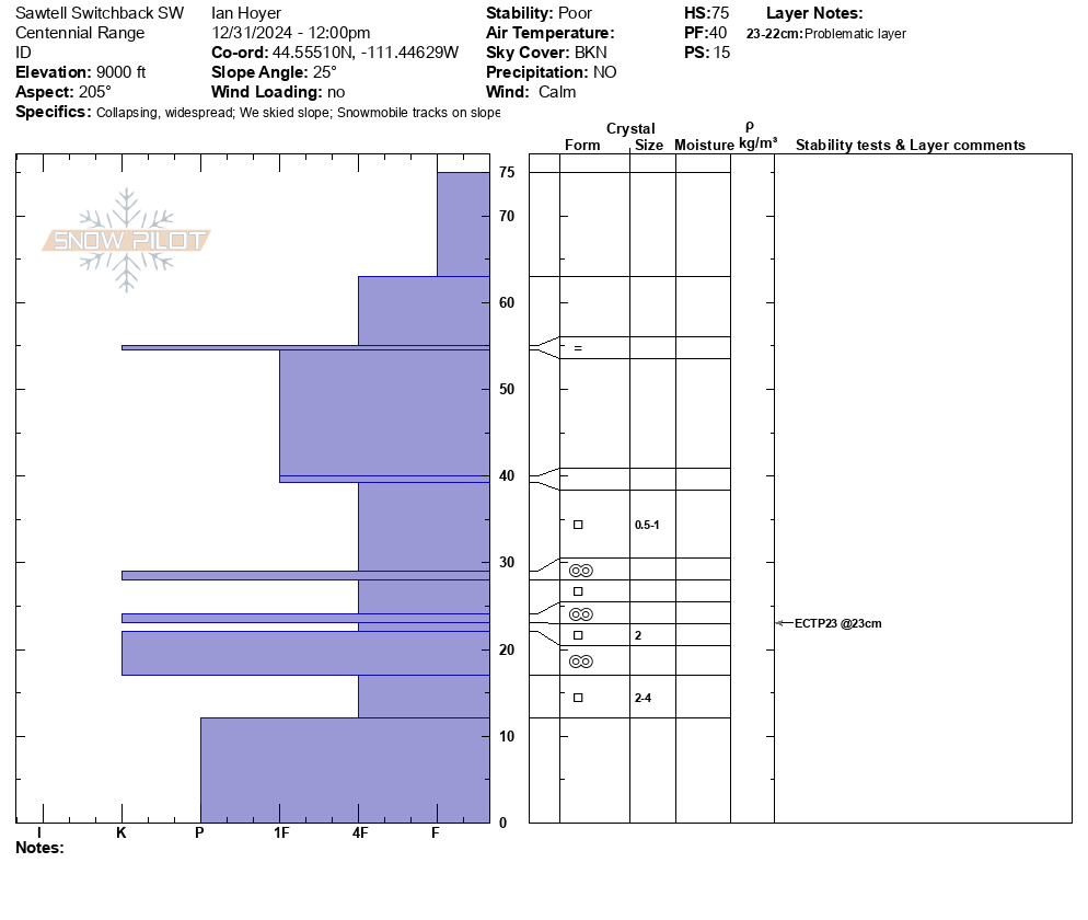
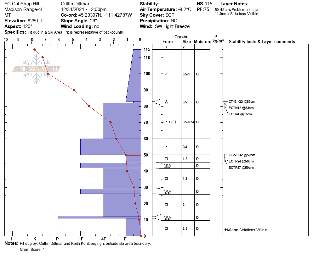
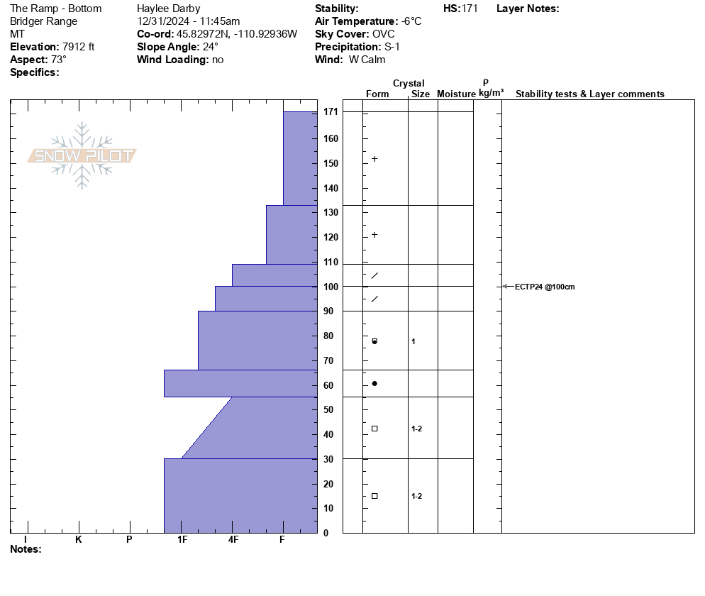
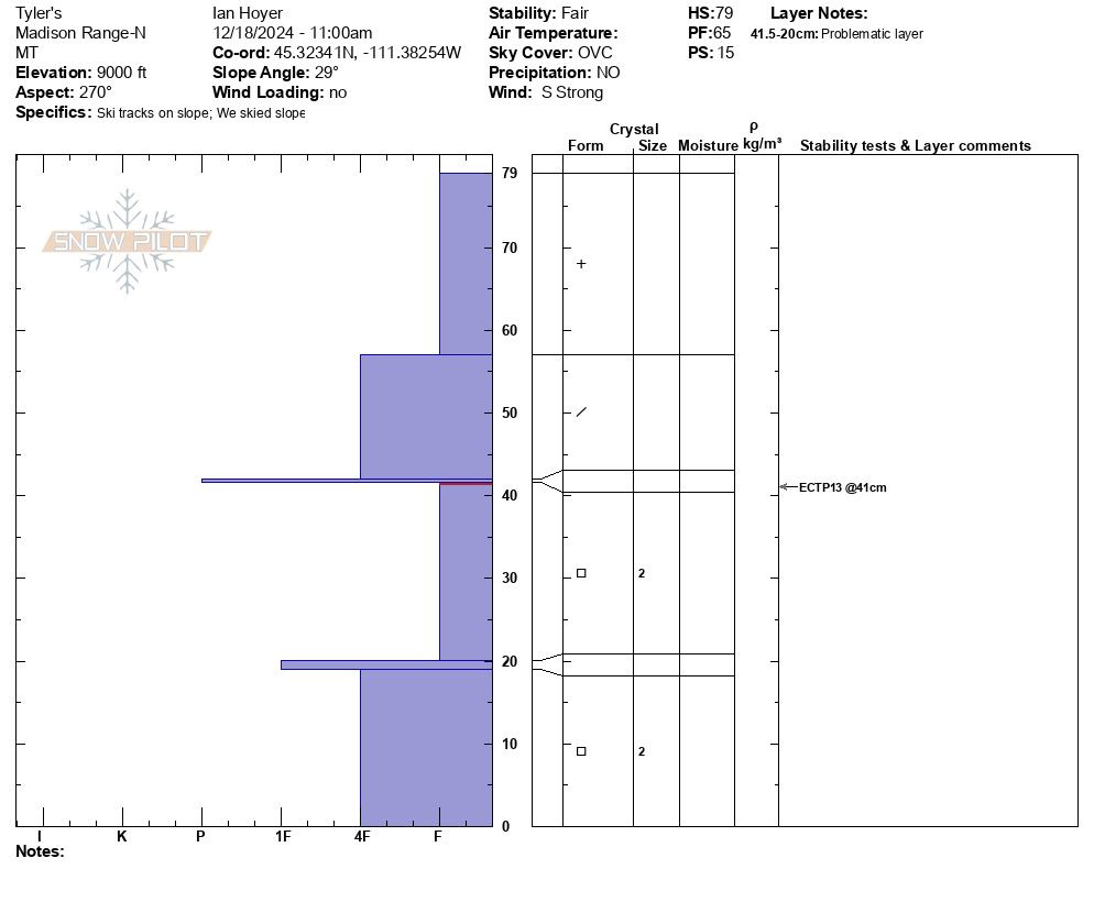
Jan 2, 2025 We dug a pit between Scotch Bonnet and Sheep Mtn. on a sw facing slope at 9,800'. HS was 135cm (4feet). We had ECTP12 and ECTP26, both on a layer at similar height as the surface hoar has been found (1.5-2 feet above the ground). The weak layer was mostly 2-3mm facets w/ small cups and some signs of surface hoar on top of a melt-freeze crust. Photo: GNFAC
-
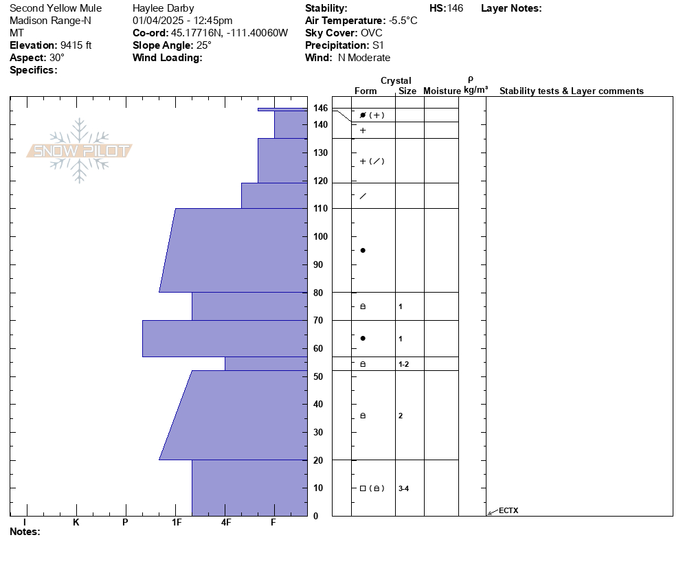
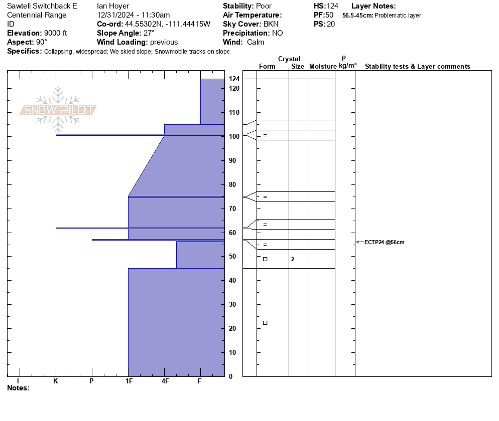
Rode out to Wolverine Pass on New Years Eve. Daisy pass is a little spicy for novices still. On approach to wolverine pass/YNP boundary we found HS 160cm on NE facing slope at 9200'. Found 3-4mm SH in tact at 110 cm deep. Found 1-2mm FC at 60cm deep. Ectn27 at storm interface layer 60 cm deep. No results on SH layer, but many collapses during the day assumed to be on this layer. Large D2-3 deep Slab avalanche seen on NW facing slope of Sunset Peak. Picture attached. Generally stable condions, but big avalanches on N,NE,NW facing slopes are a real concern for sure.
-
We were ski touring on the SW side of Mt. Henderson today, and noticed a large (natural?) avalanche on the NE aspect of Henderson. First observed at around 1:15pm. It appeared to be very fresh, possibly from a remote trigger this morning.
2 photos attached. A NE aspect, around 10,000'.
It looked to be 4-6' deep and about 500' wide. And it failed on snow at/ near the ground.
Photo: B Fredlund
-
Scotch Bonnet Depth to Weak Layer 28 Dec 2024
-
A group on the "Rip Curl" area of Woody Ridge south of Cooke City report ECTP1 test results failing on buried weak layers. Photo: B. Henry
-
We ski toured in Sheep Creek today, north of Cooke City. Of note, a thin (4mm) rime crust was forming due to the high humidity/ quasi rain. Remarkably the rime crust skied very well. Photo: B. Fredlund
-
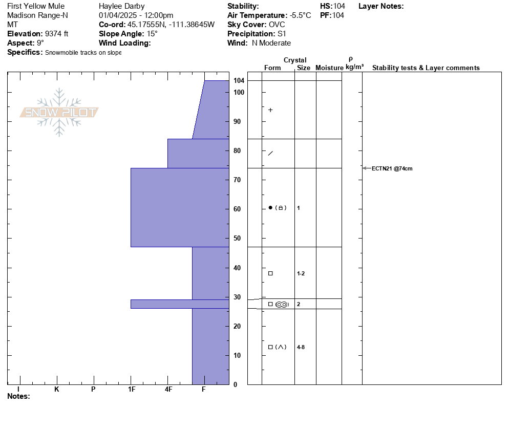
We experienced several collapses and had propagation in multiple ECTs performed. HS varies between 85-105cm. Photo from 9940
Photo: BMG
-
Photo: BMG
-
I saw a wide slab avalanche up on west Woody Ridge from town. It happened late on Wednesday or overnight during or after the strong winds and snowfall. Photo: GNFAC
-
Wind slab avalanche near Lulu Pass. Photo: GNFAC
-
Large persistant slab avalanche on Henderson. Photo: GNFAC
-
Persistant slab avalanche on Fisher that broke near the ground. Photo: GNFAC
-
D2 avalanche on east facing Mount Fox that appears to be on the SH layer, triggered by a cornice drop.
Photo: B Zavora
Videos- Cooke City Area
Weather Stations- Cooke City Area
Weather Forecast Cooke City Area
Extended Forecast for2 Miles NNE Cooke City MT
This Afternoon

High: 18 °F
Chance Snow
Tonight

Low: -6 °F
Chance Snow
Saturday

High: 4 °F
Chance Snow
Saturday Night
Low: -12 °F
Slight Chance
Snow then
Partly CloudySunday

High: 6 °F
Chance Snow
Sunday Night

Low: -20 °F
Chance Snow
M.L.King Day
High: 3 °F
Slight Chance
Snow then
SunnyMonday Night

Low: -8 °F
Partly Cloudy
Tuesday

High: 15 °F
Cold
The Last Word
Thank you for sharing observations. Please let us know about avalanches, weather or signs of instability via the form on our website, or you can email us at mtavalanche@gmail.com, or call the office phone at 406-587-6984.


