Avalanche Activity
SS-N-R1-D1
Coordinates: 45.0745, -109.9070
Caught: 0 ; Buried: 0
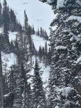
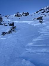
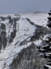
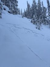
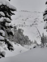
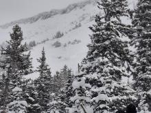
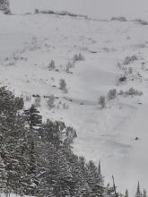
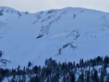
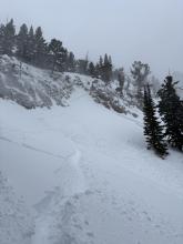
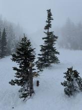
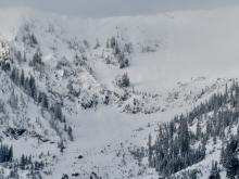
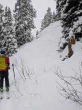
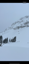
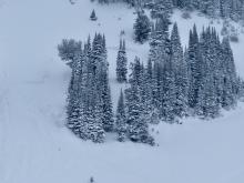
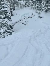
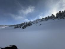
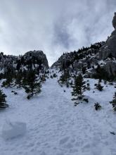
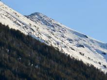
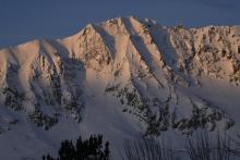
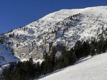
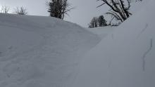
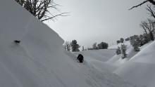
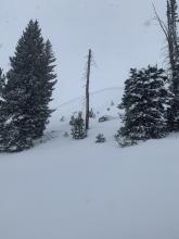
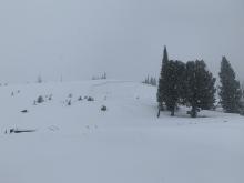
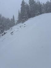
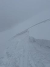
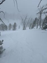
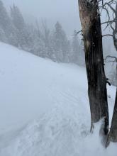
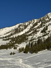
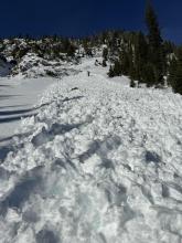
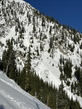
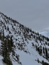
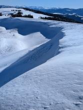
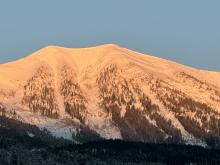
During a full day of ski touring near Round Lake, we saw about 4" of new snow. Hard to tell though because the wind was really blowing snow around. I saw two small shallow wind slab avalanches but vis was poor.
More Avalanche Details
SS-N-R1-D1
Elevation: 9,200
Aspect: NW
Coordinates: 45.0202, -109.9380
Caught: 0 ; Buried: 0
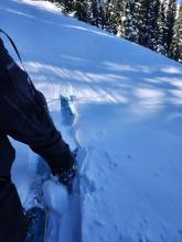
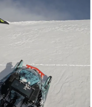
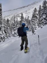
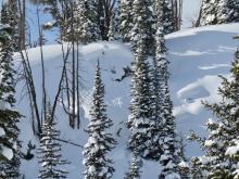
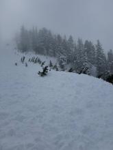
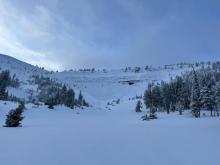
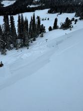
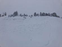
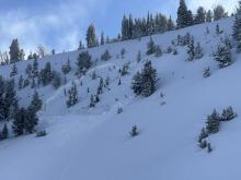
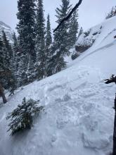
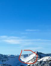
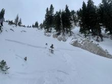
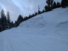
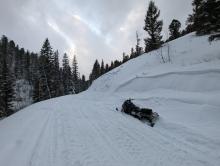
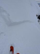
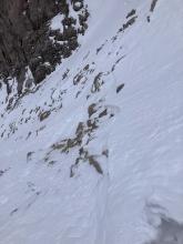
Skied north of Cooke City. Lots of cracking and small slabs on pillows. Observed one small wind slab on NW facing slope 9200 ft.
More Avalanche Details
SS-AMc-R1-D1
Coordinates: 45.1628, -111.3510
Caught: 0 ; Buried: 0
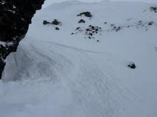
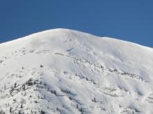
Human triggered release of cornice overhang near the weather station on Buck Ridge. Recent activity next to the small release. Crown 1-2’ deep, 40’ run, 75’ across running over the tracks riding underneath in the recent wind transported slab.
More Avalanche Details
SS-NC-R1-D1
Coordinates: 45.4298, -111.0000
Caught: 0 ; Buried: 0
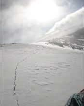
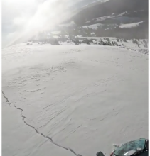
Skied into South Cottonwood basin from Blackmore today. Skiing was sub-par with lots of wind scouring and intense active snow transport. Along with the slides observed yesterday, two recent R1-D1 slides were observed in South Cottonwood Basin: below the Dogleg and on N Twin's west wall via cornice break. No surface hoar, slides from today, or cracking/collapsing were observed.
More Avalanche Details
HS-N-R1-D1
Coordinates: 45.4444, -111.0040
Caught: 0 ; Buried: 0
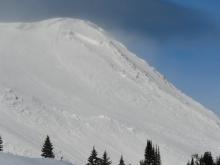
Three small fresh natural wind slab avalanches were seen on the east face of Mt. Blackmore on 1/31/25.
More Avalanche Details
WL-N-R1-D1
Coordinates: 44.6249, -111.2590
Caught: 0 ; Buried: 0
Two Point release avalanches seen on the south slopes of Two Top on 1/30/25.
More Avalanche Details
WL-N-R1-D1
Aspect: S
Coordinates: 45.0344, -109.9840
Caught: 0 ; Buried: 0
We spotted several loose wet avalanches that occurred yesterday in steep, rocky terrain up Sheep Creek.
More Avalanche Details

HS-N-R2-D2
Aspect: NE
Coordinates: 45.0607, -111.2720
Caught: 0 ; Buried: 0
Wind slab avalanche on Woodward Mountain, observed on 1/30. Avalanche appeared recent but date of slide is estimated.
From email: "Today I drove down Taylor fork road, with the thought of potentially getting up on woodward mtn, until I saw a crown on the NE
Face of its northern summit, basically wall to wall near the top of the slide path. There were a couple other sled tracks that also went to the end of the road, so I figured maybe it was pretty recent, as I didn’t hear about it in the advisory. Concerning because it appears to have propagated maybe 250ft across, while maybe only 1-2 ft deep"
More Avalanche Details
SS-N-R1-D1
Aspect: E
Coordinates: 45.4472, -110.9620
Caught: 0 ; Buried: 0
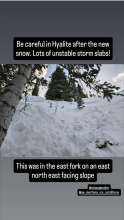
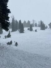
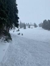
From IG Message: Wind slab avalanche on “east facing slope in hyalite”
More Avalanche Details
SS-ASu-R1-D1
Aspect: NW
Coordinates: 45.4272, -111.0140
Caught: 0 ; Buried: 0
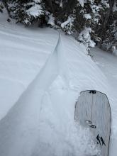
Attempting to ski the Hellmouth The snowpack appeared very stable on most aspects, however when dropping into the northwest face of Alex Lowe peak up and lookers left from the couloir the snowpack was extremely wind scoured. There was maybe 6 inches of un compacted facets below two inches of wind slab. Slightly farther down slope the snow became deep enough for me to put in several jump turns on ski belay. After coming off belay I skied forward maybe 5 feet and broke off a wind slab around 20 feet wide and five feet below me. Shifting my weight right after that the snow below me also broke and slid away. After that I booted back to the ridge and we safely descended the south east face.
More Avalanche Details
Coordinates: 45.8426, -110.9290
Caught: 0 ; Buried: 0
From obs: "We skied north from Texas Meadows to the Playground. Strong southerly winds were actively building wind slabs up to 25 cm deep in immediate lees at treeline. We experienced a few instances of cracking in this wind slab, propagating 2 or 3 meters from our ski tips."
More Avalanche Details
SS-ASu-R1-D1-I
Aspect: NE
Coordinates: 45.8436, -110.9410
Caught: 0 ; Buried: 0
From obs: "We triggered a small soft slab avalanche when skinning near the top of Pair Of Chutes in the Playground. The slab was about 1 foot thick, fist hardness, propagated 20 feet wide and ran 50 feet before breaking up and arresting. The slab did not entrain additional snow as it slid. The avalanche hit my feet but did not disturb my balance. However, it could have been dangerous above consequential terrain. Moderate gusting to high winds were sustained the entire day and wind slabs were widespread in the backcountry terrain north of Bridger."
More Avalanche Details
SS-N-I
Coordinates: 45.2268, -111.5120
Caught: 0 ; Buried: 0
Recent avalanches noted on the NE-E aprons on cedar mountain. SS-N-R2-3-D2-I These appeared to have possibly happened during the last storm cycle and looked to be isolated to layers within the new old snow interface. I also noted similar activity on the same aspects on the adjacent ridge during our approach.
More Avalanche Details
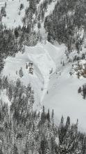
SS-N-R3-D3-O
Aspect: NE
Coordinates: 44.9952, -109.9080
Caught: 0 ; Buried: 0
While touring today, we saw a deep slab avalanche at the southern end of the Hayden Creek drainage. NE aspect. It seemed to be recent, likely in the last day or so.
More Avalanche Details
SS-R1-D1-S
Coordinates: 45.4472, -110.9620
Caught: 0 ; Buried: 0
Very touchy storm slabs formed throughout the day. 6-8” deep by 3pm. low density snow/slab but very fast moving. We were able to trigger steep (35+) rolls with chunks of ice and even got one to go with a falling rope. We saw one natural (d1) that ran ~200’ down a gully near mummy 2.
More Avalanche Details
SS-N-R3-D3-O
Elevation: 9,800
Aspect: NW
Coordinates: 44.9560, -109.9440
Caught: 0 ; Buried: 0
On 1/30 we noted an old, deep persistent slab avalanche on a NW' aspect near the south end of the Republic Creek drainage. This likely broke around a week ago.
More Avalanche Details
R1-D1
Elevation: 9,800
Aspect: SE
Coordinates: 45.3934, -110.9690
Caught: 0 ; Buried: 0
From obs: "noted a recent natural wind slab avalanche below ridgeline on a SE aspect at 9800’. It was around 60’ wide and ranged from 2-6” deep. "
More Avalanche Details
SS-N-R3-D3-O
Elevation: 10,000
Aspect: NE
Coordinates: 44.9595, -109.9350
Caught: 0 ; Buried: 0
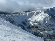
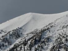
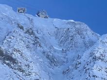
We saw one old, but very large persistent slab avalanche further up Republic Creek (pictured). It was on similar aspect and elevation as a somewhat more recent persistent slab in nearby Hayden Creek, North-northeast, 10,000'. It appeared to be 6'+ deep and 500'+ wide. The bed surface and crown had been partially drifted in, so it seemed it was probably at least a week old...
More Avalanche Details
N-R1-D2-O
Elevation: 10,000
Aspect: NE
Coordinates: 45.0524, -109.9450
Caught: 0 ; Buried: 0
Wind slab avalanche on E Henderson North of the large slide path close to Fisher Pk. R1 D2,1-2' deep, 200' wide. It broke aprx 200' below the summit mid slope. Phone was too cold to take photos. It looks like it broke on the 19th. Wind slabs 5-10" deep were easy to trigger on test slopes North o Lulu pass. Active loading today on upper elevation SW-SE aspects. Multiple ECTX test results on S aspects at 8600' over the weekend.
More Avalanche Details
SS-AS-R1-D1-I
Coordinates: 45.4164, -110.9700
Caught: 0 ; Buried: 0
From obs. 1/19: "Wind was swirling in Maid of the Mist yesterday, mostly upslope winds that were transporting snow, but inconsistently and were difficult to predict where they were loading. We did not find widespread wind loading, but did get a very small windslab to release just below the top of the ridge (max 3-4" thickness, see image)."
More Avalanche Details
Elevation: 7,000
Coordinates: 45.9090, -110.9580
Caught: 0 ; Buried: 0
From obs 1/19: "We experienced whumphs the entire walk in from the parking lot and had a pretty sketchy time attempting to ski a glade directly above fairy lake."
More Avalanche Details
Aspect: SW
Coordinates: 44.8949, -111.2280
Caught: 0 ; Buried: 0
From FB message 1/19: "In between redstreak peak and white peak... The whole slope cracked... the one I stopped on I put my leg in the crack and went to my knee inside the crack"
Screenshots from videos sent in messenger
More Avalanche Details

SS-ASc-R1-D1-I
Elevation: 7,800
Aspect: S
Coordinates: 45.8288, -110.9310
Caught: 0 ; Buried: 0
Above Bradley's Meadow, we triggered a small soft slab avalanche on a south facing aspect around 7800'. This avalanche broke in a wind drift, 4" deep in low density new snow, likely on a sun crust or near-surface facets.
More Avalanche Details

SS-N
Aspect: N
Coordinates: 45.4444, -111.0040
Caught: 0 ; Buried: 0
Observed a fresh slide on the north side of Mt Blackmore, crown was already filling in, but looked to be a foot or two deep in steep rocky terrain to the skiers left of the north couloir.
More Avalanche Details
HS-N-R2-D2-O
Elevation: 9,800
Aspect: E
Coordinates: 44.9474, -111.1560
Caught: 0 ; Buried: 0
This avalanche was spotted from the air on Wednesday, Jan 15 on Red Mountain in the southern Madison Range (just west of Ernest Miller Ridge).
It appears to be on an east facing slope at around 9800 ft.
More Avalanche Details
WL-N-R1-D1
Coordinates: 45.4347, -110.9630
Caught: 0 ; Buried: 0
From obs: "Yesterday afternoon, 1/14, saw lots of roller balls and a few sizable sluffs come down around the dribbles area. This morning lots of small sluffs coming down around bingo cave as soon as the sun hit it. Noticeably heavy, wet snow on solar slopes as well."
From obs: "Things were really moving by mid morning. The trail along Unnamed Wall was buried in several places by wet slides as the wall warmed. Some were big enough to take you down. We did not see any movement on the other side of the valley."
More Avalanche Details
Coordinates: 44.9609, -111.1000
Caught: 0 ; Buried: 0
While ascending the burn, we triggered so many thunderous collapses that we quickly lost count. These collapses shook snow off the trees around us and visibly dropped the snow surface beneath our feet. Near the top of the ridge, we saw a large avalanche (SS-N-R3-D2-O) that broke on a north facing aspect, around 2' deep, on weak snow near the ground a week ago. It was not clear whether it was one large avalanche or two that released sympathetically with one another. If one slide, this avalanche broke nearly 900' wide and slid around 1000' vertical. It broke during the most recent period of intense loading in this area, likely January 5th or 6th.
More Avalanche Details
SS-AS-R2-D1.5-O
Elevation: 7,200
Aspect: SW
Coordinates: 44.9842, -111.0770
Caught: 0 ; Buried: 0
While driving to and from West Yellowstone today, I noticed what is potentially a skier/snowboarder-triggered avalanche on the east side of HWY 191 on a West/Southwesterly aspect, directly across the highway from the Bacon Rind Area and Snowslide Creek. There were numerous tracks through steep rocky chutes next to the road, one of which had avalanched perhaps 75' wide, 18-24" deep, and running nearly to the flats at the base of the slope. Judging by the thin layer of fresh snow it potentially happened on Sunday or maybe Monday. There were tracks through the cliffs above the slide and coming out of the slide.
***Attached video is from a GNFAC field work at Bacon Rind unrelated to the avalanche, but likely on the same day***
More Avalanche Details

HS-N-R2-D2.5-O
Elevation: 9,600
Aspect: NW
Coordinates: 44.9940, -109.9220
Caught: 0 ; Buried: 0
From obs. 1/13: "Spotted another natural avalanche today on Woody Ridge north of the "KNBs." Northwest facing slope, crown elevation approx 9600'. Ran 1000 to 1200'. Unsure of when it went, we did not notice it this morning only this afternoon on the hike out."
More Avalanche Details
Coordinates: 44.7292, -111.3230
Caught: 0 ; Buried: 0
We rode below Lionhead Ridge via Denny Creek and found a snowpack with the worst structure we've seen in our forecast area. There was around 3 feet of snow on the ground between 8000-9000'. The bottom foot was sugary weak facets, and the upper snowpack was a supportable hard slab with new snow on top (profile attached).
We had two large collapses. The most significant collapse happened when we were leaving our snowpit and walking back to our sleds a few feet away. We heard a long "whumph" sound and saw our snowmobiles drop an inch, as the snowpack on the entire slope around us collapsed. Our snowpit had ECTP23 x2 breaking on the sugary weak layer.
More Avalanche Details
SS
Coordinates: 45.1170, -109.8930
Caught: 0 ; Buried: 0
On 1/12 observed a D .5 soft slab near Long Lake above the snowmobile trail. Also saw some small dry loose activity on E facing terrain in Zimmer Creek.
More Avalanche Details
HS-N-R3-D3-O
Elevation: 10,000
Aspect: W
Coordinates: 44.9701, -109.9270
Caught: 0 ; Buried: 0
Observed a large avalanche on a west facing slope approx 10000ft, with a higher crown at 10200'. Crown depth 4-6'. HS-Ns-D2-R2-O . Ran 1000ft and into terrain I had previously considered safe.
More Avalanche Details
SS-N-R1-D1
Aspect: NE
Coordinates: 44.6232, -111.2580
Caught: 0 ; Buried: 0
A wind slab avalanche was seen just below Two Top. This appeared to be a natural slide although tracks can be seen above and to the left of the crown. This was on a northeast facing slope that was wind loaded. The avalanche appeared to be fresh after recent snow.
More Avalanche Details
SS-N-R2-D2
Elevation: 8,700
Aspect: N
Coordinates: 45.4468, -110.9890
Caught: 0 ; Buried: 0
From obs: "Probably already reported...but touchy storm slabs on Mt Blackmore. Attached is a photo of a natural from the approach, at the switchbacks to the upper basin."
From obs: Saw a fairly large (could bury a person) slide while heading up to ski on mt Blackmore. It was on a north aspect at around 8700 ft. It seemed to have failed in the recent storm snow, some wind may have made the slab a little thicker. The debris covered a portion of yesterday’s ski track. Higher in the bowl we found unstable snow around ridge lines, with several small loose sluffs coming down."
More Avalanche Details
SS-N-R2-D2
Elevation: 9,200
Aspect: E
Coordinates: 45.9151, -110.9810
Caught: 0 ; Buried: 0
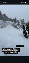
Recent natural avalanche: on an easterly aspect around 9200', on Hardscrabble Peak in the northern Bridgers.
More Avalanche Details
SS
Aspect: N
Coordinates: 45.4445, -111.0030
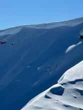
Caught: 0 ; Buried: 0
Wind slabs were the issue today. A lot had changed since Thursday when it was all sunshine and deep powder. Winds picked up and changed the landscape.
We found two small wind slabs that had released on their own, then watched a big one release froM a falling cornice, then triggered a small one (expected).
Overall, winds were the perfect speeds for moving snow which they did all day. Looking south, there was a massive plume coming off Mt Bole.
More Avalanche Details

HS-AMr-R1-D1
Elevation: 9,100
Aspect: SE
Coordinates: 45.0773, -110.0210
Caught: 0 ; Buried: 0
On Jan9 When we rode away from our snowpit on Mt. Abundance we saw a fresh 3'deep x 10' wide slide that we might have remote triggered from the flat ridge above.
More Avalanche Details
HS-N-R2-D2-S
Elevation: 9,800
Aspect: NE
Coordinates: 45.0773, -110.0210
Caught: 0 ; Buried: 0
On January 10 we saw one 3-4' deep slide that looked like it broke within recent new and wind-drifted snow on the north end of Henderson Mtn. Photo: GNFAC
More Avalanche Details
HS-N-R2-D2-O
Elevation: 9,900
Aspect: NE
Coordinates: 45.0524, -109.9450
Caught: 0 ; Buried: 0
We looked at two 4-6' deep persistent slab avalanches that were reported yesterday on the east side of Henderson Mtn., which likely happened yesterday. Wind-loading was the likely trigger. There were not tracks near the larger one above the bench, where riders could easily get to, but they could have been filled in. The other slide was below the highest point below a cornice and likely natural. Both looked like they broke on facets at the bottom of the snowpack.
More Avalanche Details
HS-R2-D2-O
Elevation: 9,500
Aspect: SE
Coordinates: 45.0773, -110.0210
Caught: 0 ; Buried: 0
Jan. 9, About 45 minutes after we left a snowpit on Mt. Abundance, from a couple miles away, we saw a 4-6' deep avalanche that happened since we had been there, about 1000' up the ridge from our snowpit m. This slide was either natural or remote triggered by riders about 1000' away who were there after we were.
More Avalanche Details

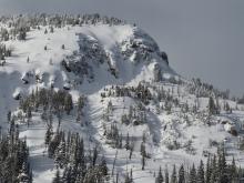
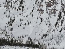
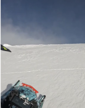
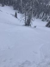
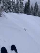
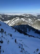
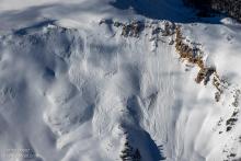
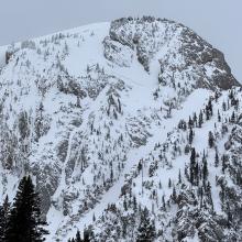
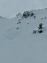
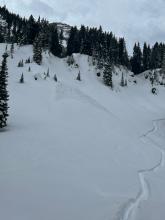
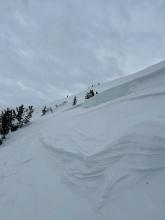
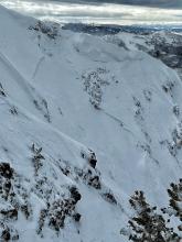
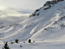
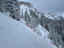
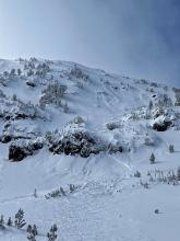
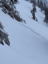
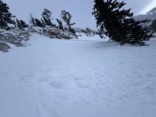
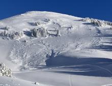
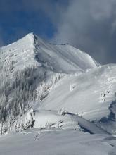
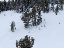
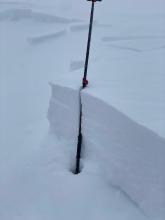
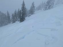
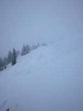
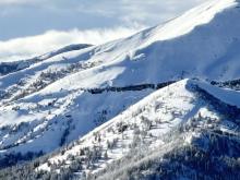
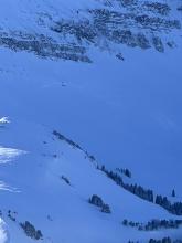
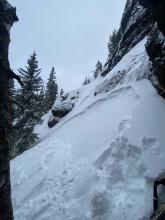
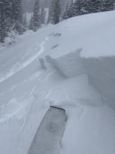
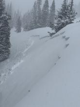
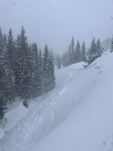
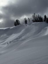
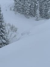
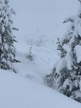
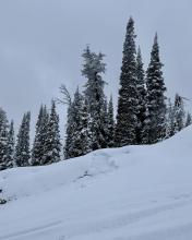
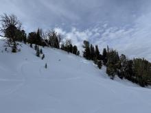
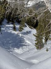
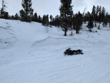
SS-N-R2-D2-O
Coordinates: 45.0746, -109.9070
Caught: 0 ; Buried: 0
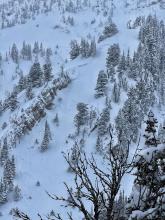
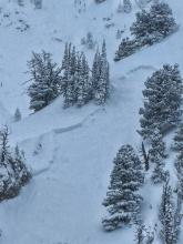
Went snowmobiling north of Cooke City today near Round Lake. I saw about 20cm of new snow. I also saw some avalanches. There were a couple on E Henderson, one that I think happened today, a few on E Sheep Mountain, some shallower avalanches, and plenty of loose dry snow moving around in the steeps. Here are some photos. Some looked like they were from today, some are older. Lots of evidence of wind from the past day or so.
More Avalanche Details
SS-N-R1-D1.5-S
Elevation: 9,500
Coordinates: 45.4444, -111.0040
Caught: 0 ; Buried: 0
Avalanche Activity
We spotted 6-7 storm slabs that failed about 8-10 inches deep. There were 3 on the East face Blackmore, 1 on the north face, 1 on north facing flank, and 1 notable one in a steep below treeline cirque ENE facing (this one broke ~400 ft wide). A possible 7th was down the Fox creek drainage. It seemed a bit random where they happened and didn't. They likely occurred sometime late yesterday afternoon during snowfall and high winds. This instability should be mostly stabilized by tomorrow.
We didn't see any avalanches that broke deeper in the snowpack
More Avalanche Details
SS-ASu-S
Elevation: 8,000
Aspect: NE
Coordinates: 45.8512, -110.9480
Caught: 0 ; Buried: 0
On 01/08 my partner and I skied into Frazier basin in the northern Bridgers, we skied the love chutes east down and overall the descent was pretty wind hammered from a downward wind. Once at the lake we took the Frazier return route where we found much better ski conditions in the corridor and decided to lap some of the features. We ended up triggering a small wind slab at around 8k on a NE aspect that broke about a foot deep and ran about 25 yards. Very dense wind slabs were forming on a lot of the aspects getting out of Frazier and we opted to not test our luck any further for the day.
More Avalanche Details
SS-N-R2-D1-S
Elevation: 8,000
Aspect: E
Coordinates: 45.8406, -110.9330
Caught: 0 ; Buried: 0
Traveled out the North boundary of Bridger Bowl to Texas Meadow. S1-2 from 1030-1200. S2-3 from 1330 until we ended our day (1600). Moderate to Intense snow transport observed NTL. Loading observed on N & S aspects due to swirling and inconsistent winds. Total snow accumulation of 4" observed during our time in the field. Observed two natural avalanches in steep terrain above Texas Meadows, likely released during periods of high PI combined with wind (SS-R2-D1-N).
More Avalanche Details
HS-N-R1-D2-O
Elevation: 10,000
Coordinates: 45.0773, -110.0210
Caught: 0 ; Buried: 0
On Jan 9 we saw many avalanches of various types and ages. Some occurred today and within the last 24 hours and some were up to a week old. Avalanche types ranged from 3-6' deep and broke on weak layers near the bottom of the snowpack... these were on Abundance east face and north side of Crown Butte and looked 3+ days old.
More Avalanche Details
HS-N-R3-D2.5-O
Elevation: 10,000
Aspect: N
Coordinates: 45.0773, -110.0210
Caught: 0 ; Buried: 0
On Jan 9 we saw a large avalanche on the north side of Fisher Mtn. that happened at some time in the last week (could have been 48 hours to a week old), regardless of timing, this slide further shows the deeper weak layers are a real problem as snowfall continues to adds weight to the snowpack.
More Avalanche Details
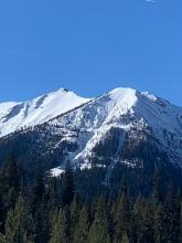
SS-N-R2-D2.5-O
Elevation: 9,500
Aspect: NE
Coordinates: 45.2630, -110.7070
Caught: 0 ; Buried: 0
As I made my way up toward emigrant peak I observed a very large natural avalanche that ripped out on a NE aspect at 9500ft. It propagated hundreds of feet wide and ran approximately 1500ft. The deepest part of the debris pile was ~15-20ft deep. The crown was approximately 3-5ft deep, maybe deeper.
Observed several large collapses and whoomphing as I toured around the area. I observed at least 4 other natural avalanches in the area, not as big but still a tell tale sign to have cautious route finding and avoid slopes steeper than 30 degrees in this mountain range.
More Avalanche Details
SS-AS-R2-D1
Coordinates: 45.8300, -110.9280
Caught: 0 ; Buried: 0
Observed one avalanche in the steep chutes just outside the N Bridger Bowl boundary, SS-R2-D1-AS
HS between 150 and 200 cm. 90-120 cm of storm snow over firm mid Dec layers over facets. 15cm from the last few days. Some wind transport at mid elevations with lots of W wind up at ridgetop throughout the day. Much windier than expected in Bradley Meadow with moderate winds swirling from N and W. Sky was BKN and, no new snow. Temps around 10F.
More Avalanche Details
Coordinates: 44.8949, -111.2280
Caught: 0 ; Buried: 0
Group from Wisconsin spotted 3 very fresh avalanches today. 2 for them near Red Canyon and 1 near Whites Peak. No other info. Might get photos tomorrow.
2 other slightly older slides spotted
More Avalanche Details
SS-ASr-D2-I
Aspect: N
Coordinates: 46.0291, -112.9720
Caught: 0 ; Buried: 0
A small slide was remotely triggered by the second skier catching up to the first skier. We were skiing mellow terrain on the east side of a small ridge and remotely triggered the slide at a roll over point on the north aspect of the ridge. Prior to skiing we conducted an extended column test on a near by north slope with good results but kept our path mellow do to some wind affect areas we noticed on the west side of the ridges. We skied to the debris pile after the slide stopped to take a picture and would estimate it broke 30 cm down at the base of the new snow over the last week.
More Avalanche Details
SS-ASc-R2-D2.5-S
Elevation: 9,000
Aspect: E
Coordinates: 45.7875, -110.9350
Caught: 0 ; Buried: 0
From IG Messages: “as expected, broke a slide out while ski cutting saddle today. Here’s the report.
After summiting south saddle peak, we noticed wind loaded snow on top of an old avalanche crown (maybe 4-5 days old - 2’ deep). We made the decision to ski cut high, hoping to break out the new wind drifted snow. We were the first ones out there today with just a party of two still on north summit. No one below us. I was able to get several small pockets to pop before a larger pocket broke, triggering a sympathetic slab down lower in Argentina bowl. Both slides ran 1000-2000’ into the flats down low (crossing the standard traverse). Debris piled up 20’ deep and broke trees up to 6” in diameter. Slow start, but picked up lots of steam. We skied lower and found good snow below the ridge where there was less wind effect.”
More Avalanche Details
SS-N-R3-D2-O
Elevation: 8,800
Aspect: N
Coordinates: 44.9609, -111.1000
Caught: 0 ; Buried: 0
We saw a large avalanche (SS-N-R3-D2-O) that broke on a north facing aspect, around 2' deep, on weak snow near the ground. It was not clear whether it was one large avalanche or two that released sympathetically with one another. If one slide, this avalanche broke nearly 900' wide and slid around 1000' vertical. It broke during the most recent period of intense loading in this area, likely January 5th or 6th.
More Avalanche Details

SS-R1-D1.5-O
Elevation: 8,500
Aspect: E
Coordinates: 45.0607, -111.2720
Caught: 0 ; Buried: 0
We did note two small avalanches along the Carrot Basin headwall from sometime in the last two days that broke on weak snow near the ground. These areas looked to have a shallower snowpack.
More Avalanche Details
SS-R2-D2
Elevation: 8,200
Aspect: E
Coordinates: 45.4164, -110.9700
Caught: 0 ; Buried: 0
A skier noted an avalanche below Maid of the Mist on January 6, 2025. From the photo, the avalanche appears to be relatively recent, 1-3 days old, and failed on persistent weak layers deeper in the snowpack.
More Avalanche Details
SS-N-R2-D2-O
Elevation: 9,800
Aspect: N
Coordinates: 45.4444, -111.0040
Caught: 0 ; Buried: 0
There was a recent avalanche on the north face of Blackmore. Visibility was poor but it was a small pocket in a steep, rocky zone that broke near the ground.
More Avalanche Details
Coordinates: 45.0265, -111.0480
Caught: 0 ; Buried: 0
Many ridgelines had been scoured down to the grass from yesterday's winds. HS was around 100cm around 8k feet and significantly shallower at lower elevations. New snow totals from the past couple of days was around 20-30cm. We experienced a remarkable number of thunderous collapses throughout the day (I lost count), one of which triggered an avalanche into Specimen Creek while we were in the flats.
More Avalanche Details
SS-ASc-G
Elevation: 8,700
Aspect: E
Coordinates: 44.8404, -111.3410
Caught: 0 ; Buried: 0
Skied above hebgen today, and conditions were similar to what they were a couple days ago. An east facing pit at 8700’ had 85 cm of snow and failed on facets near the ground at ECTP 16. I ski cut a steeper slope and got no result, but my larger-volume partner was able to trigger a slide that broke 40-50’ wide and ran to the ground and through some trees. This was immediately adjacent to the fresh tracks of a very fortuitous skier and their pooch. Subjectively, it seemed like the basal facets had a bit more moisture in them today, but they are not strong yet.
More Avalanche Details
HS-R2-D2-O
Elevation: 8,600
Aspect: NE
Coordinates: 44.7292, -111.3230
Caught: 0 ; Buried: 0
On Jan 12, We saw 4-5 avalanche crowns that were up to a week old, some had been reported and a few we had not heard of (3 pictured were previously not reported to my knowledge). One was a 3-4'+thick slab on a rocky heavily wind-loaded slope off Lionhead ridge, and the other two were ~2' deep on less wind affected slopes lower down in the trees, but probably had some previous wind-loading.
More Avalanche Details
HS-N-R2-D2.5-O
Coordinates: 44.9855, -109.9410
Caught: 0 ; Buried: 0
Skied south of Cooke today and noticed a large natural avalanche just north of the South Siren. N-R2-D2.5-O. It wasn't fresh and likely ran during the last storm cycle.
We dug on an east aspect at 9800', ECTX, HS150. No cr, co.
More Avalanche Details
N-R2-D2
Elevation: 9,500
Aspect: NE
Coordinates: 44.5591, -111.4830
Caught: 0 ; Buried: 0
Almost constant Whumphing at higher elevation. I saw a couple of days old avalanche on a wind-loaded east northeast facing slope. This area in known as Yahoo.
More Avalanche Details
N-R2-D2.5
Elevation: 8,600
Aspect: NE
Coordinates: 45.8512, -110.9480
Caught: 0 ; Buried: 0
With decent visibility we drove up Bridger canyon to Battle Ridge to look for recent avalanches. The most noteworthy was a slab 500'+ wide, 2'+ deep in Argentina Bowl (photo), and there was an R1-R2 sized debris pile below the Saddle Peak cliffs, but clouds obscured the top of Saddle.
More Avalanche Details
SS-R3-D2-O
Elevation: 9,300
Aspect: SE
Coordinates: 44.7145, -111.3180
Caught: 0 ; Buried: 0
Riders noted a large avalanche in Airplane Bowl in the Lionhead area.
More Avalanche Details
SS-AMr-R2-D2.5-O
Elevation: 9,340
Aspect: SE
Coordinates: 44.7269, -111.3180
Caught: 0 ; Buried: 0
Remote triggered this avalanche at Lionhead. We were snowmobiling to the left of where the avalanche occurred. No one was caught.
Coordinates: 44°43'36.8"N 111°19'05.0"W
More Avalanche Details
HS-ASu-R1-D1-I
Elevation: 8,500
Aspect: E
Coordinates: 45.8280, -110.9330
Caught: 0 ; Buried: 0
Toured up the ramp this morning, found between 3-6" of new snow on the skin track, winds were fairly strong from the north/northwest and moving snow. Snow was falling heavily for the duration of the tour. As we made our last switchback in the ridge line meadow (8500ft directly east facing) near the top of the ramp, we triggered a wind slab. It propagated about 200 ft wide and was 3 ft at the deepest point. Interestingly on the edges and near the bottom (downhill side) of the slab it was only a few inches deep. It broke on the interface between the wind loaded snow and the light and dry snow we received a few days ago. When we entered the upper meadow there was no evidence of tracks from the day before. Further down the ramp we found cross loaded rolls that produced shooting cracks and collapses, and active snow loading from the new snow and wind. A half hour later on our ski down, the skin track was partially buried by new snow as we exited the area.
More Avalanche Details
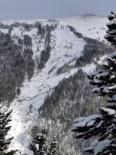
N-R2-D2
Elevation: 9,400
Coordinates: 45.2268, -111.5120
Caught: 0 ; Buried: 0
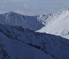
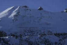
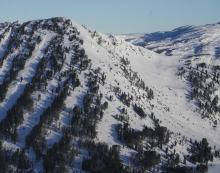
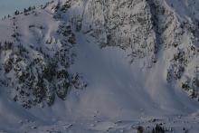
Multiple large avalanches on different bowls and different aspects of Cedar. Photos taken from Yellowstone Club by YC Ski Patrol. NE and E aspects. Both approximately 9400 feet elevation. Shaded photo is N aspect, photo with sun and shade is NE.
More Avalanche Details
SS-N-R1-D1
Elevation: 6,000
Aspect: S
Coordinates: 45.8601, -110.9490
Caught: 0 ; Buried: 0
From obs: "Toured up to the low angle meadows on the NE shoulder of Ross Peak. Dug a 8000ft and found no action in an extended column test but a significant result in a propagation saw test (PST END 20/100) at about 90 cm down. Some recent small avalanches in steep terrain along Brackett Creek that broke naturally within the storm snow from 1/3."
From obs: "Saw a small recent looking storm slab avalanche that appeared to be naturally triggered above the road on a south facing slope around 6000'. It ran all the way across the slope ~30' wide and ~4" deep within the recent snow. The snow didn't move far enough to reach the road. The slope was quite steep-- we didn't measure but I'd estimate 40*.
We also had localized cracking around our skis with planar breaks on that interface throughout the day, as well as a shooting crack when a member of our group jumped on a south facing test slope. On our way back down we saw an even smaller (~10' across) avalanche on a SW facing creek bank that appeared to be triggered by another party as a test slope. Both of these test slopes were steep and we had no results on two other, less steep slopes."
More Avalanche Details
SS-AMu
Coordinates: 45.1719, -111.3800
Caught: 0 ; Buried: 0
From IG 1/3: “Buck ridge today. NE aspect. Probably 100’ wide and at least 3’ deep. Looked like it was triggered by a snowmobiler earlier in the day.”
More Avalanche Details

SS-N
Aspect: E
Coordinates: 45.8822, -110.9520
Caught: 0 ; Buried: 0
Lots of 9''-10'' soft slabs running on the overnight snow/Thursdays density change interface, pretty much one side to the other on the East face. Mostly naturals, one skier triggered. D'oh!
More Avalanche Details
Coordinates: 45.1247, -111.2690
Caught: 0 ; Buried: 0
We observed many large whumps and shooting cracks while headed up the meadows of Cinnamon mountain today, several of which were large enough to shake nearby saplings. These collapses were likely triggering on the recently buried layer of basal facets. Conditions included warm temps, light SW winds, overcast to obscured cloud cover, and S-1 to S1 precip including steady graupel. Nothing particularly surprising considering the conditions in nearby areas, and we chose to keep our terrain choices conservative.
More Avalanche Details
SS-N-R2-D2-G
Aspect: E
Coordinates: 45.0722, -109.9280
Caught: 0 ; Buried: 0
3-4 foot crown about 100 yards wide on East face of sheep mountain.
More Avalanche Details
SS-AV-R4-D1-O
Elevation: 7,000
Aspect: E
Coordinates: 44.8320, -111.0780
Caught: 0 ; Buried: 0
Small slopes at low elevations were avalanching including some along Hwy 191 in YNP. It's always a bad sign when road cuts are avalanching. .
More Avalanche Details
SS-AM
Elevation: 8,200
Aspect: S
Coordinates: 44.8528, -111.1660
Caught: 0 ; Buried: 0
Small slopes at low elevations were avalanching including some along Hwy 191 in YNP. It's always a bad sign when road cuts are avalanching.
More Avalanche Details

N
Coordinates: 45.0423, -109.9650
Caught: 0 ; Buried: 0
Skied north of Cooke today. The light wasn't great, but I think there is an older avalanche on the east face of Miller Ridge in steep terrain. Could barely make out a crown line near the ridge and old debris on the apron. Maybe it ran 3-5 days ago? No cr, co and the winds were light out of the W-NW, moderate at ridge tops. We picked up 8cm of low density new snow overnight, plus an additional 1cm throughout the day today.
More Avalanche Details
SS-R3-D2
Elevation: 9,800
Aspect: W
Coordinates: 45.0590, -109.9560
Caught: 0 ; Buried: 0
On Jan 2, 2025 We rode over Daisy Pass and out to Abundance, then around Fisher and behind Scotch Bonnet, and back to Lulu Road. Visability was marginal with overcast skies and light snowfall in and out through the day. Wind was light to moderate with moderate gusts. Moving some snow from trees and along the surface, stiffening slabs. Snowfall rates picked up this evening.
We saw three avalanches just north of Daisy Pass and one on Henderson Mtn. The one on Henderson was difficult to see the crown, but we could see the debris. Two of the slides north of Daisy were 2-3' deep and 100-150' wide and ran into thick stands of trees, looked like thick soft slabs/drifts of recent snowfall. The other slide was 1-2' deep and 300-500' wide, soft slab of recent snow.
More Avalanche Details

SS-R1-D1-O
Elevation: 9,300
Aspect: NE
Coordinates: 45.1675, -111.3610
Caught: 0 ; Buried: 0
Wasn't surprised to see this fresh human triggered slide in Beaver Creek when just around the corner was a previous one in 1st Yellowmule.
More Avalanche Details
L-N-D1
Elevation: 9,200
Aspect: N
Coordinates: 45.4164, -110.9700
Caught: 0 ; Buried: 0
The only avalanches seen were small (<10ft in length) loose snow releases directly below small trees on north facing 35+ degree aspects at 9200 feet. Poor visibility generally limited views to a few hundred yards.
More Avalanche Details
SS-N-R2-D2-S
Elevation: 7,800
Coordinates: 45.8742, -110.9510
Caught: 0 ; Buried: 0
We went out today and saw the crown of this avalanche around 2-3pm. Looked quite fresh.
More Avalanche Details
HS-N-R2-D2.5-O
Elevation: 9,800
Aspect: NE
Coordinates: 45.0469, -110.0010
Caught: 0 ; Buried: 0
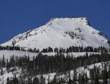
Rode out to Wolverine Pass on New Years Eve. Daisy pass is a little spicy for novices still. On approach to wolverine pass/YNP boundary we found HS 160cm on NE facing slope at 9200'. Found 3-4mm SH in tact at 110 cm deep. Found 1-2mm FC at 60cm deep. Ectn27 at storm interface layer 60 cm deep. No results on SH layer, but many collapses during the day assumed to be on this layer. Large D2-3 deep Slab avalanche seen on NW facing slope of Sunset Peak. Picture attached. Generally stable condions, but big avalanches on N,NE,NW facing slopes are a real concern for sure.
More Avalanche Details

SS-AMu-R1-D1-O
Coordinates: 45.0607, -111.2720
Caught: 0 ; Buried: 0
From text message: a snowmobile triggered a small persistent slab avalanche in the Taylor Fork on Tuesday. The rider was not caught.
On a nearby slope, a larger avalanche failed 150 wide on weak layers near the ground.
More Avalanche Details
SS-N-R1-D1.5
Coordinates: 45.1720, -111.3850
Caught: 0 ; Buried: 0
The wind had definitely been moving things around, signs of decent loading and some avy activity today, kind of where I thought we’d find some action. See attached photos. Noticed a small 8-10” wind slab pocket on the way in, looked like storm load but could have been sled triggered from the top. Found a bigger pocket that had pulled out on steeper terrain in the 1st Yellow Mule no tracks around since we were the first in there. Both were N to NE facing which we had flagged for ourselves due to the wind direction during a post storm. We were suspect of the east side of the compass from north to south.
More Avalanche Details
SS-N-D2
Coordinates: 45.8822, -110.9520
Caught: 0 ; Buried: 0
We saw numerous D1 dry loose avalanches and a few D2 slab avalanches between Ross and the throne, visibility was in and out so no pictures unfortunately.
More Avalanche Details
SS-AFu-R1-D1
Elevation: 7,600
Coordinates: 45.4521, -110.9260
Caught: 0 ; Buried: 0
Small wind slab in hyalite at the start to champaign slot, 7600’, WNW, ~8” crown
More Avalanche Details
SS
Coordinates: 45.8288, -110.9310
Caught: 0 ; Buried: 0
Toured up the ramp at around 4 yesterday, snow was still falling heavily. Counted 4 or 5 natural storm slabs breaking mostly within the new snow. A skier before us triggered a slide in the chutes on a ski cut. I struggled to find a clean interface where the storm slabs were breaking on a few hand pits, mostly just a lot of fresh snow.
More Avalanche Details
SS-N-R2-D2-G
Elevation: 9,400
Aspect: NE
Coordinates: 44.8949, -111.2280
Caught: 0 ; Buried: 0
We toured into Carrot Basin and Sage Creek this morning. The storm ended and skies were broken by 1000. The spx is about 1M deep and the surface conditions are soft and excellent in most areas with wind effect along the ridges. At about 130 we moved from carrot to sage creek and notcied three small and one large avalanche along cabin creek divide that were not present earlier in the day. Most looked remote and were isolated pockets (R1/D1). As we rounded the corner into sage there was one fresh larger slide (R2/D2) at about 9,400' on a NE facing slope. It appeared to be natural (remote?), failed at the ground and was about 200' wide and ran for 200' the crown was 2-3' deep.
More Avalanche Details
SS-N-R3-D2-O
Elevation: 7,200
Aspect: N
Coordinates: 44.8524, -111.3920
Caught: 0 ; Buried: 0
There was a natural avalanche on the landslide face above quake lake. The avalanche failed on a weak layers near the ground and broke several hundred feet wide.
More Avalanche Details
ASu
Elevation: 7,800
Aspect: SE
Coordinates: 45.8322, -110.9280
Caught: 1 ; Buried: 0
From the phone message: A skier on the south side of Bradley's Meadow triggered an avalanche and was caught and carried by the slide. Thankfully, everyone was okay.
More Avalanche Details
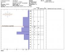
HS-N-R4-D2-O
Elevation: 10,090
Aspect: NE
Coordinates: 45.0524, -109.9450
Caught: 0 ; Buried: 0
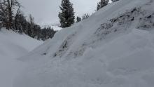
From obs "We were ski touring on the SW side of Mt. Henderson today, and noticed a large (natural?) avalanche on the NE aspect of Henderson. First observed at around 1:15pm. It appeared to be very fresh, possibly from a remote trigger this morning.
2 photos attached. A NE aspect, around 10,000'.
It looked to be 4-6' deep and about 500' wide. And it failed on snow at/ near the ground."
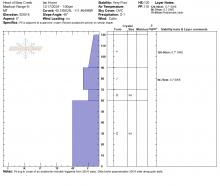
From obs: "We popped over to the recent avalanche on the east side and got a crown profile. Avalanche is NE facing, 10090. HS-N-D2-R4-O
Crown is 105 cm deep, breaking on surface hoar. Details are in attached profile
Something noteworthy.. the slope angle at the crown is 30.1 degrees."
More Avalanche Details
SS-R1-D1
Aspect: N
Coordinates: 45.0344, -109.9840
Caught: 0 ; Buried: 0
From email: "Skied ghost trees in Sheep Creek today. Still a little lean, but mostly good to go for taking clients. Surprised to only see one D1R1 soft Slab on steep north facing slope. No other avalanche activity seen on Miller Mountain, Mineral, Sunset and Republic Mountain. No cr/co."
More Avalanche Details
SS-ASc-R3-D1-I
Elevation: 8,200
Aspect: W
Coordinates: 45.3407, -111.3910
Caught: 0 ; Buried: 0
We triggered a small avalanche in a terrain trap from a flat bench above in Beehive Basin. This slide (R3 D1) broke 150' wide, about a foot deep, and filled the creek bed below.
More Avalanche Details

SS-N-D1
Aspect: NE
Coordinates: 45.1647, -111.3640
Caught: 0 ; Buried: 0
Small avalanche NE aspect near top of beaver. D1 natural trigger wind slab. Only observed avalanche from groomer trail.
More Avalanche Details
Coordinates: 45.0745, -109.9070
Caught: 0 ; Buried: 0
Been at the yurt the last couple days. About 2 feet of new snow since Friday, 10 inches of that were today.
Couple collapses... Most aspects. No avalanches observed but visibility has been very low
More Avalanche Details
SS-AMc-R3-D2-O
Coordinates: 44.8949, -111.2280
Caught: 0 ; Buried: 0
Dug a small test pit. Unprofessional observation ectp 10 on the persistent weak layer seen across the advisory area. On our way out near the cabin I cut a line close to a creek to see if I could trigger something.
More Avalanche Details
SS-R2-D2-O
Coordinates: 44.7145, -111.3180
Caught: 0 ; Buried: 0
On Saturday (12/28) we saw a small avalanche along Lionhead Ridge while riding (photo).
From the highway, with binoculars, we also saw a larger avalanche north of Lionhead Ridge in a large lower elevation steep meadow. This one appeared 1-2' deep and 150-200' wide, possibly slightly wind-loaded, but not a heavily/typical wind-loaded slope.
More Avalanche Details
AMu
Coordinates: 44.7292, -111.3230
Caught: 1 ; Buried: 0
We received a vague report of a partial burial in the Lionhead area after a snowmobiler unintentionally triggered an avalanche. The slide was reported to a homeowner near the Denny Creek trailhead. The homeowner is friends with several members of Fremont County search and rescue. One of which happened to be with GNFAC Forecasters today.
More Avalanche Details
SS-N-R1-D1
Elevation: 9,050
Aspect: E
Coordinates: 45.7943, -110.9360
Caught: 0 ; Buried: 0
A member of the Bridger Bowl Ski Patrol reported a relatively small, natural avalanche between the North and South Saddle Peak (in an area appropriately referred to as "Between the Peaks").
More Avalanche Details
Coordinates: 44.8899, -111.0630
Caught: 0 ; Buried: 0
Widespread cracking and collapsing at Tele Meadows today, primarily in wind-affected areas. Shooting cracks up to 100 feet.
More Avalanche Details
SS-AM-R2-D1.5
Elevation: 9,500
Aspect: NE
Coordinates: 45.1719, -111.3800
Caught: 0 ; Buried: 0
From email: "Rode buck today. It was very windy this week. Open areas are quite scoured, but there are still great stashes to be found if you hunt around. We triggered a 12" soft wind slab on a NE facing slope at 9.5k'."
More Avalanche Details
SS-NC-R2-D2-O
Elevation: 8,500
Aspect: E
Coordinates: 45.8301, -110.9340
Caught: 0 ; Buried: 0
Avalanche in the Hourglass chute above Wolverine. It looked to be triggered by an intentional cornice drop, was around 12 inches deep at the crown, 100' wide and ran 850' vertical feet. It looked around three days old.
More Avalanche Details
SS-N-R2-D2
Coordinates: 45.2981, -111.5240
Caught: 0 ; Buried: 0
More Avalanche Details
SS-NC-R2-D2-O
Elevation: 11,000
Aspect: E
Coordinates: 45.1153, -109.9140
Caught: 0 ; Buried: 0
From email: "Maiden Voyage to Goose Lake for the season today. Lots of wind drifted snow everywhere and challenging riding conditions. Performed Stability test on shoulder of Mount Fox NE facing slope at 10,300'. HS 180cm. ECTP2 40cm down on Buried Surface Hoar. ECTP 23 90cm down on MFcr with 1-2mm Facets. Saw several recent wind slab avalanches in steeper windloaded terrrain around Goose Lake, but limited activity was seen on Henderson. Lots of co/cr while touring on Mount Fox. D2 avalanche on east facing Mount Fox that appears to be on the SH layer, triggered by a cornice drop."
More Avalanche Details
SS-N-R3-D2.5-U
Elevation: 10,000
Coordinates: 45.0202, -109.9380
Caught: 0 ; Buried: 0
Ob1: Photos 1-4, GNFAC
We rode out to Lulu Pass to look at the few avalanches that were reported yesterday on Henderson and Fisher Mtn. Today we did not see any avalanches that weren't previously reported, other than one small, but thick wind slab on south facing slope of Scotch Bonnet (photo). At least the avalanche on Fisher and one on Henderson broke near the ground (pics attached). Some slides were heavily refilled by drifted snow, so it was hard to tell how deep they broke.
Yesterday I saw a wide slab avalanche up on west Woody Ridge from town (photo attached). It happened late on Wednesday or overnight during or after the strong winds and snowfall.
Ob 2: B Fredlund, Photos 5-13
Quite a few natural avalanches observed north of Cooke City today. Photos attached of:
5: NE facing, 10,000, Miller Ridge
6: E facing, 9900', Bull of the Woods Pass
7: NE facing, 9700', Miller Ridge
8: E facing, 10,200' Scotch Bonnet Mtn.
9: E facing, 10,000 Mt. Henderson
10-12: NE- N facing, 10,000' Mt. Henderson
13: NE facing, 10,000' Sheep Creek.
More Avalanche Details
N-R2-D2
Elevation: 9,950
Coordinates: 45.4106, -110.9880
Caught: 0 ; Buried: 0
Observed from Flanders this morning. Presumed recent natural slide around ~9950 ft. on a E/NE aspect. Hard to tell from a distance, but cornice interference and/or wind loading are possible culprits. Poor image quality, but there may be more debris piles along the ridgeline to the south.
More Avalanche Details
SS-N-R2-D1.5-I
Aspect: E
Coordinates: 45.8883, -110.9590
Caught: 0 ; Buried: 0
From the top of The Throne, we got eyes on two avalanches that occurred naturally during the major wind event yesterday in the bowl south of Naya Nuki. The largest of which was a R2-D1.5 that broke in the new snow in the main part of the bowl. The second avalanche (R1-D1) broke off the ridge near the summit of Naya Nuki and ran 150'.
More Avalanche Details
N-R2-D2.5
Elevation: 9,100
Aspect: E
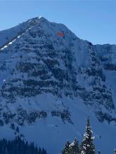
Coordinates: 45.7943, -110.9360
Caught: 0 ; Buried: 0
There was a natural avalanche on Saddle Peak on Wednesday, December 18. Strong winds ripped through new snow and loaded many slopes. The avalanche broke an estimated 250 feet wide, 1-3 feet deep, and ran 1500 vertical feet.
More Avalanche Details
HS-ASr-R1-D1-I
Elevation: 8,500
Aspect: N
Coordinates: 45.9233, -110.9800
Caught: 0 ; Buried: 0
HS-ASr-R1-D1-I
Fraizer Basin, 8500', North facing, 35-37 degree slope, 1pm
30' wide, 6'' deep, ran 150', In the love chutes, Fraizer Basin
1Finger wind slab sitting on a 4Finger hardness break. Triggered from 30' above the crown, ran slowly. A majority of the slab rode back up on the surface 50' below the crown. Bed surface felt like small grained facets under skis, didn't look too close. Small and localized cracks and collapses were felt and seen throughout the day in the same location.
More Avalanche Details
Aspect: W
Coordinates: 44.9739, -109.9240
Caught: 0 ; Buried: 0
Lots of wind slabs south of Cooke today. Strong wind all day and lots of blowing snow.
More Avalanche Details
SS-N-R1-D1
Elevation: 9,000
Aspect: E
Coordinates: 45.3407, -111.3910
Caught: 0 ; Buried: 0
Small natural windslab under the cornice on the Beehive Ridgeline around noon on 12/18. It broke up to around a foot deep, 20 ft wide, and ran about 15 vertical feet.
More Avalanche Details
SS-AMu-R1-D1
Coordinates: 45.1877, -111.4550
Caught: 0 ; Buried: 0
Small slide in terrain trap. Looks to be old, likely from before the wind event that occurred mid last week. A snowmobile track leads into it with wind-drifted snow covering the track.
More Avalanche Details
Elevation: 10,000
Aspect: SW
Coordinates: 45.0470, -109.9400
Caught: 0 ; Buried: 0
As we entered non wind-effected, upper-elevation terrain on Henderson, we consistently triggered many localized collapses and heard audible whumpfs.
More Avalanche Details
SS-NC-R2-D1-O
Elevation: 9,200
Aspect: NE
Coordinates: 44.5657, -111.4810
Caught: 0 ; Buried: 0
More Avalanche Details
SS-AMr-R2-D1
Elevation: 9,200
Aspect: N
Coordinates: 45.1719, -111.3800
Caught: 0 ; Buried: 0
We remotely triggered a slide in upper Bear Creek that broke approximately 200 ft away in a gully. It failed ~18" deep on facets underneath the snow that has accumulated since Sunday. It broke in several pockets, totaling around 200 ft wide. There was 12" of new snow at the crown, with 0.7" SWE. The slab contained 1.4" SWE total (which accumulated since Sunday).
More Avalanche Details

SS-ASc-R2-D2-I
Elevation: 8,300
Aspect: NE
Coordinates: 45.8586, -110.9560
Caught: 0 ; Buried: 0
Triggered a small slide (r2 d2) in a north east facing chute at around 8300 ft. The slide was triggered on a ski cut through a wind loaded drift and propagated about 15 or 20 ft wide. It about 6 in deep on the edges and two feet in the loaded area. We observed several other signs of instability throughout the day, most wind loaded terrain was touchy and easy to rip off with slabs anywhere from 6 in deep to two or three feet deep. All signs of instability originated from the interface between the new snow from the last few days and facets from the last high pressure system.
More Avalanche Details
SS-N-R2-D2
Elevation: 9,800
Aspect: E
Coordinates: 45.0050, -109.9570
Caught: 0 ; Buried: 0
The clouds broke briefly around noon today in Cooke City. It looks like the Fin slide naturally in the past day or so (12/15 or 12/16). It looks like two sections of the face slid, one from the top, and one lower and to the right in the photo.
More Avalanche Details
SS-N-R2-D2
Coordinates: 45.1719, -111.3800
Caught: 0 ; Buried: 0
We saw two avalanches while riding along Buck Ridge on 12/17. These likely broke overnight on 12/16. One was a storm slab avalanche on the far (southwest) side of Buck Creek - broke 2-300 ft wide and ran ~500 vertical feet. The other was a similar, but smaller slide in 3rd Yellowmule (~100 ft wide and ran ~200 vertical ft).
More Avalanche Details
SS-AMu-R2-D1-O
Aspect: NE
Coordinates: 45.1719, -111.3800
Caught: 0 ; Buried: 0
From FB messenger: “Bottom of Slats area. Buck ridge.
NE slope/hole wind loaded. Sled triggered, 315 pm Sunday Dec 15, 2024”
More Avalanche Details
SS-R3-D2-S
Aspect: E
Coordinates: 45.8231, -110.9260
Caught: 1 ; Buried: 1
From Bridger Bowl: "On December 15th, 2024 at 12:09 p.m., a skier in open terrain was caught and buried by an avalanche in the Papa Bear region below Bridger Gully. The skier, who was with a partner, was buried just below the snow surface and was able to punch a hole up through the top of the snow. The skier's partner and other members of the skiing public responded quickly and were able to extricate the uninjured skier.
Although rare, inbounds avalanches may happen and are defined in the skier's responsibility code as an inherent risk of skiing, even within ski area boundaries. We share this as a reminder of the importance of skiing and riding with a partner, especially in deep snow conditions."
Notes about snowpack:
Slide was 8 inches deep, 450 feet wide, and broke within the storm snow 2 inches above the new snow/old snow interface. Trigger unknown.
The Alpine weather station received 2.5" snow = 0.2" SWE from 2200 on 12/14 to 0300 on 12/15, then intense snowfall from 0700 to 1200 added 7" and 1"SWE for a storm total of 9.5"=1.2"SWE over 14 hours as of noon.
More Avalanche Details
SS-N-R3-D2-S
Elevation: 8,800
Coordinates: 45.7943, -110.9360
Caught: 0 ; Buried: 0
These avalanches were reported yesterday 12/15 by ski patrol who heard them run and saw debris around 1230. They broke naturally towards the end of a period of heavy snowfall that totaled 10"=1.22" SWE. Photos taken 12/16 at 1045-1100.
More Avalanche Details
SS-R1-D1-S
Caught: 0 ; Buried: 0
from @brendan_durrum_photo
More Avalanche Details
SS-ASu-R3-D2-S
Aspect: NE
Coordinates: 45.8822, -110.9520
Caught: 0 ; Buried: 0
From IG: "Storm slab broke about 200’ above us as skinning up the hallway coming from the north side on the throne."
More Avalanche Details
SS-ASr-R3-D2-I
Elevation: 8,900
Coordinates: 45.0433, -109.9180
Caught: 0 ; Buried: 0
Sunday morning 12/15 we were skiing just Southwest of Henderson Mountain between the road cuts. The first skier in our party remotely triggered this slide from a slightly lower angle aspect about 50 ft to the skiers left of the slide where the snowpack was shallower. It broke on a convex rollover about 100 ft wide and ran about 80 ft. downslope. The crown averaged 30 inches and broke on sugary facets about 18 inches from the ground. No one was caught.
More Avalanche Details
Coordinates: 45.4444, -111.0040
Caught: 0 ; Buried: 0
I observed a large whoomph about 150ft from the ridge (top of glades) going up Blackmore today while breaking trail. was definitely wind loaded area… I could feel the energy in the snowpack today once I got up higher, super sensitive it seems. ECTN 14 in my pit I dug lower down the meadow with no wind slab prevalent.
More Avalanche Details
SS-ASr-R1-D1-S
Elevation: 8,200
Aspect: SE
Coordinates: 45.3374, -111.3810
Caught: 0 ; Buried: 0
Skied into middle basin from Beehive this morning and found 8-12 inches of unconsolidated snow on top of a sun crust. While skinning back up to the Beehive/Middle ridge we remotely triggered 12 inches of storm snow on a SE facing gully from 15 ft away, the crown was ~50 ft long. ~8,200 ft.
Winds increased throughout the morning, actively loading E aspects.
More Avalanche Details
SS-ASu-R1-D1-I
Coordinates: 45.2952, -111.4100
Caught: 0 ; Buried: 0
More Avalanche Details
Coordinates: 45.3374, -111.3810
Caught: 0 ; Buried: 0
When skiing into middle basin, I stopped at the top of a convex roller and had cracks shooting out 50 feet in either direction from what seemed to be a soft slab in the new snow that slid about a foot or so. This was the most major sign of instability from the day. Lots of shooting cracks when skiing and skinning in the new snow.
More Avalanche Details
SS-AMu-R2-D1-O
Coordinates: 44.6104, -111.3030
Caught: 0 ; Buried: 0
Small windslab triggered on approach for inspection. Failure interface had 5 mm Surface Hoar. Soft slab, remote propagation onto the adjacent slope. Debris covered about half of the road bed.
More Avalanche Details
SS-ASu-R2-D1.5-I
Elevation: 9,500
Aspect: NE
Coordinates: 45.0607, -111.2720
Caught: 0 ; Buried: 0
Gusty winds transporting snow in Taylor Fork on Saturday. Triggered a 4-5 inch deep wind slab that propagated about 50 ft at the top of a north east facing slope at 9,500 ft.
More Avalanche Details
SS-N-R1-D1-I
Elevation: 9,500
Aspect: E
Coordinates: 44.9952, -109.9080
Caught: 0 ; Buried: 0
Noticed this natural avalanche on 12/8. East facing slope, ~9500 feet, Hayden Creek above Ripcurl area
More Avalanche Details
WL-N-R1-D1-I
Elevation: 9,300
Aspect: S
Coordinates: 45.1960, -111.4360
Caught: 0 ; Buried: 0
On 12/4, from the junction of Buck Ridge and Third Yellow Mule, we observed one small loose-wet avalanche (R1 D1) on a S facing aspect on Eglise Rock that likely broke in the last day or two of hot temperatures.
More Avalanche Details
WL-N-R2-D1-S
Elevation: 10,000
Aspect: S
Coordinates: 45.0709, -109.9580
Caught: 0 ; Buried: 0
Natural loose wet avalanche
More Avalanche Details
WL
Aspect: S
Coordinates: 45.2760, -111.4360
Caught: 0 ; Buried: 0
From BSSP "On steep solar aspects, the surface snow became unstable and low-volume slides ran.
Point releases would entrain the top 3-4”, running on firmer layers below."
More Avalanche Details
WL-N-R2-D2-O
Elevation: 8,500
Aspect: SE
Coordinates: 45.8156, -110.9230
Caught: 0 ; Buried: 0
On Sunday, an R2-D2 wet snow avalanche broke out of the run Close Call within the boundaries of Bridger Bowl. This is a rocky, south-facing run. The slide ran ~650 vertical feet. The width of the chute constrained it, but it broke about 20 feet wide.
From obs 12/1: "A decent sized loose/ wet D1.5 came down between laps (probably 1300) in what i believe is called gangstas. South facing, steep, thin and rocky. "
More Avalanche Details
HS-NC-R1-D1-I
Elevation: 9,480
Aspect: E
Coordinates: 45.1719, -111.3740
Caught: 0 ; Buried: 0
"The head of Beaver Creek was scoured nearly to dirt and the cornice is quite large there already. We noted one small wind slab avalanche just below it. We found a similar avalanche in Second Yellowmule that again appeared to be from wind loading. Both appeared to be several days old. We dug a quick pit on a north facing slope in Second Yellowmule and had an ECTN in 85cm of snow. Only the bottom 5cm or so of that pit were sugary and faceted. "
More Avalanche Details
SS-ASu-R1-D1-O
Elevation: 9,200
Aspect: W
Coordinates: 45.3407, -111.3910
Caught: 0 ; Buried: 0
A skier near Going Home Chute in Beehive Basin triggered a small avalanche in steep terrain that broke 20 feet wide and ran 100 feet downslope over rocks.
More Avalanche Details
HS-ASc-R1-D1-I
Elevation: 9,900
Aspect: N
Coordinates: 45.4444, -111.0040
Caught: 0 ; Buried: 0
From obs: "Intentionally triggered on a ski cut. Broke about 1 foot deep and 10 feet wide, ran on a hard compact surface below the soft wind slab."
More Avalanche Details
HS-NC-R2-D1.5-G
Elevation: 10,100
Aspect: NE
Coordinates: 45.0524, -109.9450
Caught: 0 ; Buried: 0
Hard wind slab likely on facets happened naturally maybe last week around Thanksgiving or just after. It is typically heavily wind loaded spot and was probably triggered by cornice fall.
More Avalanche Details
HS-AEc-R3-D2-G
Coordinates: 45.2760, -111.4360
Caught: 0 ; Buried: 0
Big Sky Ski Patrol triggered a deep slide in the Big Couloir during avalanche mitigation work on 11/28/24: "Summit north peeled the cornice way back to the ridge and took out the upper hanging snowfield before crashing into the Couloir, leaving a 5-6’ tall crown in the chute above the dogleg."
More Avalanche Details
L-N-R1-D1-S
Elevation: 9,500
Aspect: E
Coordinates: 45.4444, -111.0040
Caught: 0 ; Buried: 0
Dave and I toured into Blackmore basin today and skinned up the SE shoulder to the ridge. As we entered the basin, we immediately noticed several natural loose snow avalanches (R1 D1) in steep rocky sections of the direct E face. These looked to have occurred in the last 12 hours, and though they would not have buried someone, they would have strained one through some nasty trees and cliffs.
More Avalanche Details

HS-AE-R1-D2-G
Coordinates: 45.2760, -111.4360
Caught: 0 ; Buried: 0
Big Sky Ski Patrol triggered this avalanche during mitigation work in The Wave on 11/26/24... "2-3' deep on an ice crust just above the ground with a 2# shot in the Upper rodeo. Volume was limited as most of the snow was loaded just underneath the cornice, but still produced a sizeable size 2... Other paths in the Lenin region ran meaty wind slabs, full track with no significant step downs." Photo: BSSP
More Avalanche Details
SS-ASc-D1-G
Aspect: N
Coordinates: 45.2777, -111.4510
Caught: 0 ; Buried: 0
From email: "Northerly facing terrain harbors October snow, which has faceted. It is holding up plenty of dense snow and wind slab from the quite snowy and windy November. It was unable to hold the additional weight of a human trigger, and two pockets failed at the ground, which produced avalanches. Crown height maxed at 2’. Notably, where it did not avalanche, the failure propagated hundreds of feet down the ridge. It is a good data point- northerly aspects near tree line have potential instability."
More Avalanche Details
SS-N-R2-D2-I
Elevation: 9,100
Aspect: E
Coordinates: 45.7943, -110.9360
Caught: 0 ; Buried: 0
Driving up Bridger Canyon this morning, we noted several natural avalanches in wind loaded terrain on Saddle Peak, the Football Field, and in Mundy’s Bowl. All The avalanches seems to be a similar wind slab problem. They broke just below the cornice line. From a distance and considering yesterday’s new snow, I would guess a foot deep or so (R2, D2, I)
More Avalanche Details
Coordinates: 45.8156, -110.9230
Caught: 0 ; Buried: 0
Wind was ripping on the ridge and creating hard wind slabs 3-6” in depth. Without much new snow to transport they weren’t very large or widespread, but we got cracking and propagation on a steeper terrain feature (Hidden) near the ridge that led to us skiing a different line. The slab development was also found in isolated areas further down from the ridge in cross loaded gullies, but slabs were isolated to breaking at the skis.
More Avalanche Details
Elevation: 9,700
Aspect: SW
Coordinates: 45.0524, -109.9450
Caught: 0 ; Buried: 0
Localized collapsing and cracking yesterday on the upper slopes of Mt. Henderson, SW aspects. HS ranged from about 30-75cms.
More Avalanche Details
WL-N-R1-D1.5-U
Elevation: 7,900
Caught: 0 ; Buried: 0
From obs: "With the inversion and warmer temperatures yesterday, we (group of 3) discovered a super saturated, cohesive snowpack in Hyalite on the approach to High Fidelity. On the first pitch, I narrowly avoided a point release wet loose, probably around D1-1.5. After this we decided to bail. On the rappel, my partner narrowly avoided another wet loose, which he estimated to be D1.5 and deep enough to bury a person past their chest. The sun was not out but the mountains were shedding and there was evidence of warming and wind, because the trees had no snow on them. We were able to make ~2.5 feet in diameter “cinnamon rolls” by rolling a snowball downhill. If you’re going to any of the more exposed climbs in Hyalite, be very mindful of overhead hazards and wet loose problems which you would not expect this time of year."
More Avalanche Details
SS-AS-R1-D1
Coordinates: 45.9233, -110.9800
Caught: 0 ; Buried: 0
Skiers triggered several very thin avalanches in the northern Bridger Range on 11/21/24. They broke only a couple inches deep on windloaded slopes, mostly in north facing couloirs.
More Avalanche Details
Coordinates: 45.3480, -111.4030
Caught: 0 ; Buried: 0
Party of three made our way into Beehive Basin up to near the bottom of 4th of July Couloir. Noted strong winds blowing from the south southwest (up the canyon) Saw shooting cracks up to 8 feet out skinning up a boulder pile on a east facing aspect, (picture my friend took). Snowpack still to shallow to confidently ski any of the upper couloirs. Further down in the canyon on the short grassier slopes snowpack was reasonably dense and stable with a weak crust layer under 8-10 inches of the light fluffy stuff, snow depth up to 2 feet in select spots. Friend reported hearing one small whumph breaking trail up to the ridge on a convex roll. Skied out the entire slope with 10ish other people and didn't see any other signs of instability.
More Avalanche Details

SS-R1-D1-I
Coordinates: 45.9196, -110.9760
Caught: 0 ; Buried: 0
A small avalanche released in the northern bridger range on Sunday.
More Avalanche Details


SS-ASc-R1-D1-S
Elevation: 8,700
Aspect: NE
Coordinates: 45.8156, -110.9230
Caught: 0 ; Buried: 0
We skied hidden gully that had small storm slabs that propagated at our ski tips and only ~3inches in depth.
More Avalanche Details


L-N-R2-D1.5-G
Elevation: 8,000
Aspect: NE
Coordinates: 45.8156, -110.9230
Caught: 0 ; Buried: 0
On 20241107 I observed a small natural avalanche from the top of the PK lift at Bridger Bowl. The slide occurred near the Slushman’s lift on a NNE aspect. It started as a small release in the upper start zone and entrained much of the snow in the couloir down to the ground. L-N-D1.5- G.
Avalanche occurred after the start zone had come into the sun for a few minutes. The rest of the path was in the shade.
Wind speed at 11am 24mph gusting to 28mph on Bridger Ridge. Sky Clear. Temp 26F.
It was a relatively small slide but had enough power to carry a skier or rider through some very nasty terrain. Similar aspect and elevation to the Super Couloir slide.
More Avalanche Details

SS-N-R1-D1-G
Elevation: 9,400
Aspect: N
Coordinates: 45.9043, -110.9580
Caught: 0 ; Buried: 0
From obs: "I made it up to an old crown in a north-facing chute around Fairy Lake at around 9400 ft; it broke the night of 11/6 or the morning of 11/7. It looked like a wind slab that broke on a rotten layer of facets intermixed with scree. Found facets to be fairly widespread through the bottom of the snowpack on the north-facing slopes and surface hoar on most nonsolar slopes."
More Avalanche Details
Coordinates: 45.8156, -110.9230
Caught: 0 ; Buried: 0
From IG message: "Hey the post of super jogged my memory to send you this, a friend and I had whumpfing and cracks while skinning up the trees in the apron yesterday [11/6], we dug a pit and got an ect 4 collapse against the rocks. We were about halfway up the apron when we took this."
More Avalanche Details