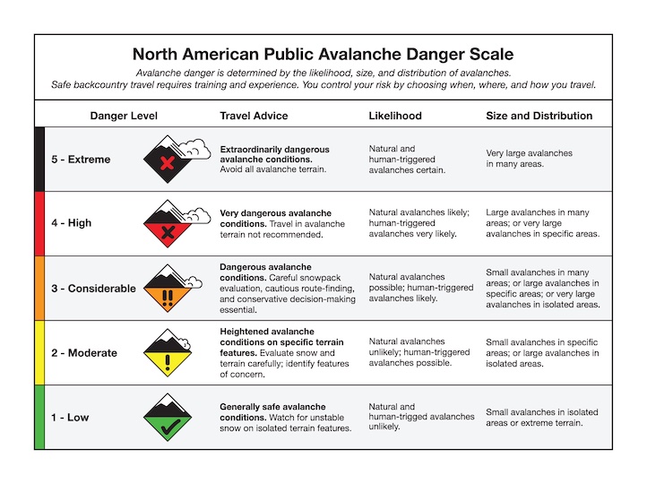
Snow Observations List
I skied above hebgen today, and found some encouraging signs. No collapsing on the way up, but I did get a few small ones on the way out below 7k. A pit on an east facing slope at 8800’ had 90 cm of snow, and I got a poorly-defined propagation at ECTP16 in the big, granular facets that make up the base of the snowpack. The newer snow slab was quite cohesive, although there is a thin rain crust that formed yesterday afternoon. The lake is currently a slushy experience.
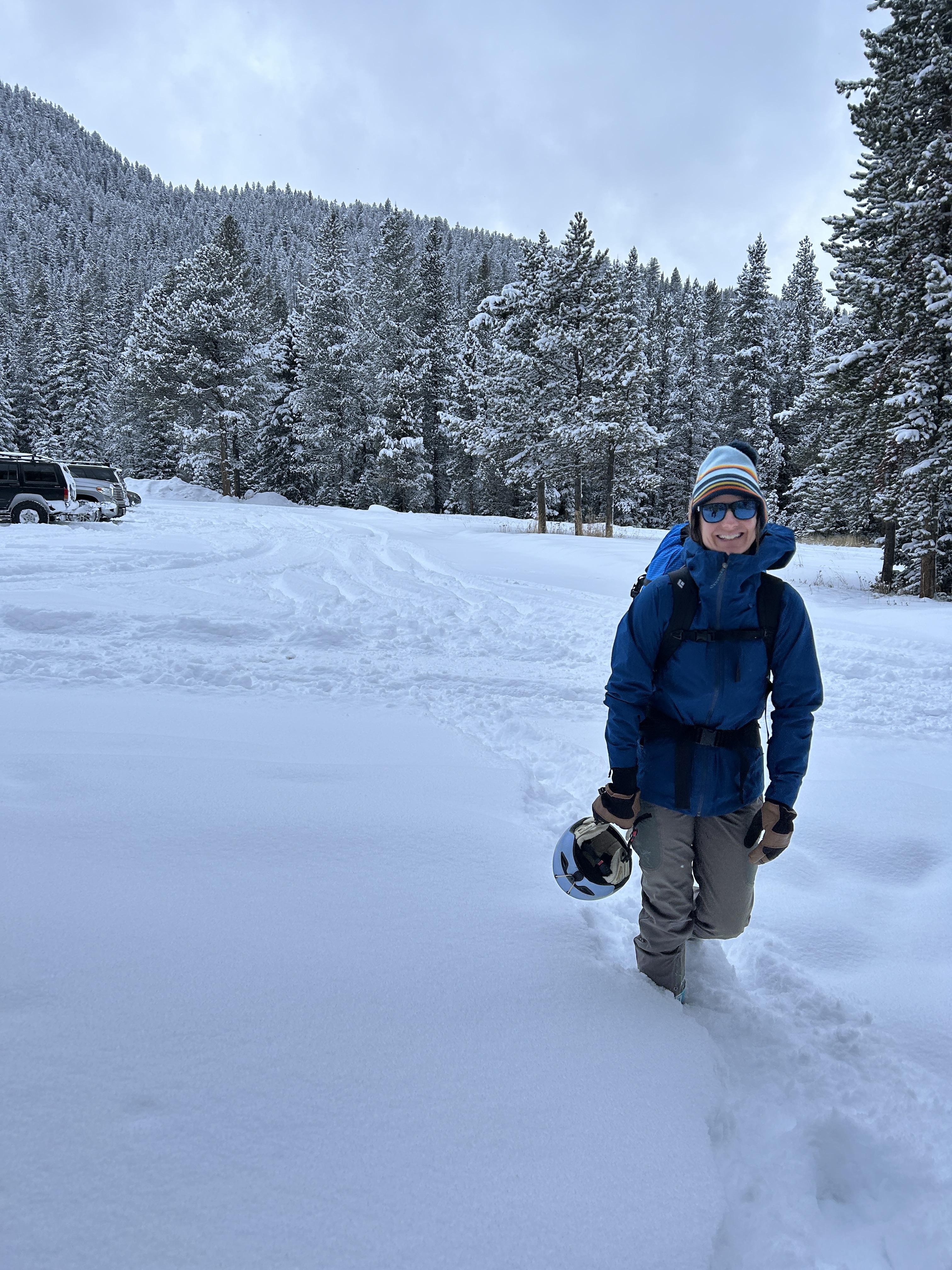
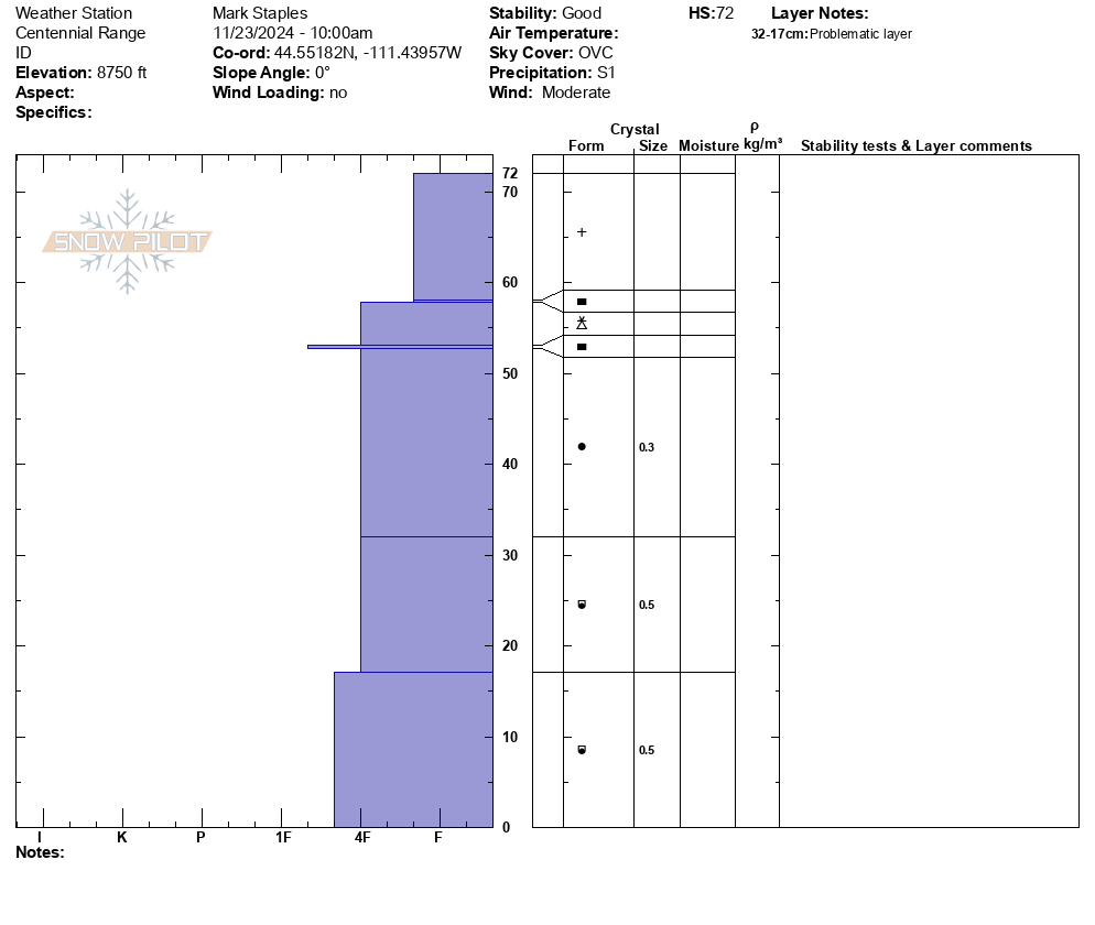
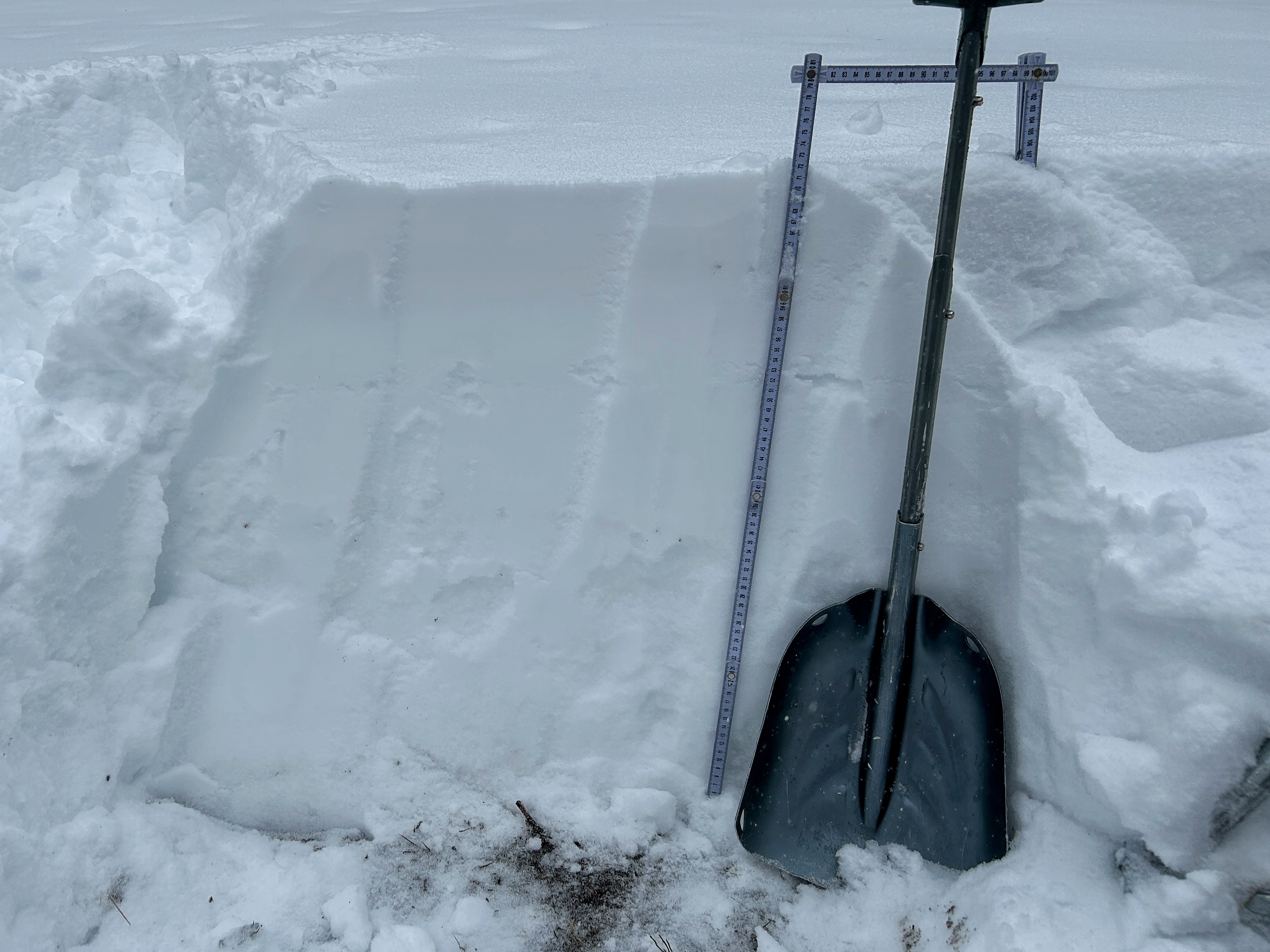
Full Snow Observation ReportWe skied around Sawtelle Peak today where there is a solid 4 feet of snow at 8750' where we restarted the snow depth sensor which is working now.
The good: We didn't see any recent avalanches, but we were traveling on foot and couldn't see all the terrain. The weak layer of snow that formed on the snow surface after Thanksgiving into early December is slowly gaining strength. There's also a ton of snow and coverage has improved dramatically.
The bad: The weak layer of facets is generally in the middle of the snowpack and can be found on all slopes. The recent snow is the first big test of this weak layer, and it produced numerous big rumbling collapses on both an East and Southwest aspect. These collapses are an obvious sign of unstable snow and told me not to trust the snowpack.
Of interest: There are several thin rain crusts within the upper two feet of snow. You'll likely feel the upper most rain crust under your track but not under skis. The attached photo shows the most recent freezing rain event on the trunks of trees.
Full Snow Observation Report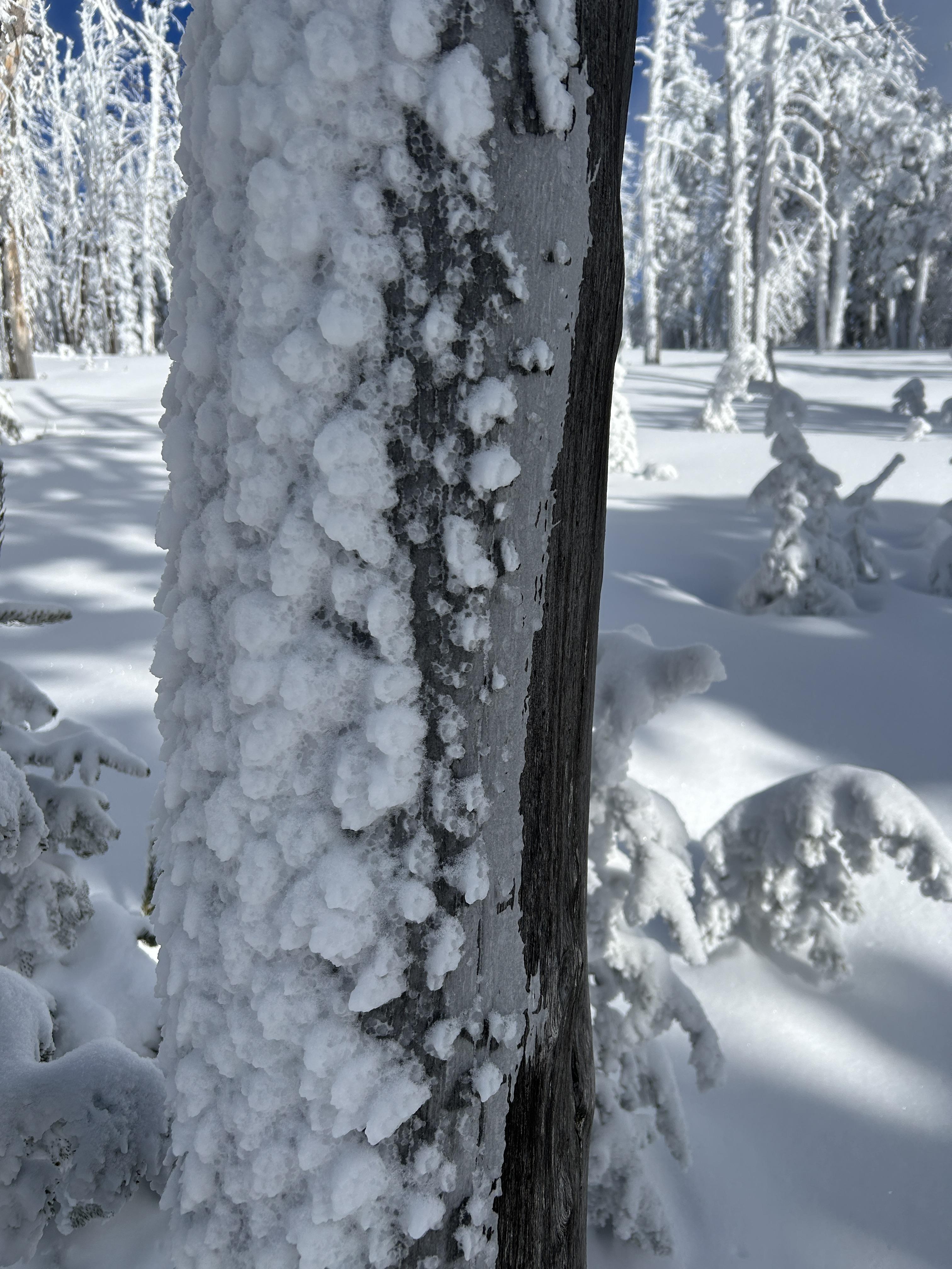

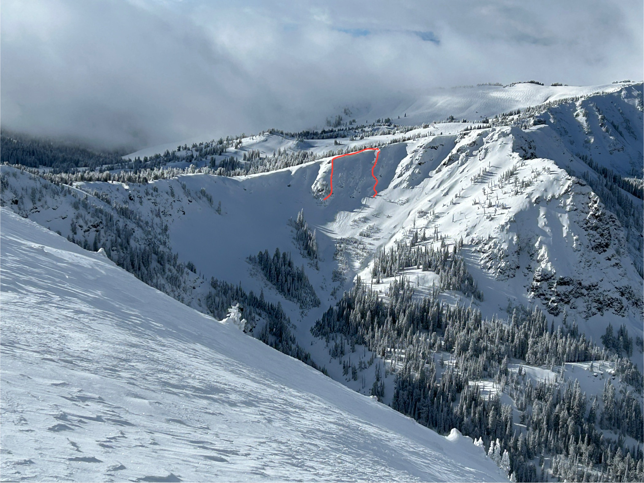
We were ski touring on the SW side of Mt. Henderson today, and noticed a large (natural?) avalanche on the NE aspect of Henderson. First observed at around 1:15pm. It appeared to be very fresh, possibly from a remote trigger this morning.
2 photos attached. A NE aspect, around 10,000'.
It looked to be 4-6' deep and about 500' wide. And it failed on snow at/ near the ground.
Weather: today alternated between heavy snowfall, and patches of sunshine. Temps in the low/ mid 20's F, and calm winds. A very nice day for ski touring.
No other avalanche activity observed in Miller Creek.
We experienced a couple of large collapses on westerly aspects/ in wind affected terrain around 10,000'.
Full Snow Observation Report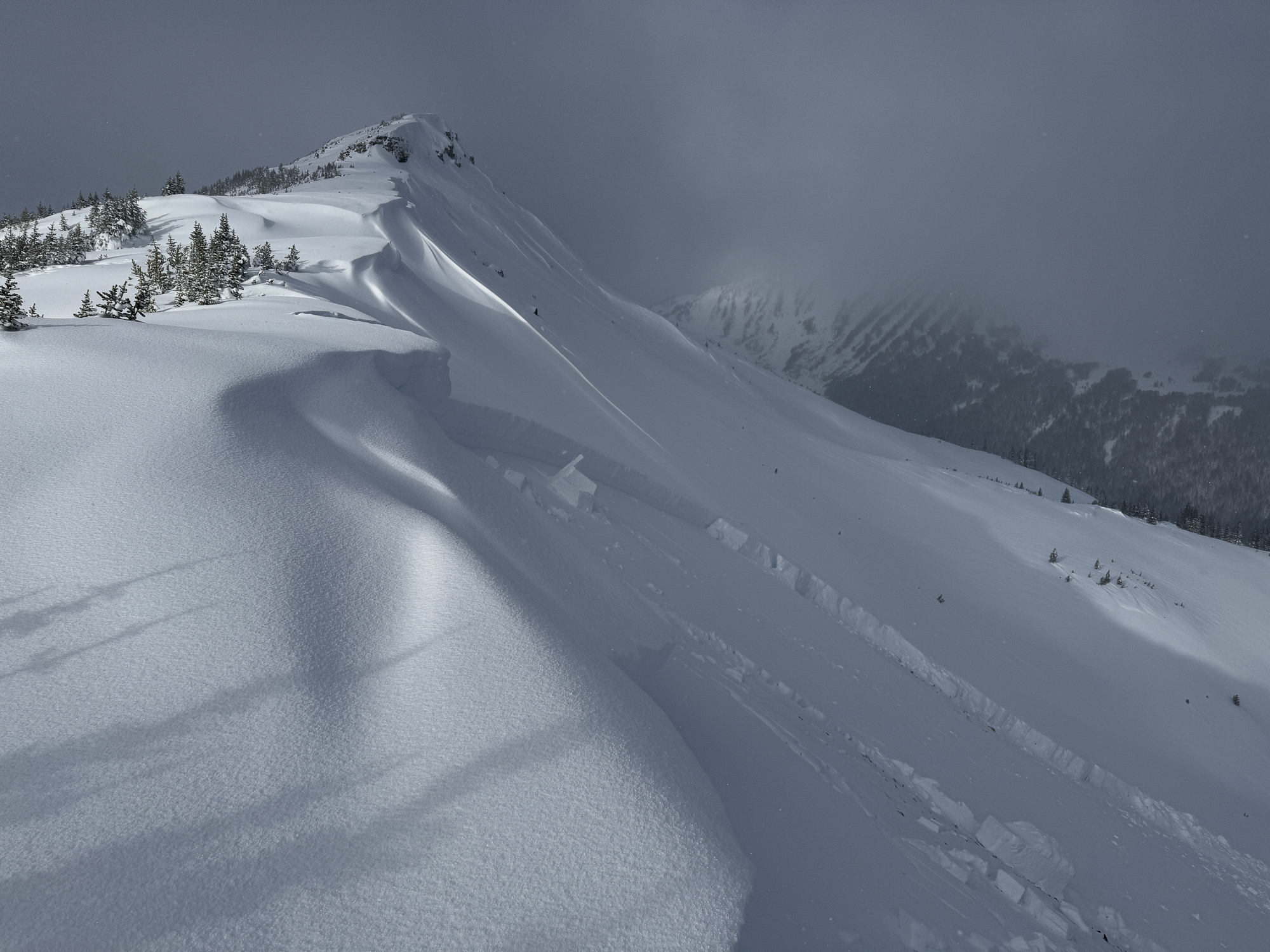
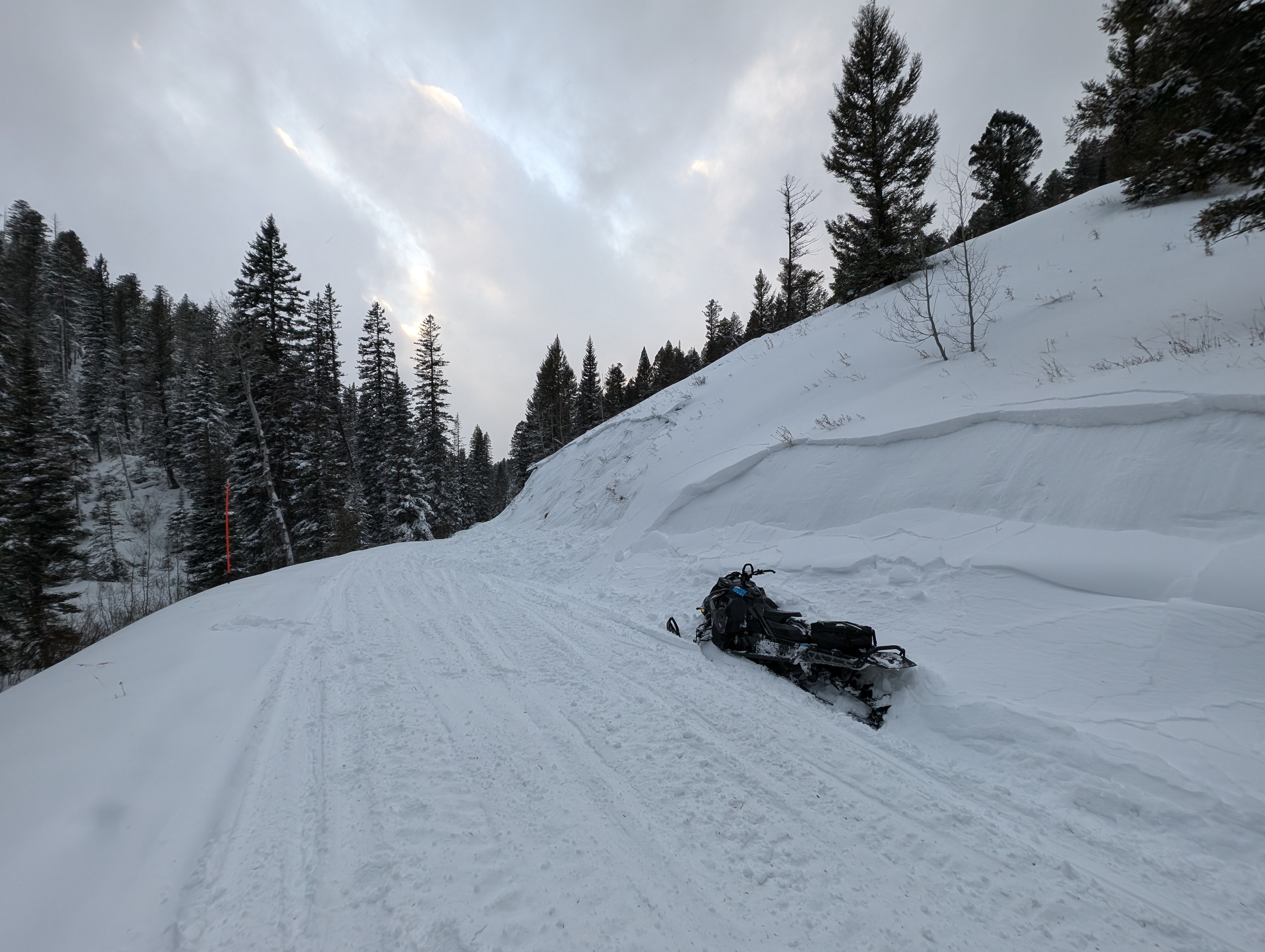
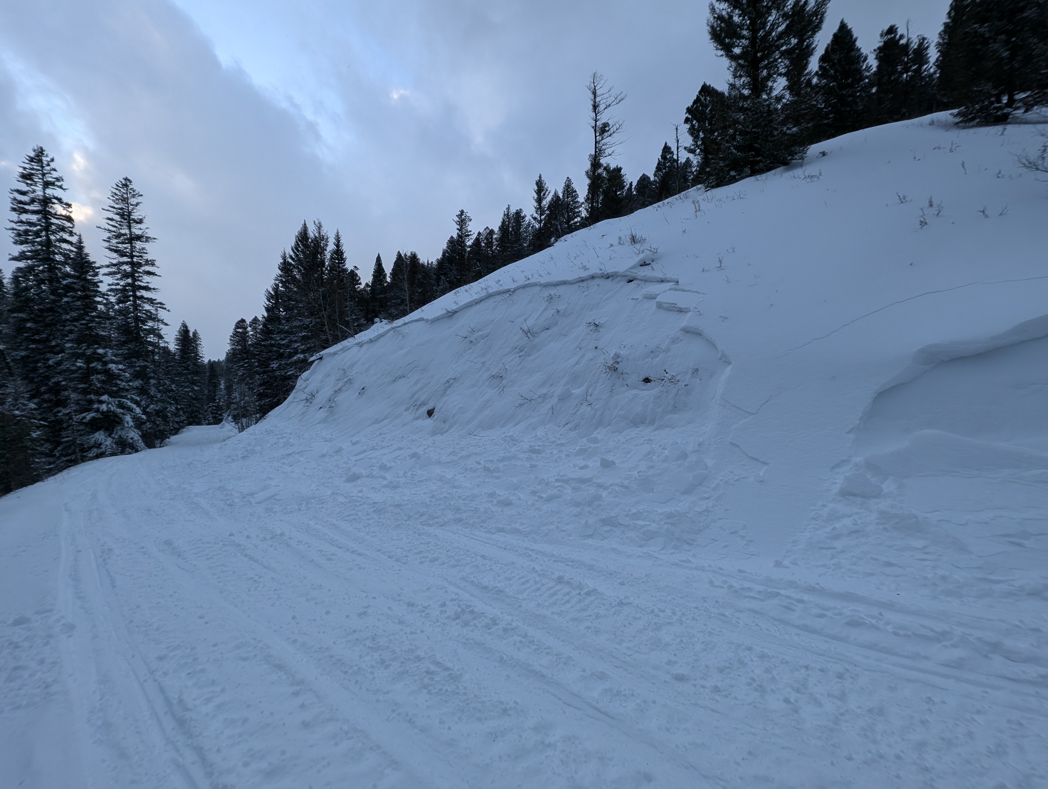
We rode teepee sat morning. Pretty good snow but relatively baseless. Broke an arm so fixed and went up blue creek on the west side of IP down Yale Kilgore road.
we went in about 3pm so it was warm and super dense fog up high towards reas peak.
rode several draws southwest of the peak prolly about 8000 but could be wrong.
as we got to the open areas it was already super trenched out and setting up fast forming a nasty ice layer that was everywhere. Open areas, in tight trees etc.
it was setting up but also warm so kind of turning to corn snow but the ice layer was so thick and rigid it was audible over the sound of the sleds. If you stuck a leg in it wouod grab your leg etc and it was everywhere we rode.
rode until dark then rode out. Seemed to be getting worse the later it got.
heard from others that they experienced similar conditions in big springs.
hope this is helpful :) pin is approximate
Full Snow Observation ReportThick and robust ice crust layer widespread above white elephant. Currently 4-5” of fresh snow on top of crust. Currently snowing heavily with moderate winds SW with gusts.
Full Snow Observation Report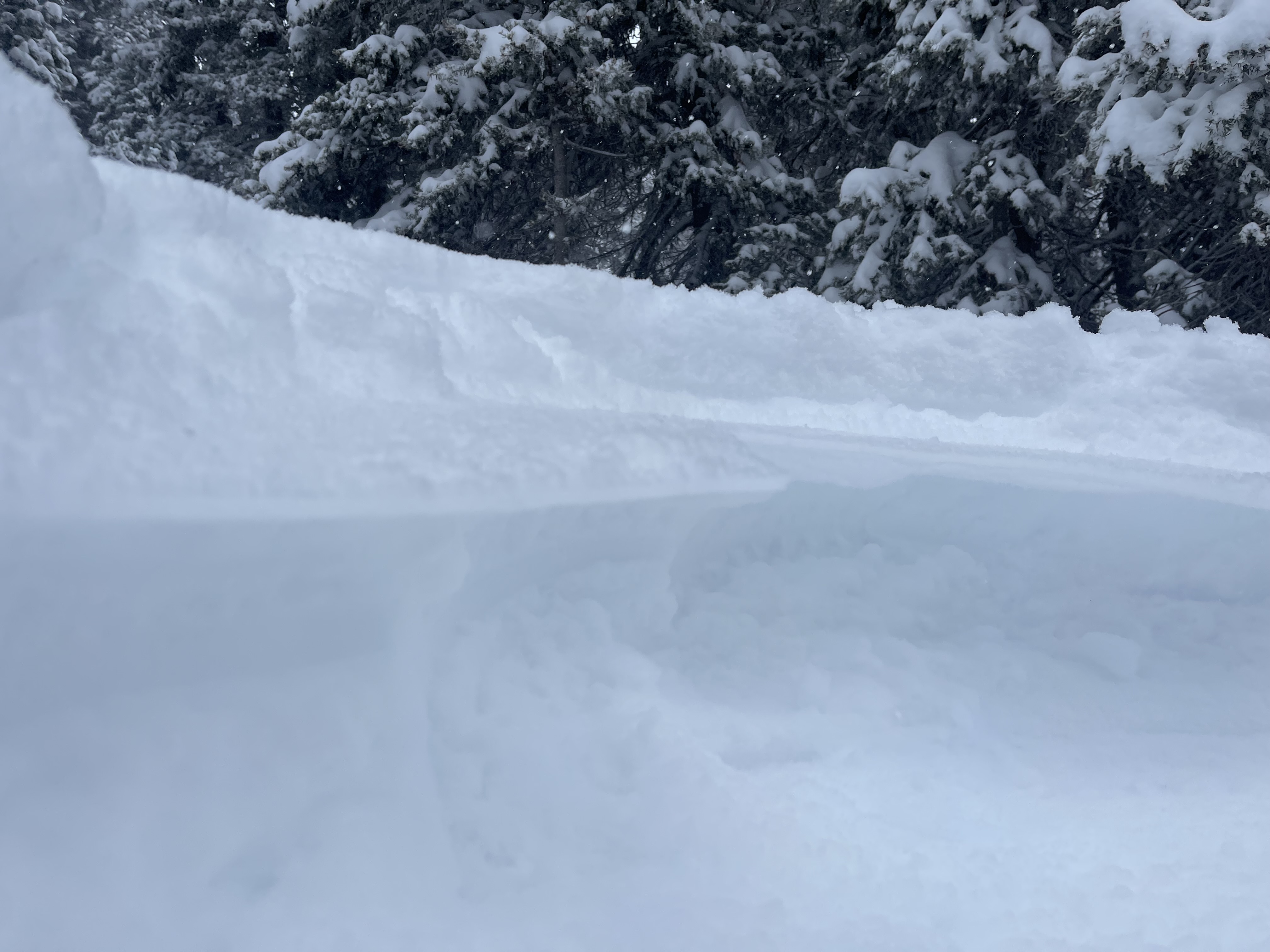
Riding in the vicinity of Fish Creek Trail. Conducted a snowpit, result, ECTX. Snow was stable in this particular spot, did not have enough time to conduct another snowpit. HS 115, melt freeze crust 6-8" below surface, SH at 75cm, facets approximate lower 1/3 snowpack, 2-3 melt freeze crusts in snowpack. Overall 2 cohesive slabs make up the snowpack in this particular snowpit, split by MFcr. Also in the area signs of wind slabs on N, NE, E, and SE aspects. Airtemp -6C, moderate winds from SW, light snow, and OVC.
Full Snow Observation Report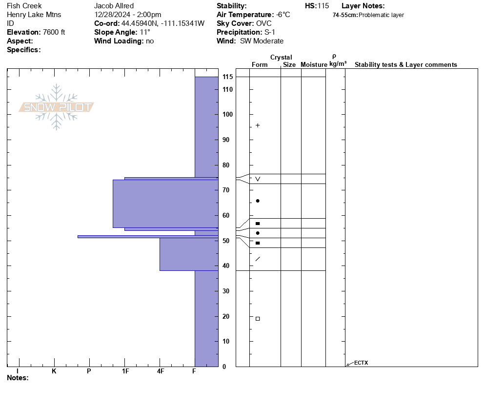
Felt 2x collapsing or wompfing of the snow in the Two Top area, observed wind scoured terrain with wind slab deposits on the N, NE, E, and SE slopes. Storm Slab of 6-8" over melt freeze cust. Shooting cracks in front of skis. Light snowfall during the day, overcast skies, and light winds.
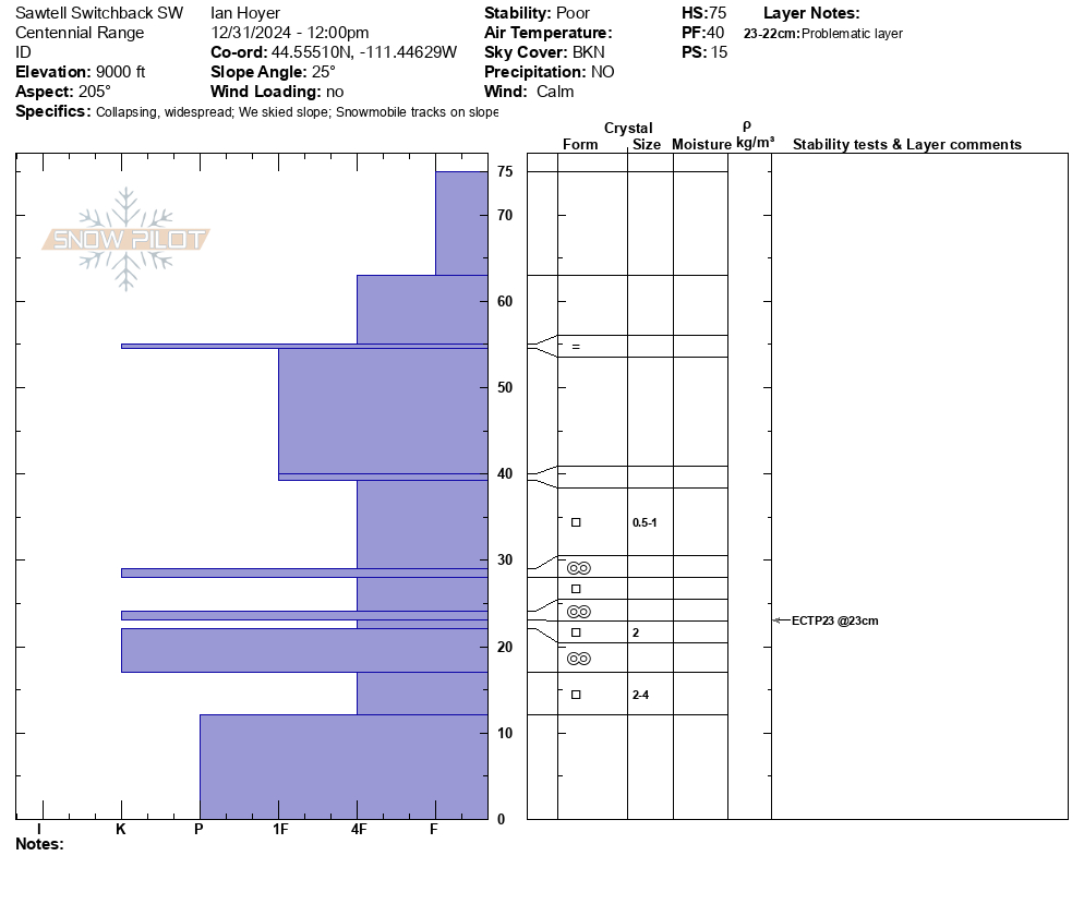
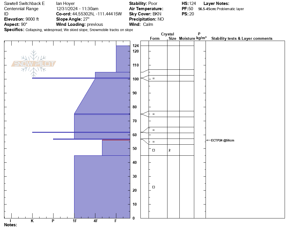
Full Snow Observation ReportECTP 15 75cm up from ground. HS90-110 9000ft SE aspect. Down 1000 feet similar aspect we also got propagation up 23cm with a HS of 55cm. Photo from the 9000ft pit.
Full Snow Observation Report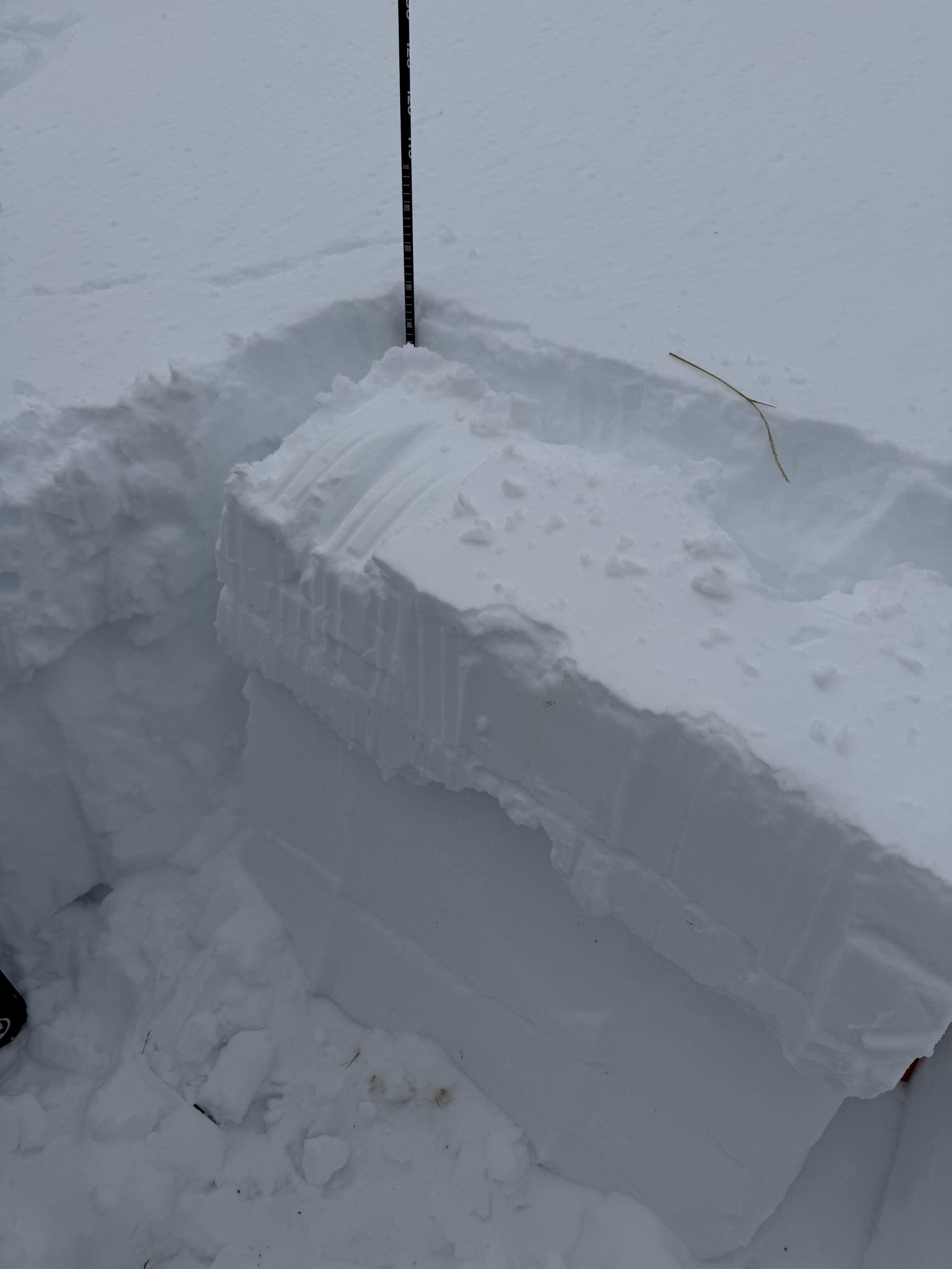
The old snow surface from the first two weeks of dry weather in December is the main weak layer in the snowpack. It is easy to find on all slopes just under the new snow and two crusts. It's generally buried about a 12-14 inches deep.
We got a range of test scores (mostly bad) of ECTP2, ECTP3, ECTP13, and ECTN. We experienced a few collapses, but it was not widespread. No cracking.
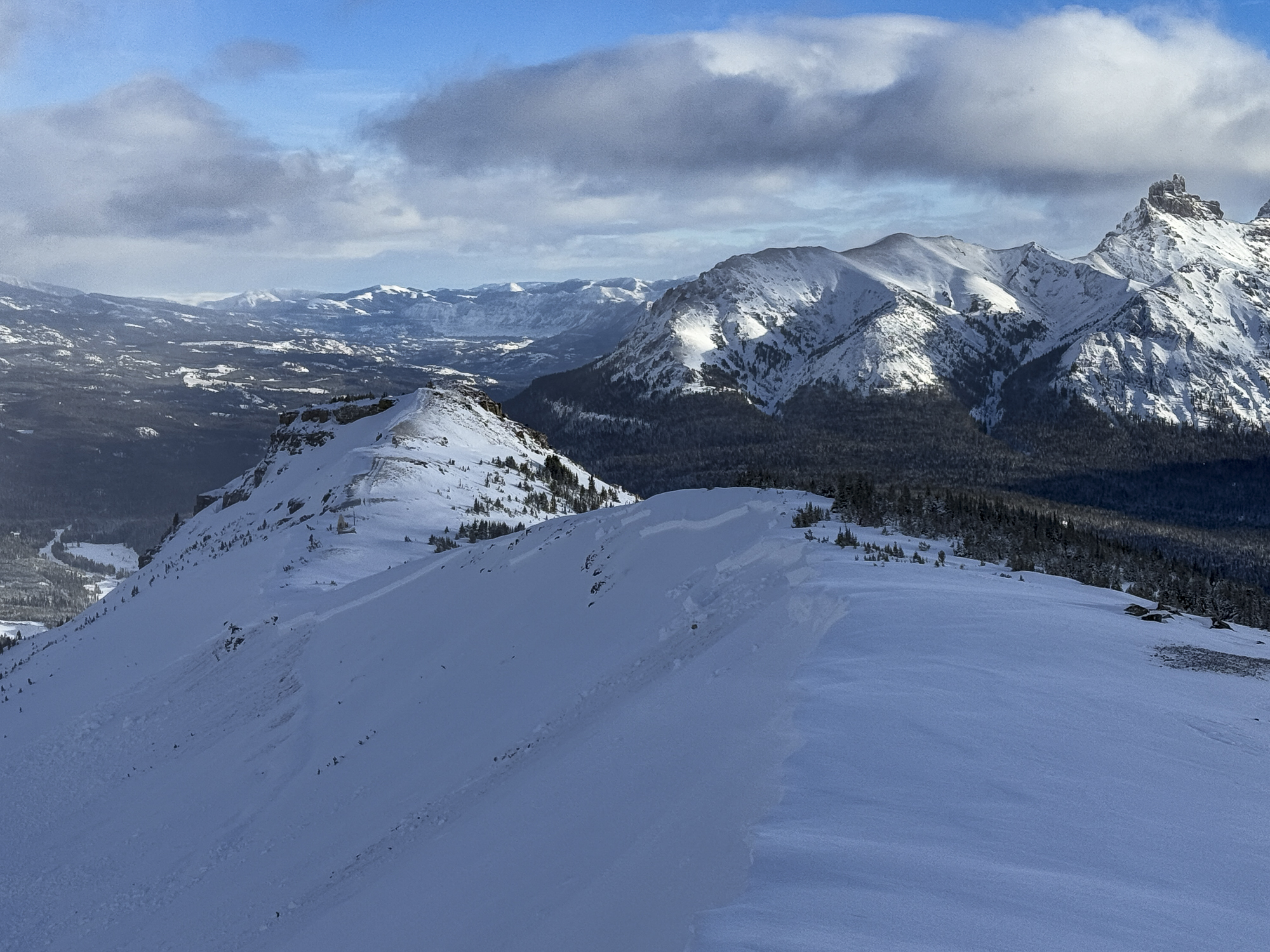
Avalanches - we got above the clouds into the sun and could only spot one avalanche looking towards Mt Jefferson in Rock Creek
My gut says that avalanches aren't too easy to trigger; HOWEVER, all the signs are there and can't be ignored. Some collapsing. A prominent weak layer of facets. Mostly poor test scores, recent loading (1.5-2" of water), and one fresh avalanche.
For those reasons we rode like the danger was CONSIDERABLE....which it was.
Riding and coverage is quickly improving. Above 9000 ft, there's a decent base under the weak layer. Rocks and stumps are still easy to find and we were bumping them all day long.
Full Snow Observation Report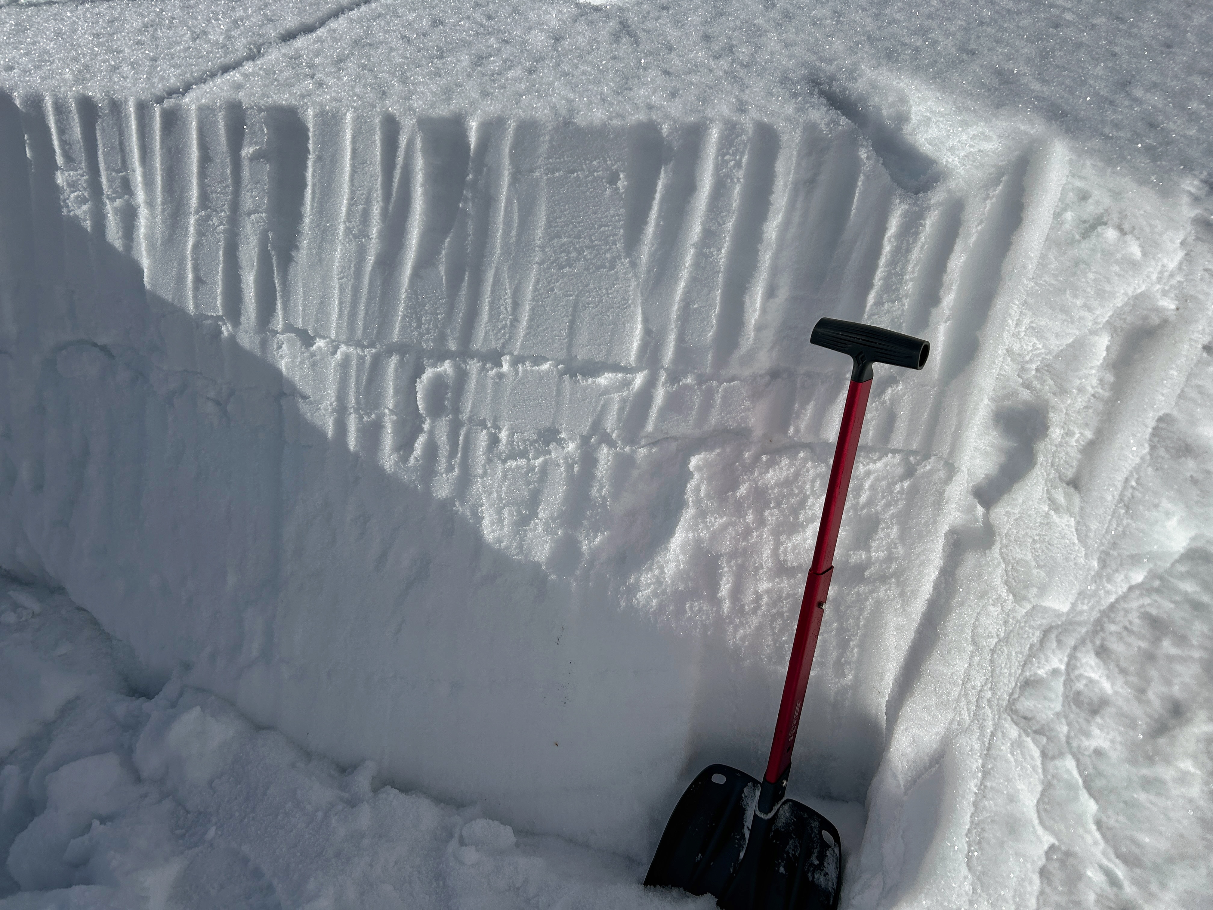

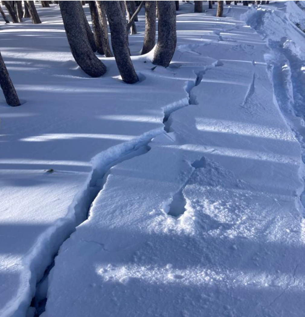
Small windslab triggered on approach for inspection. Failure interface had 5 mm Surface Hoar. Soft slab, remote propagation onto the adjacent slope. Debris covered about half of the road bed.
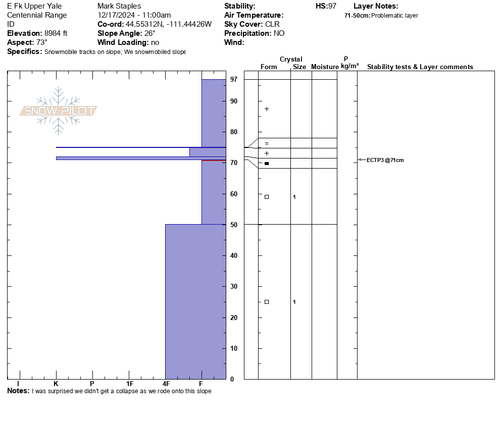
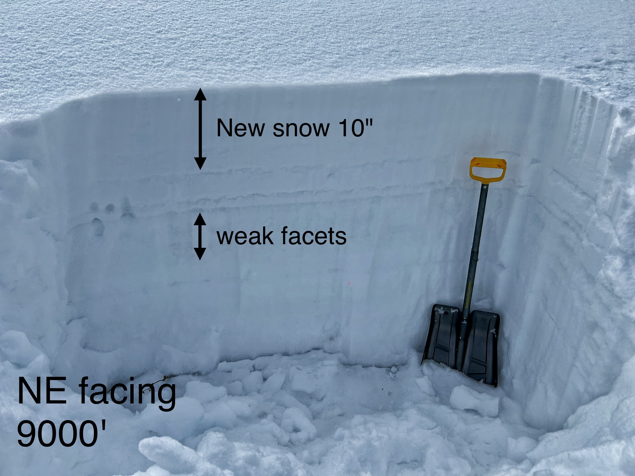
Full Snow Observation Report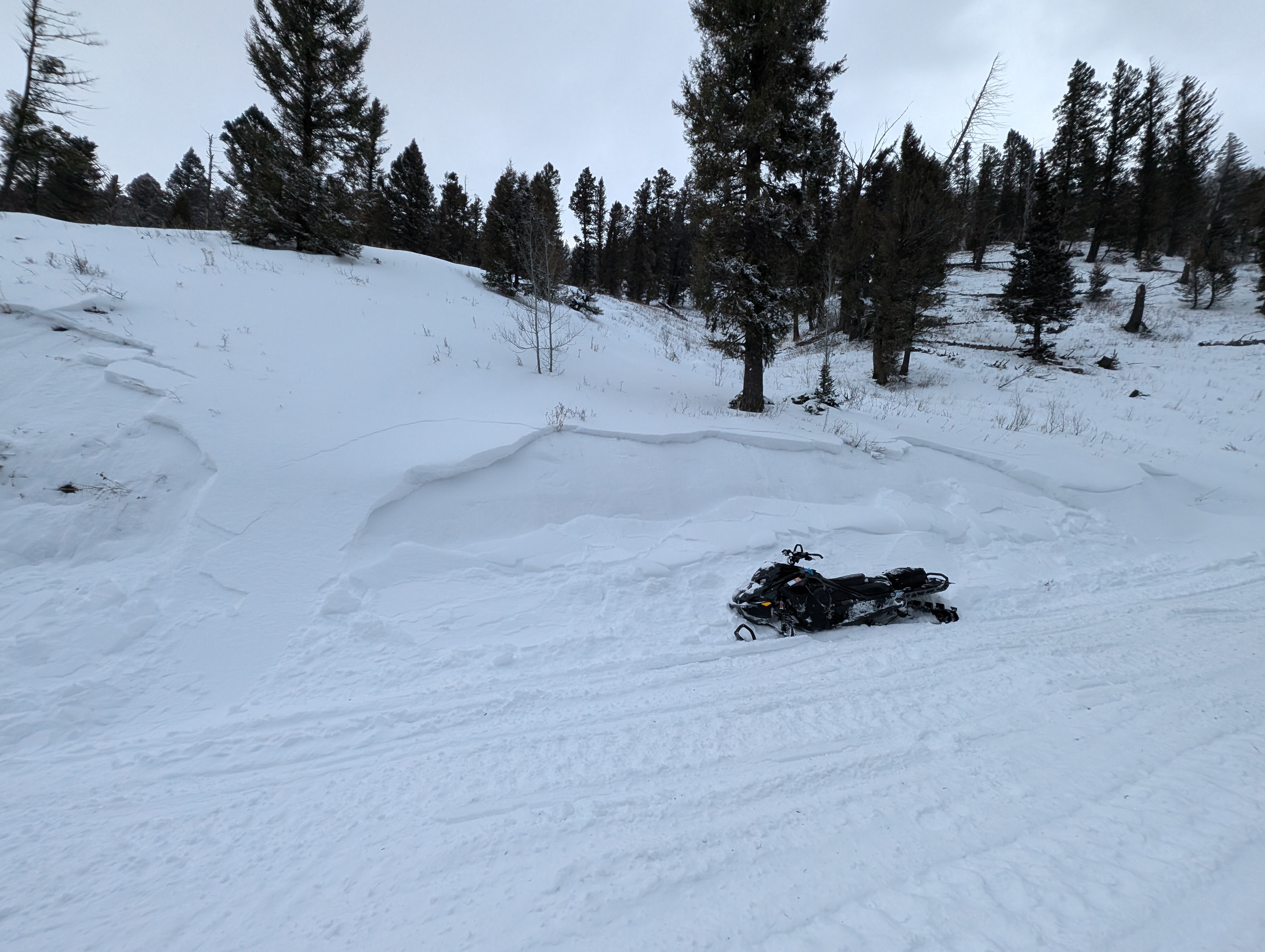
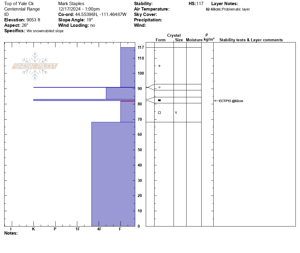
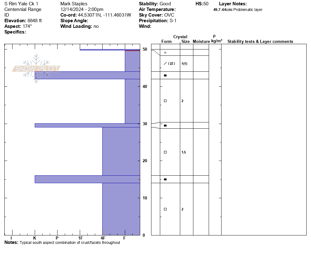
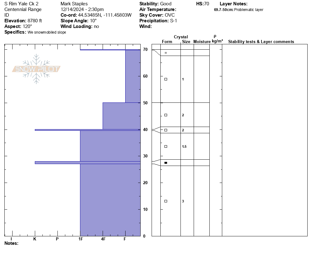
We rode into Yale Creek just south of Sawtell peak in the Centennials. Thin snowpack that is mostly faceted. There was a slight rain/mist the night before and again in the afternoon with warm air moving into the area ahead of the approaching storm. The rain/mist created a zipper crust on top of the snowpack.
The snow under that zipper crust is faceted and weak. It will be the primary weak layer once a slab forms on top.
Full Snow Observation Report

Just an initial look at low elevation snow around some of the ice climbs.
8" of new snow at the Grotto Falls TH.
I couldn't find any surface hoar that was buried by last night's snow, but I'm sure it's out there. Doesn't really matter because there's plenty of weak, faceted snow that was the previous snow surface.
The new snow is all fluff and not a concern at lower elevations in Hyalite. Perhaps it could be enough of a load and enough of a cohesive slab at higher elevations where more snow fell.
For now, things seem mostly stable, but that will change quickly with any amount of wind.
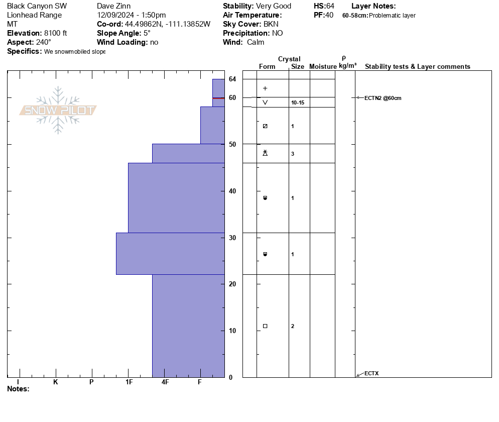
Full Snow Observation Report

The snowpack remains thin in Island Park. We rode the Big Springs Loop around the Black Canyon area in Island Park. We dug two pits near the top of the loop in the area where one crosses the Canyon. One was on a southwest facing slope and the other on a north-facing slope. Both near 8100' elevation.
The snow depth was 60-70 cm (2-2.5 feet). Surface hoar and near surface facets are now capped by this weekend's snow. The layers are buried 2-4" deep. These are not a concern currently but certainly will become so with the next significant storm (or incremental loading). ECTN2-4 on these layer for now. Winds were calm and avalanches in non-wind-loaded terrain are unlikely. Small areas of isolated instability are possible in higher elevation wind-loaded terrain.
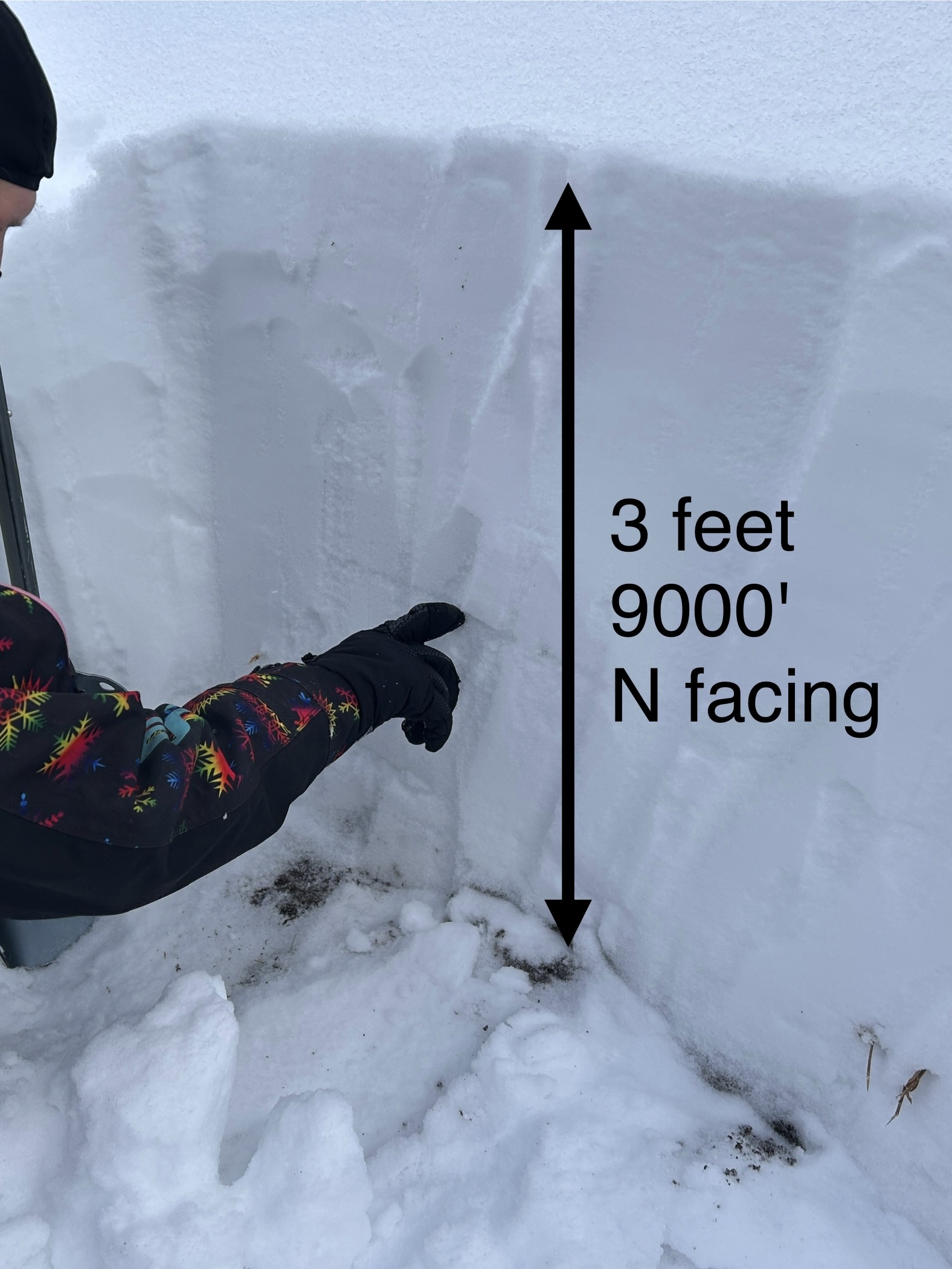
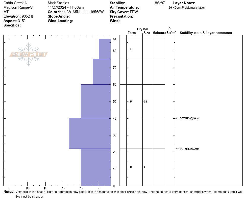
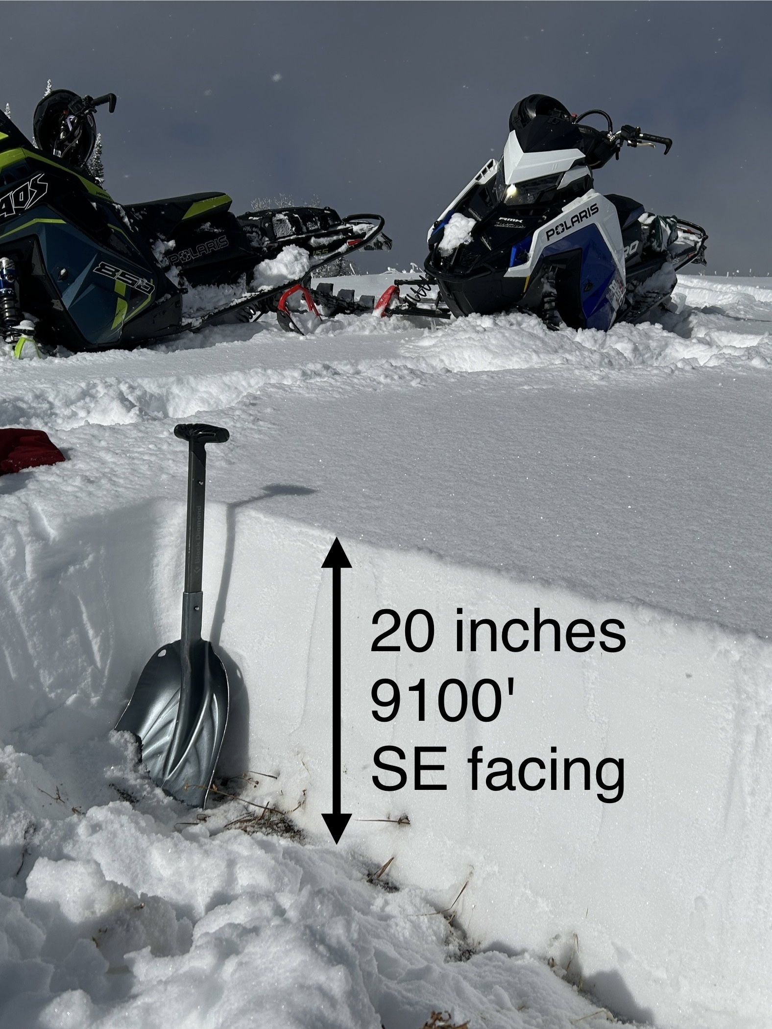
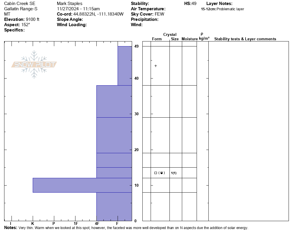
Full Snow Observation Report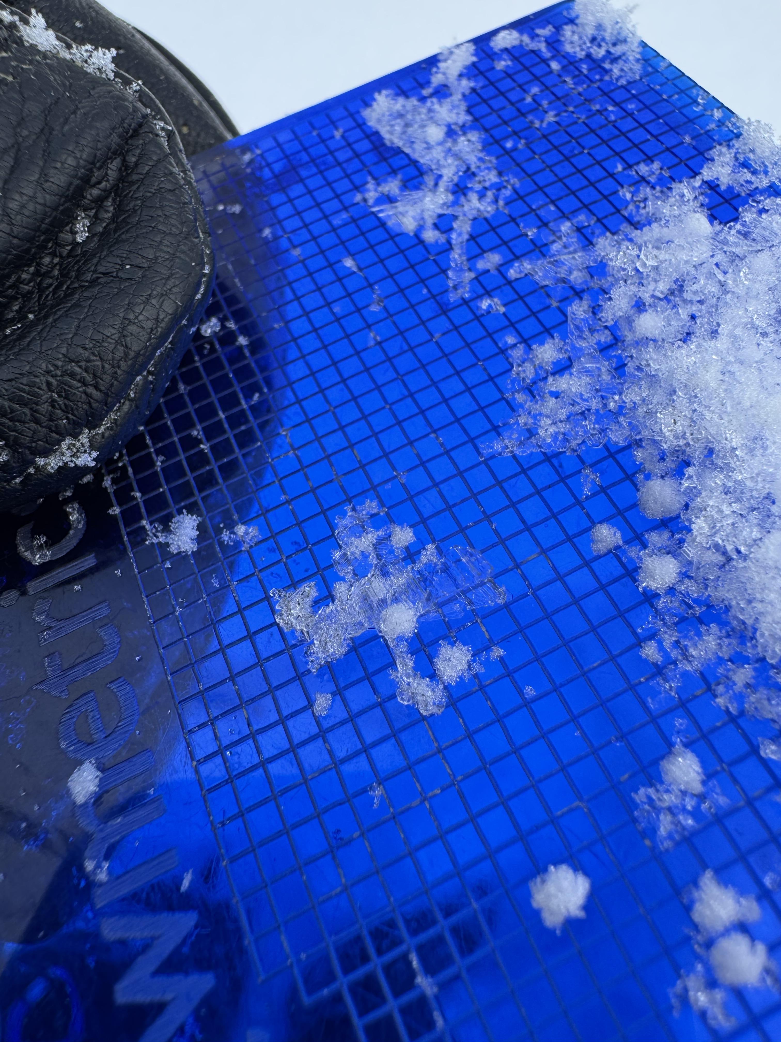


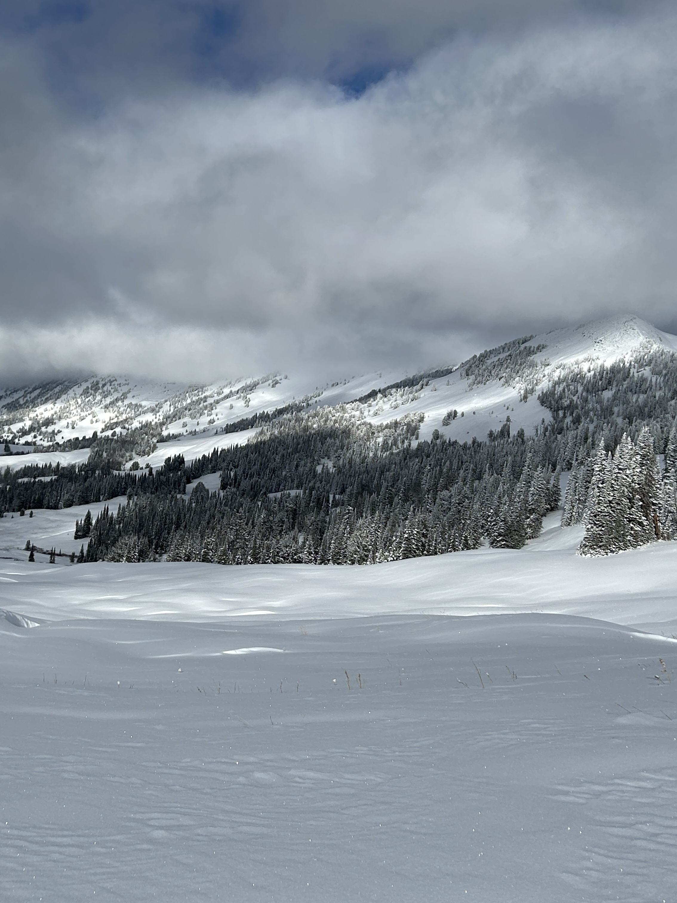
We rode into Cabin Creek very delicately, and it was great to be riding in late November. Hitting rocks is the greatest threat.
Overall conditions are thin but great to see so much snow.
9000 ft, N facing - 87 cm (~35 inches)
9100 ft, SE facing - 49 cm (~20 inches)
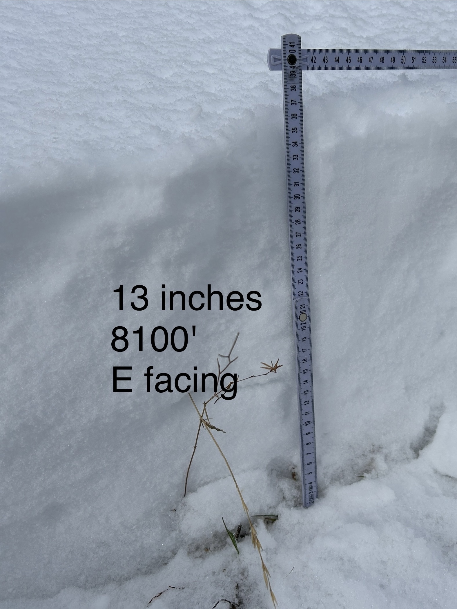
8100 ft, E facing - 35 cm (~13 inches)
Some faceting is occurring in the snowpack (aka - weakening), but the current state of the snowpack isn't the main issue. It's hard to appreciate how cold things are in the mountains and how cold the snow will get under clear skies. Clear nights in December will significantly weaken the snowpack, and it will look A LOT different the next time we come back.
What we need? - Snow. We don't need a lot but a few inches every few days along with cloudy skies will help things a TON.
Where can you trigger an avalanche right now? - I think you need to find a slope with recent wind drifts where you can either get a wind slab or persistent slab avalanche.
Lastly - the radiation recrystallization process is happening as well. On an East-facing slope at 8100 ft at around noon, the surface of the snow was dry but snow just under the surface was damp.
Full Snow Observation Report

From email: "Northerly facing terrain harbors October snow, which has faceted. It is holding up plenty of dense snow and wind slab from the quite snowy and windy November. It was unable to hold the additional weight of a human trigger, and two pockets failed at the ground, which produced avalanches. Crown height maxed at 2’. Notably, where it did not avalanche, the failure propagated hundreds of feet down the ridge. It is a good data point- northerly aspects near tree line have potential instability."
Full Snow Observation Report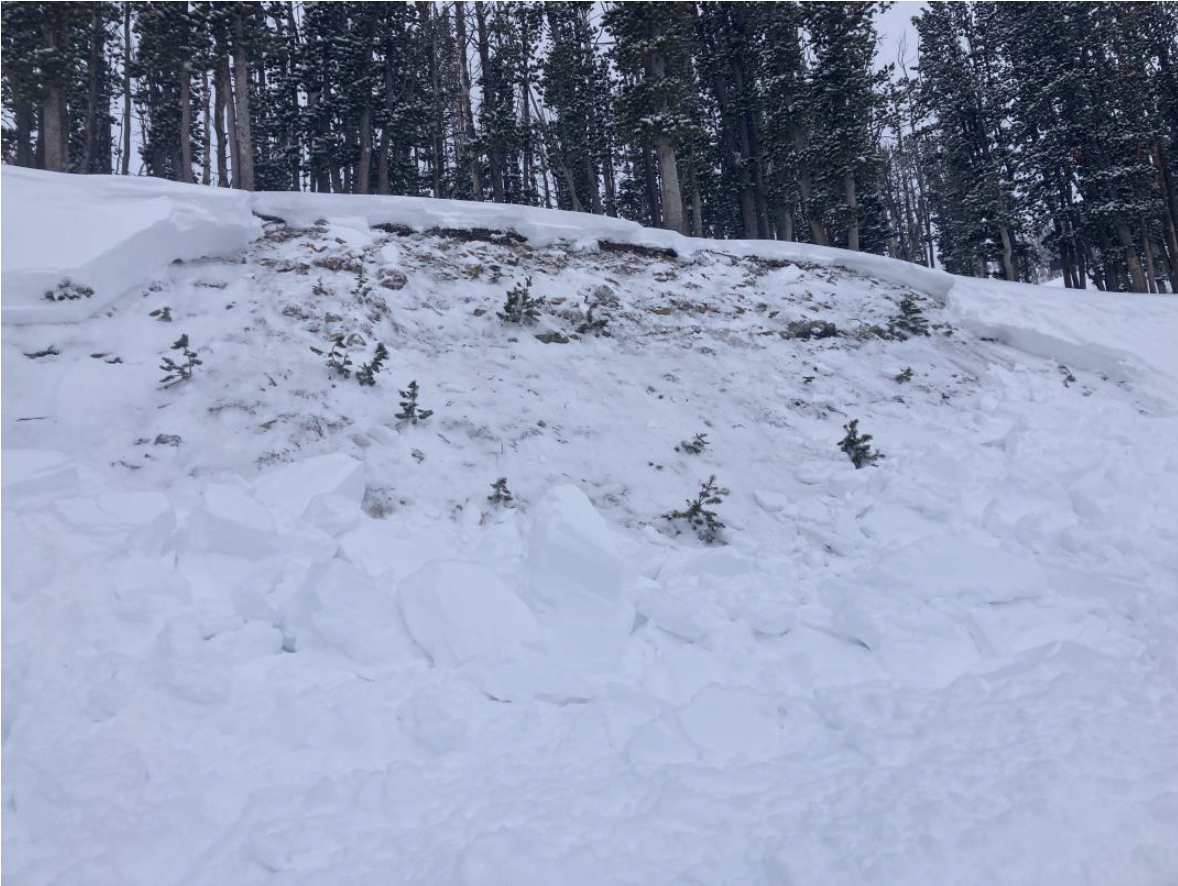
Warm, stormy day. Winds moving a lot of snow around Sawtelle
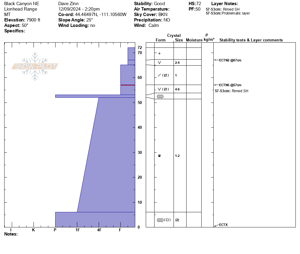
Sawtelle Pk, Island Park
- 6500' - HS 30cm
- 7000' - HS 35cm
- 7500' - HS 40 cm
- 8500' - HS 50 cm
- 8800' - HS 72 cm
Snow felt warm dense and only lightly faceted. Overall promising start to the season.
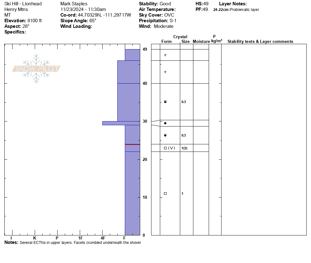
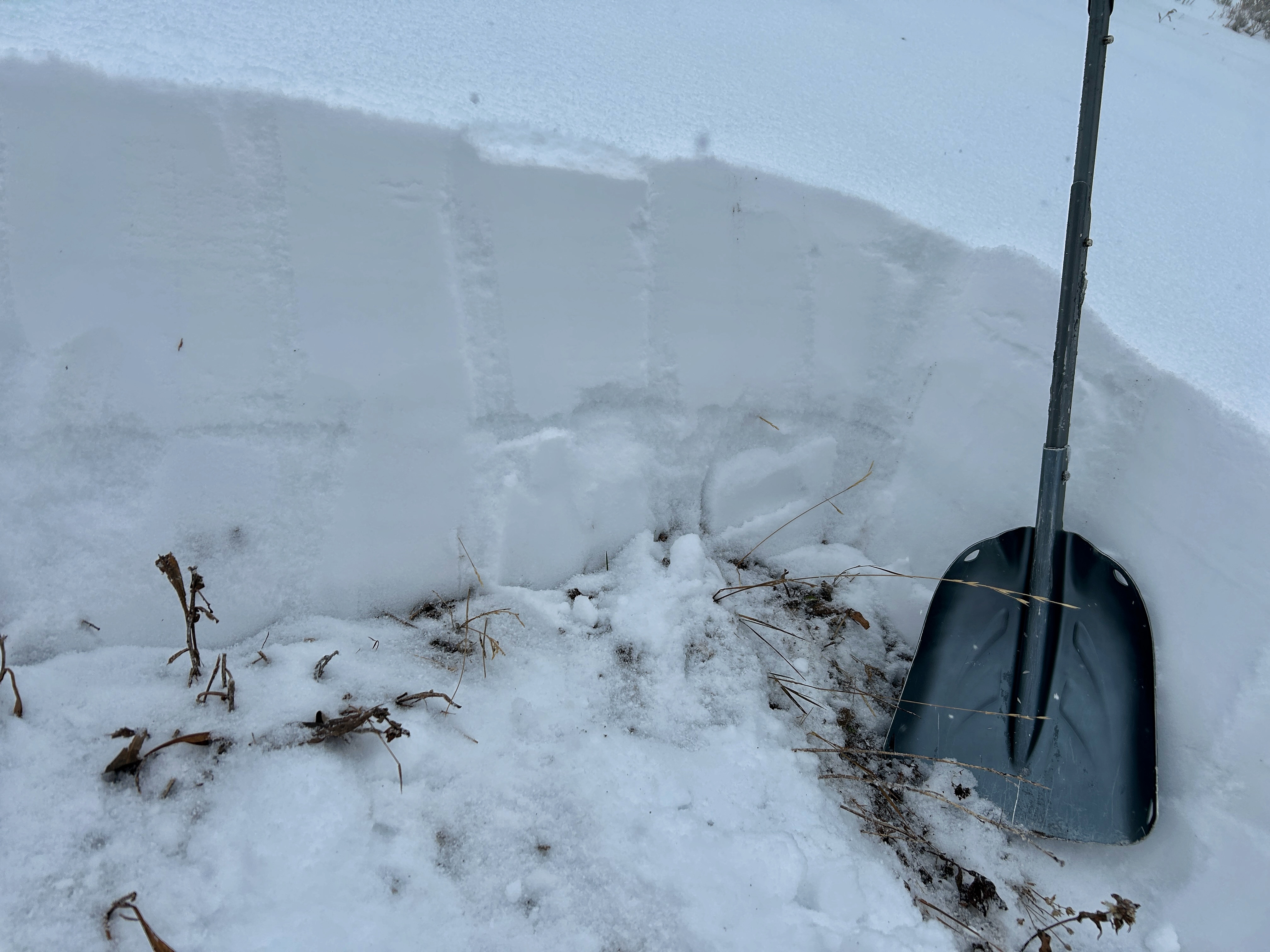
Lionhead, West Yellowstone
Barely enough snow at Ski Hill (el 8000') to get there on sleds. Also, very faceted with some surface hoar mixed in midpack. Overall, less snow and more faceted.
Full Snow Observation Report

Quick loop on the sleds around Black Canyon. 50 cm (~20 inches) of snow at 8000'. Good layer of surface hoar on top, and the upper part of the snowpack is starting to facet. Non-issue for now with snow coming this week that could double the snowpack.
South facing slopes have some damp snow.
Full Snow Observation Report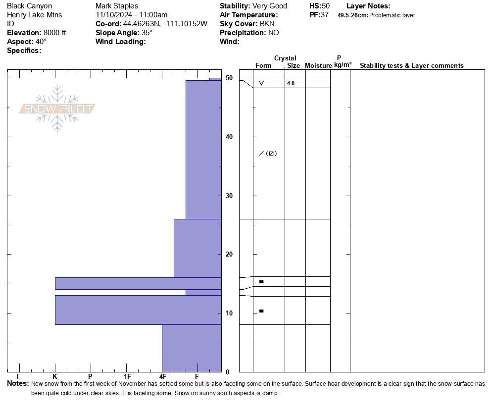

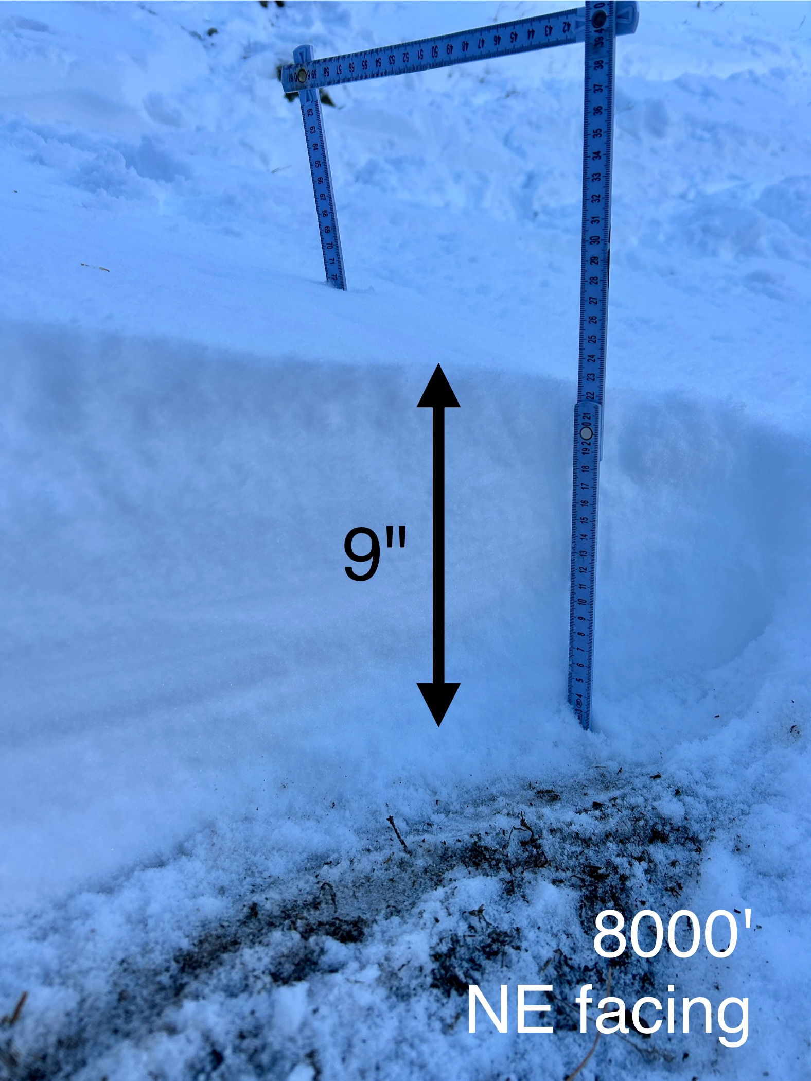
Early season conditions. At 8000' just below the Sacajawea trail bowl, there is about 9" of snow. In the trail bowl, winds moved that snow around and there is nice firm, supportable (ie - not hitting rocks) snow.
Warm weather really settled the snow and it became damp today on many sun exposed slopes. It stayed dry and cold on high north.
Overall, the things seem quite stable, even though there may be a wind slab or two that could still avalanche.
Full Snow Observation Report

From e-mail: "Photo attached from near top of hyalite peak yesterday eve , 11/2. Cracking in recent hard wind slab, I had to really jump hard to make this. Walked on many other hard slabs that were well bonded. Highly variable snowpack. I think you'd be most likely to get into trouble by popping out a small hard slab pocket like this and getting magic carpeted into some thinly covered terrain."
Full Snow Observation Report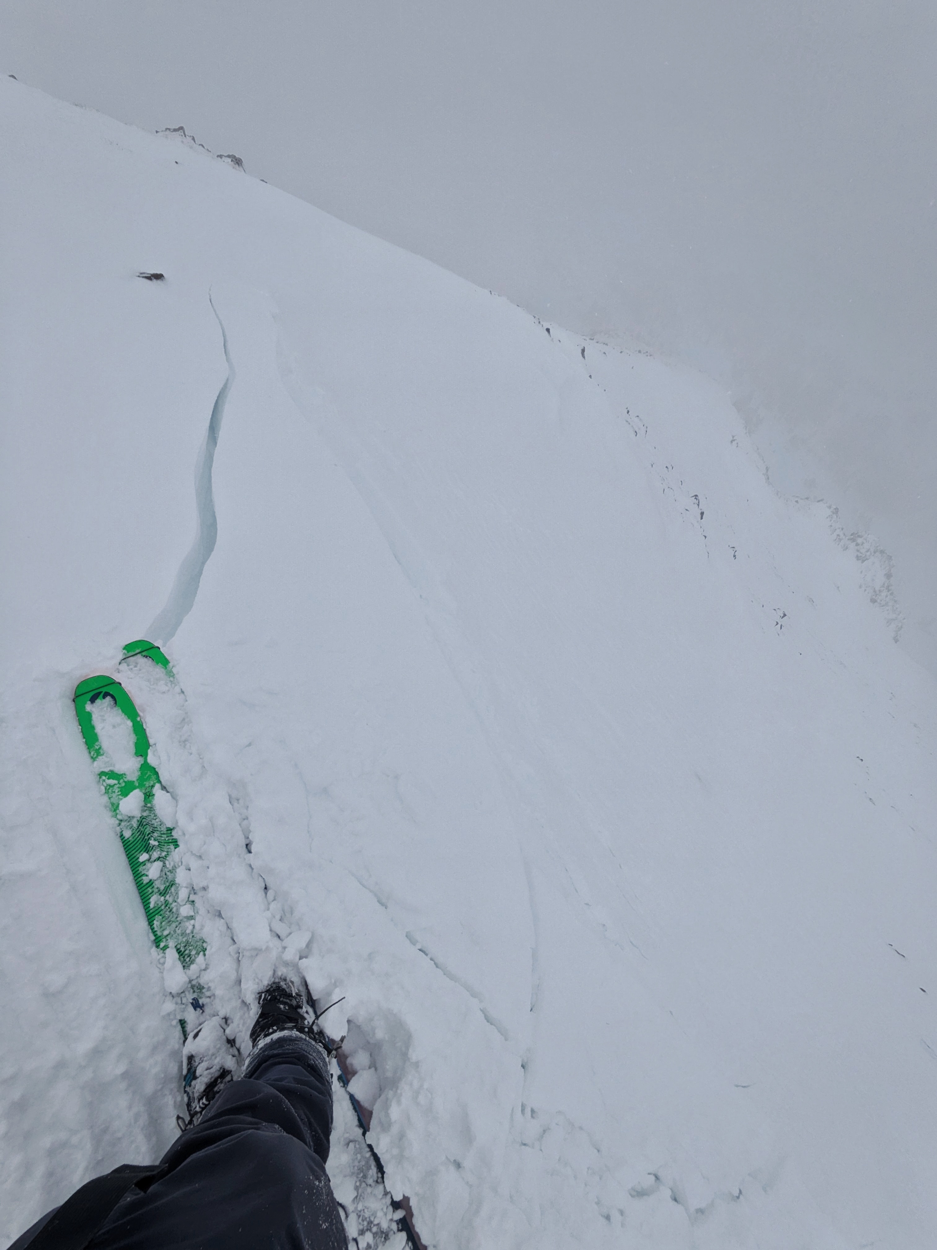
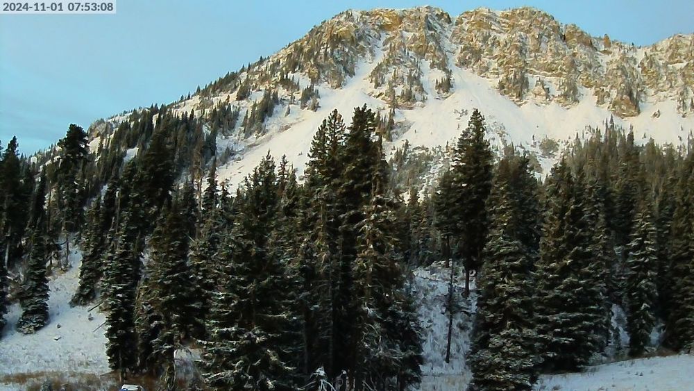
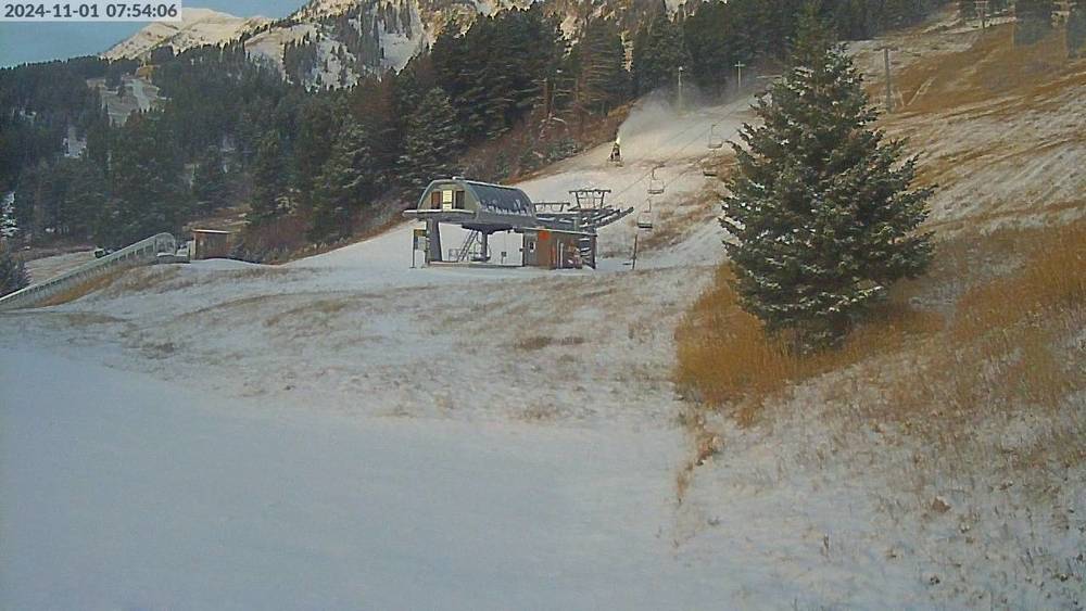
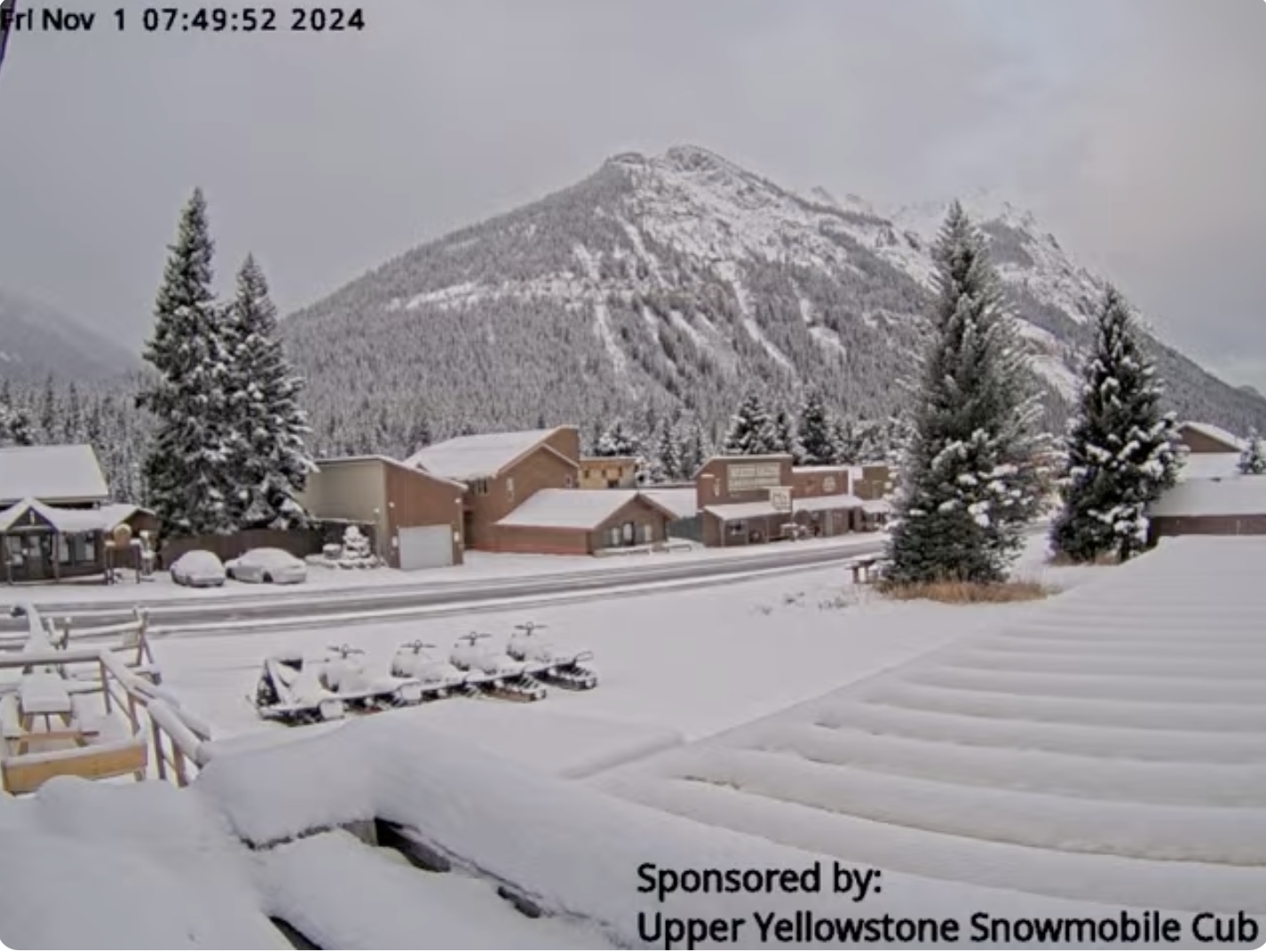
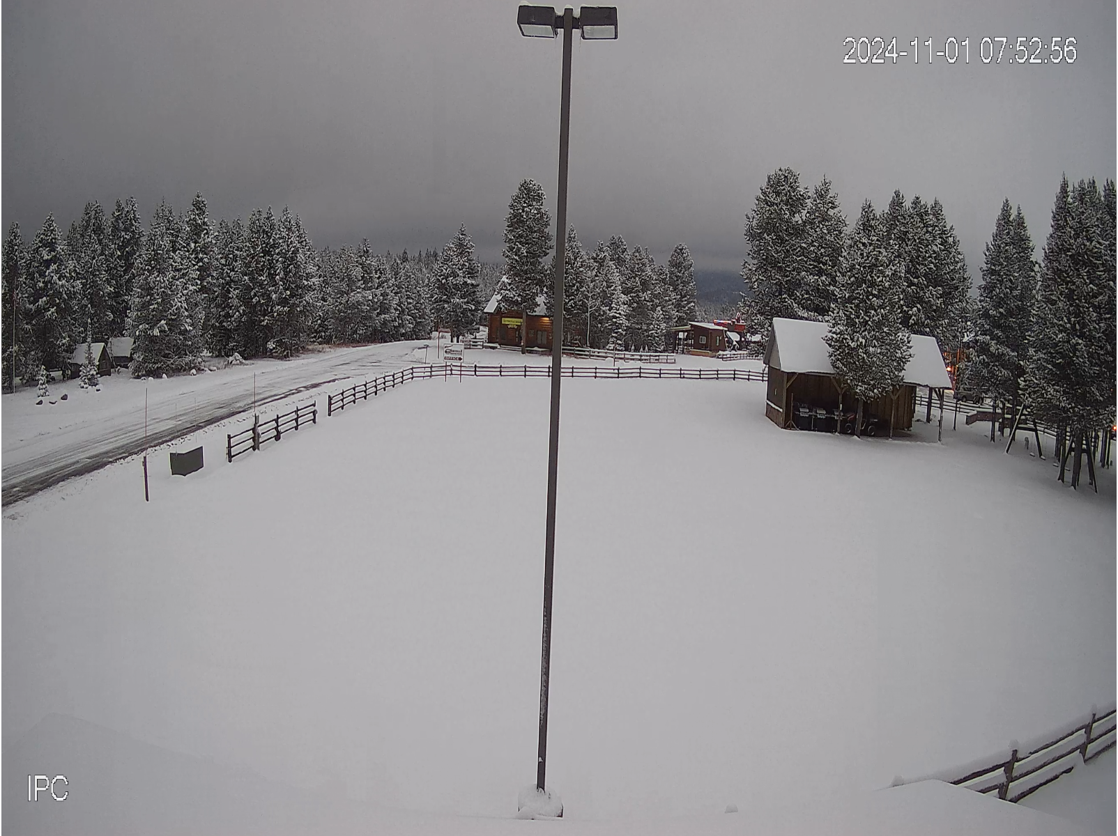
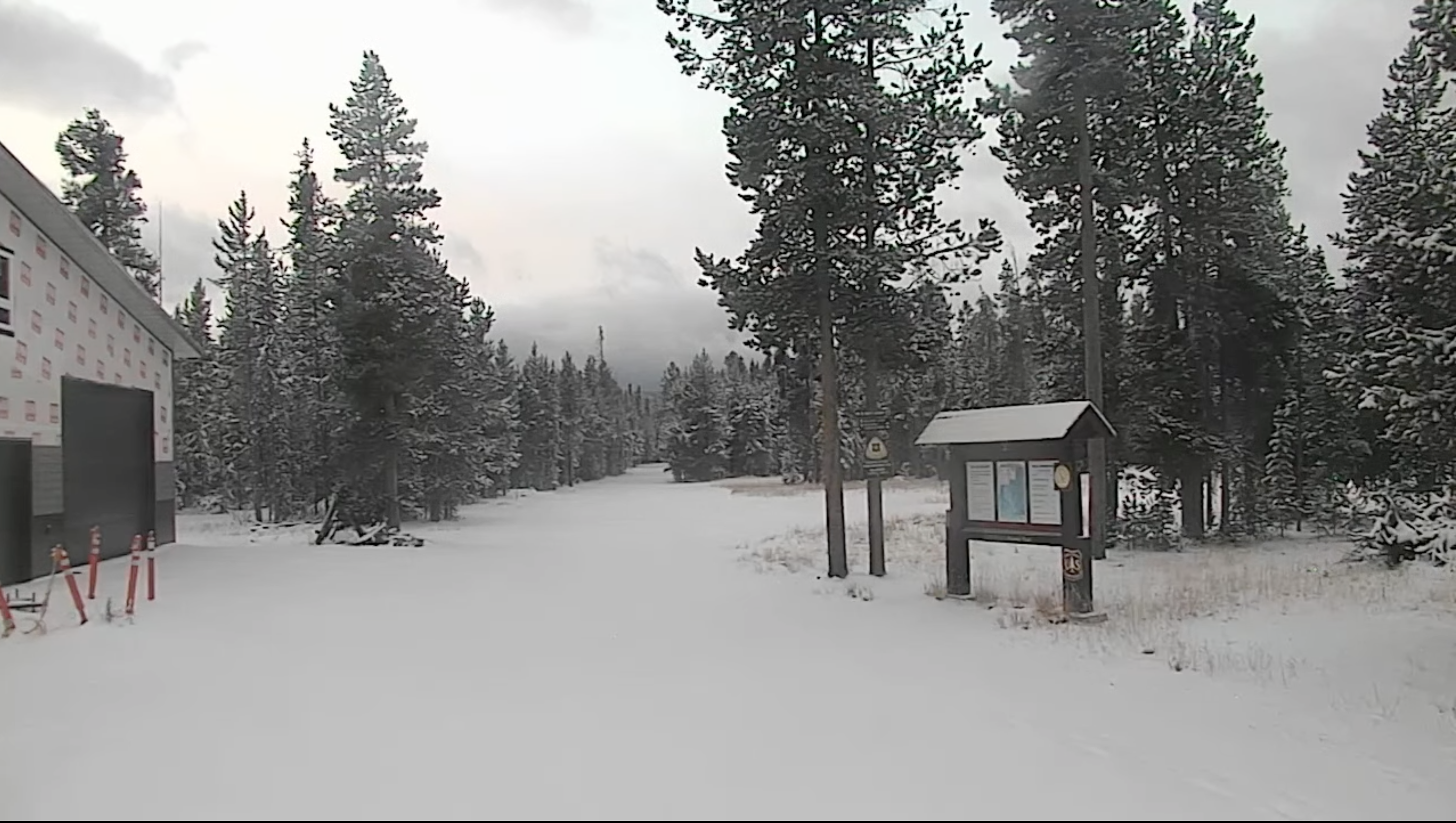
Screenshots of webcams throughout the forecast area show new snow and snow cover on November 1. Snowfall last night dropped 2-8" throughout the forecast area.
-AM
Full Snow Observation Report